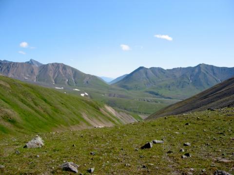
While it's hard to say whether the folks at Denali National Park and Preserve are trendsetters without first exploring all the other websites in the National Park System, their site for planning a backcountry trek should be a model, if it's not already.
Denali's a big place to explore on foot, so it's awfully helpful to have strong resources you can turn to at home while planning a backcountry trek to the park. To help make that task a bit easier, the park staff has sliced Denali's 6 million acres into 87 separate backcountry units. Forty-one of those units have a limit on the number of people who can camp in them each night.
So how do you familiarize yourself with these units and their restrictions? The park staff has developed a web page that allows you to, essentially, peer into each of those 87 units to get a brief description of the lay of the land, learn what restrictions there are on numbers of overnight campers, what topo maps cover the area in question, and how to reach the area in question.
Here's an example for backcountry units 72-79, the South Side Glaciers and Little Switzerland:
ELDRIDGE GLACIER/BUCKSKIN GLACIER/UPPER RUTH/LOWER RUTH/MOUNT HUNTER/TOKOSITNA GLACIER/MIDDLE KAHILTNA/LITTLE SWITZERLAND
Quota: No limit – but group size must be 12 or less
USGS Quad Maps: Mt McKinley A1, Mt McKinley A2, Talkeetna D1, Talkeetna D2, Talkeetna D3, Talkeetna C1, Talkeetna C2, Talkeetna C3
Description: This area is dominated by huge valleys formed by rivers of ice from the Eldridge, Ruth, Tokositna and Kahiltna glaciers. In between these glacier valleys are major mountain ridge systems with peaks 10,000 feet and higher. These ridges start to drop in elevation as they approach the area of the park boundary, to the south. It is in this area, near the toe of the major glaciers and at the ends of these ridges, that there are some possibilities for hiking on alpine terrain.
Tips/Special Features: This area presents the opportunity for trips that will test the abilities of even the most skilled backcountry traveler by combining glacier travel with some of the most rugged and difficult terrain anywhere in Alaska. The scenery is amazing and these areas are rarely visited due to the skill and work it takes to reach them. However, in a few popular areas, mountain climbers are concentrated and you are likely to camp within sight and sound of other parties. The only practical way to reach the alpine terrain on the ridgelines between the major glaciers is to be dropped off high on a glacier by ski plane and traverse off of the glacier to the surrounding ridgelines.
Access: The primary means of access to this region is by aircraft from the town of Talkeetna. There are many air taxi operators there that specialize in landing on glaciers and bush airstrips. Only authorized air taxis can land within the Park, so contact the Talkeetna Ranger Station or Denali’s commercial services division before agreeing to a flight to this area.
It is possible to access the area between the Tokositna and Kahiltna Glaciers from the end of the Petersville Road which leaves Hwy 3 at the town of Trapper Creek. Areas near the toe of the Ruth Glacier can be reached by river boat, which might provide another pickup option.
Routes/ Travel Corridors: It is beyond the scope of this guide to describe routes in this region. For more information please contact the climbing ranger staff at the Talkeetna Ranger Station of Denali National Park and Preserve.
Travel is also going to be extremely difficult once you drop off any of the alpine ridges or if you attempt to follow any of the smaller drainages downstream to the larger rivers. Any drainage is going to have very thick brush along it. Throughout this region, there is typically a 1,000 foot thick band of alder immediately below the alpine vegetation that must be traversed in order to descend to possible pickup locations at landing strips on the glacial river bars.
Additional Notes and/or Hazards: Contact the Talkeetna Ranger Station for more information on trips into this area. Travel here requires extensive cross-country hiking experience as well as glacial travel skills and equipment. Mountaineering skills will be required to get off the glaciers and onto the vegetated ridges.
During the summer, it's wise to head to Denali with several alternative trip itineraries in mind, as that's the peak season and you might find yourself at the Backcountry Information Center interested in a route that's already been claimed for your dates in the park.
Here's some more advice from the folks at Denali:
Note the following requirements when planning a trek through Denali's backcountry:
* Forty-one backcountry units have a specific quota
* Unit availability determines where you may camp each night, and you must camp in the unit for which you have a permit
* Maximum seven consecutive nights in a single unit
* Maximum thirty nights in the backcountry during a summer season (April 15 - September 30)
* "Double booking" a night in two different units or a unit and a campground is not permitted
* Permits are issued only in person (no telephone or email reservations), and no more than one day in advance of your trip
* All party members must be present to receive a permit
* Permits are not required for day-hiking in the backcountry


Add comment