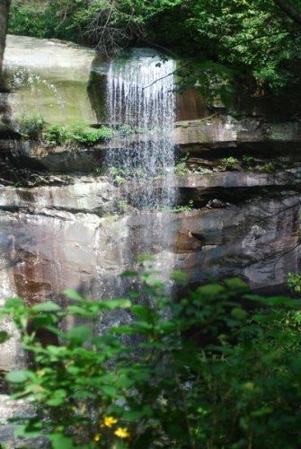
If you want to visit Rainbow Falls in Great Smoky Mountains National Park in the immediate future, be careful with your plans or you'll have to make a longer hike to do so.
The shortest route to the falls has been via the trailhead off the Cherokee Orchard Road. From it the Rainbow Falls Trail runs roughly 2.7 miles to the 80-foot waterfall, making an out-and-back trek 5.4 miles. However, with reconstruction of the road continuing, that trailhead, and the one to the Bullhead Trail, won't always be accessible in the coming weeks.
There are two other routes to reach Rainbow Falls, as TnHiker correctly points out in his comment below. One is the Old Sugarlands Trail, a horse and hiker trail that runs 3.9 miles to its connection with the Rainbow Falls route, and the Alum Cave Trail, which would entail a roughly 9-mile one-way jaunt to see the falls.
According to park officials, from Monday, August 23, through Friday, September 3, all traffic up the two-lane Cherokee Orchard Road will be required to turn around at Noah Bud Ogle Cabin. During the closure park managers are directing hikers bound for Mt. LeConte to either Alum Cave Trail or the Boulevard Trail.
Normal traffic on Cherokee Orchard Road will resume over the Labor Day Weekend from Saturday, September 4, through Monday, September 6. From Tuesday, September 7, through Friday, September 10, Cherokee Orchard Road will again be closed to public use into the park.
Park officials emphasized that since part of the work includes repaving of the two parking areas at the Rainbow Falls Trailhead, all vehicles must be removed from those parking lots by dark on Sunday, August 22. Additionally, all vehicles parked in the lots over the Labor Weekend must be removed by dark on Monday September 6.
Continuing road work will also keep the Roaring Fork Motor Nature Trail closed until Oct. 1.


Comments
A couple of errors in your article might confuse first-time visitors to this Smokies hiking area:
1. There is no Alum Creek trail. I think you were referring to Alum Cave trail (sometimes known as Alum Cave Bluffs trail).
2. There are two viable alternative trails to use to reach Rainbow Falls trail. The easiest is the Old Sugarlands Trail which would add 3.9 miles (one-way) to reach the lower end of Rainbow Falls trail Old Sugarlands trail is a pleasant, mostly level, walk thru pre-park settlement areas near the Sugarlands Visitor Center (Gatlinburg) and old C.C.C. era barracks areas. The more strenuous route would be 4.9 mile Alum Cave trail which happens to also be the most popular route for hikers bound for Mt. LeConte Lodge.
Readers wanting more info and photos taken along all of the trails in the Smokies might visit my non-commercial website: Life After 50--One Man's Perspective at URL: http://home.earthlink.net/~tnhiker/lifeafter50onemansperspective/
TnHiker,
Good catches! You're right, of course, about the Alum CAVE Trail. Fingers went in one direction, brain the other. And I had indeed overlooked the Old Sugarlands Trail. Regarding the Alum Cave Trail, however, it runs about 5 miles to its junction with the Bull Head Trail near Mt. LeConte, and then you still would have about a 4-mile hike to reach Rainbow Falls, no?
Thanks for the corrections. Perhaps we need to add you to our staff....
Kurt is right of course about the actual Rainbow Falls waterfall being another 4 miles down the mountain from the junction of Alum Cave trail and Bullhead/Rainbow Falls trails. I've always tended to focus on all the other non-waterfall features along hiking trails and sometimes forget that for many, the waterfall feature is the main event.
Staffer? Me? Nah, I've been retired since 1997 and very much enjoy the absence of deadlines. Hopes & expectations by readers are OK but, please, let there be no requirements imposed by folks other than my lovely hiking companion and our baker's dozen collection of cats.
Al
I was there last week trying to take my family on the Motor Trail. After waiting 5-10 minutes for the paving crew we got to the cabin and made a u-turn and left. Why the heck can't those large signs tell people the Motor Trail is closed before we waste 45 minutes in line to find out?
Has the Roaring Forks Motor Nature Trail reopened yet? It was supposed to open October 1st.