Treasures of history, culture, and natural beauty contained within the National Park System are increasingly at risk to the perils of climate change, with flooding and wildfire likely to sweep numerous park sites across the country, according to the Union of Concerned Scientists.
Coastal parks such as Everglades National Park in Florida, the Boston Historic District in Massachusetts, and the Bering Land Bridge National Preserve in Alaska stand to be inundated by rising oceans, while Mesa Verde National Park in Colorado and Bandelier National Monument in New Mexico are at risk of wildfires spurred by the warming, and drying, climate in the Southwest.
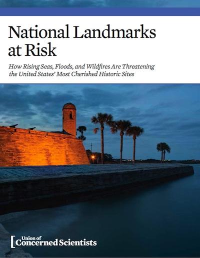
The scenarios laid out in National Landmarks at Risk, How Rising Seas, Floods, and Wildfires Are Threatening the United States' Most Cherished Historic Sites are not theoretical predictions, but rather case studies of landmarks that must be protected against the impacts of climate change, the authors write.
Now, nearly 100 years since the founding of the NPS, the agency finds itself forced to develop new ways to protect the natural and cultural resources in its care from the impacts of a changing climate. A recent NPS analysis shows that 96 percent of its land is in areas of observed global warming over the past century and that at least 85 sites have already recorded changes attributable to climate change. Many more have seen consequences such as increases in winter temperature, decreased snowpack, and shifts in precipitation that are consistent with climate change. Another study by NPS scientists has determined that more than 100 national parks are vulnerable to the combined impacts of sea level rise and storm surges.
With that evidence in hand, the Union of Concerned Scientists says it's urgent that the country begin work "to prepare our threatened landmarks to face worsening climate impacts; climate resilience must become a national priority and we must allocate the necessary resources. We must also work to minimize the risks by reducing the carbon emissions that cause climate change. The science is clear that by abating our carbon pollution we can slow the pace of change and thereby lower the risks posed by extreme heat, flooding, and rising seas."


Comments
I believe it and the National Weather Service believes it.
http://news.yahoo.com/sandy-downgraded-hurricane-tropical-storm-09194834...
Ebuck, once again, you posted a link from October 27th. At that point, the hurricane did go out to sea, and was downgraded to a tropical storm. It later built up into a hurricane, and on the night of the 29th it slammed into the East Coast and the hurricane's wrath was felt from Boston to North Georgia. It then dissipitated by the 31st. I was on Clingmans Dome, which is the 3rd highest point in the Eastern US on November 1st after it dissipitated and documented what it was like up there after that giant hurricane arm passed through. I waded through 4 feet drifts, and took a series of shots. I have a pretty decent knowledge of what I experienced and saw. You obviously were not in this area when it occured. But, it's nice of you to think you have such vast knowledge of the experience. Are you always this clueless and arrogant?
http://hikinginthesmokys.blogspot.com/2012/10/as-of-tuesday-morning-hurr...
Let's try to keep it civil, folks.
http://photos.oregonlive.com/photo-essay/2012/10/hurricane_sandy_hits_la...
First line: "The National Hurricane Center confirmed that 'post-tropical cyclone' Sandy made landfall near Atlantic City. The storm now lacks a hurricane's rotation but still packs sustained 80 mph winds."
Whatever EC. Keep your head in the sand. Seems like it suits you. It was called Hurricane Sandy, not tropical storm Sandy. Just bow out, and call it a day.
Actually it was called both, but only Tropical Storm Sandy when it hit shore.
Gosh, what would keep converstations going on this issue as well as several others if it weren't for people like ecbuck. We would all miss him.
Almost from the start of the Traveler back in 2005 we have encouraged dialogue...but also requested that it be constructive and respectful. It's guaranteed by human nature that all will not agree. That's a given.
But we will continue to ask that those who comment do it both constructively and respectfully. While moderators cannot ensure that everyone toes that line -- as evidenced by comments on this and other posts in the past week alone -- we nevertheless will continue to ask that you do.
We have installed an "ignore user" button that you can put to use if you don't agree with another's comments, and we hope you'll use it rather than waging a disrepectful and oftentimes pointless war of words.