The Sunken Forest is one of the unique aspects of Fire Island National Seashore/NPS
You may not think that you could lose yourself in the embrace of a forest at a national seashore, but that's something you'll encounter when you head to Fire Island National Seashore just off the south shore of Long Island, New York.
Here, away from the pounding Atlantic and the swells of Great South Bay, there's a gem nestled behind the dunes of Fire Island. Hidden from the ocean by two lines of rising dunes, and so protected from salt spray flung by the waves, a more than 350-yearold maritime forest of American holly, Shadblow, Sassafras, Black Gum, and thickets of other vegetation has withstood time and development. The Sunken Forest covers 39.5 acres of the seashore and preserves a globally rare collection of plants across a thin strip of forest never more than a quartermile wide.
Another surprise is that the seashore's Otis Pike Fire Island High Dune Wilderness, a 7-mile-long stretch of undeveloped barrier island, is the only officially designated Wilderness in all of New York state. It's one of the smallest wilderness areas in the National Park System, at less than 1,400 acres. You can explore it via foot or sea kayak and enjoy a rare wilderness adventure just 60 miles from New York City.
While backcountry camping (reservations and permits via recreation. gov) is a great way to experience the Fire Island Wilderness, there is more to enjoy at Fire Island National Seashore. The William Floyd Estate, home of a signer of the Declaration of Independence, can be toured on the Long Island mainland at Mastic Beach. There you'll find 250 years of history represented in architectural features and artifacts from three centuries of American life.
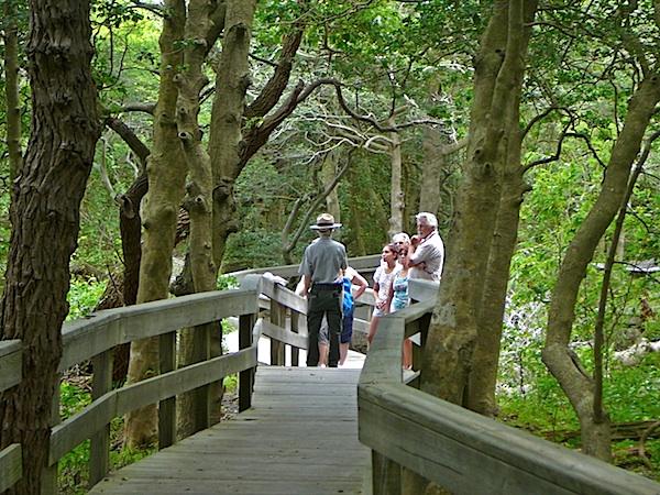
Beach lovers should consider Watch Hill, a beautiful life-guarded beach on the oceanfront. You'll also find a boardwalk nature trail that winds from bay to beach, through extensive pristine salt marsh habitat, early successional maritime woodlands and inter-dunal swale.
If You Go
Lighthouse Beach, on the west end of the national seashore, is one of the more crowded spots in summer, so you might want to avoid it and head to Watch Hill. Thanks to its location along the Atlantic Flyway, Fire Island is great for birdwatching, especially during the spring and fall migration times.
Hurricane Sandy in 2012 carved a breach from ocean to bay in the Fire Island wilderness. The natural feature continues to be shaped by the wind and waves and serves as a reminder of the dynamic nature of the barrier island. The wilderness breach is accessible via a 3 mile round-trip walk from the Wilderness Visitor Center.
Cherry Grove, one of the nation's first and oldest LGBT communities, is located within the national seashore's boundaries.


Add comment