Lava flows have led to a need for an emergency access route to Pahoa at Hawaii Volcanoes National Park/NPS
A proposal to build an emergency access route across a lava-covered section of Chain of Craters Kalapana Road at Hawai'i Volcanoes National Park is not without hazards to the environment in the form of "potentially ecosystem altering" invasive species such as fire ants and coqui frogs.
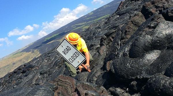
The access route is necessary because of lava flows that began June 27.
Hawaii Island is experiencing lava flows from KÄ«lauea Volcano's Pu'u'Å'Å vent. The most recent flow began on June 27 and is named for the date it started. In early September 2014, it shifted to a direction that it has not gone in the past 30 years. On September 11, it became evident that the flow is a threat to the community of Pahoa and could cut off all access to the Lower Puna community. The 'June 27' flow is likely to cross Pahoa Village Road and Highway 130, given the lava's current course.
The proposed road, which would be 22 feet wide, is needed to provide access in and out of Pahoa. The use of the emergency access route will only last as long as there is no viable alternative route for the residents of the affected area to use to gain access to the rest of the Island of Hawai'i, according to park officials.
Public comments are being taken on the proposal through December 5. Documents prepared for the project, along with noting the potential for creating a route for invasive species to the Pahoa area, note that the project could adversely impact nÄnÄ, an endangered goose species.
...even with the minimization measures, long-term vehicular traffic is likely to disturb breeding / nesting / rearing along a 1 to 1.5 mile stretch from the current end of the road to the west. This will be a long-term impact for as long as the emergency access route is needed (as opposed to the previous short-term impact during evacuation only). There is a higher likelihood of vehicle strikes with the increased traffic both near the end of the current pavement, and further up Chain of Craters Kalapana Road where nÄnÄ are known to cross or utilize habitat near the road. The increased number of road users could also contribute adverse impacts to nÄnÄ because of a higher likelihood of dogs off leash, human-bird interactions, and people feeding nÄnÄ.
Project documents are available for review at this website, where comments can also be left.


Comments
That part of Hawai'i is amazing. Near Pahua, there is a section that has been overrun by lava twice in the last 30 years, and yet people have been rebuilding homes on top of lava. Beautiful island though.