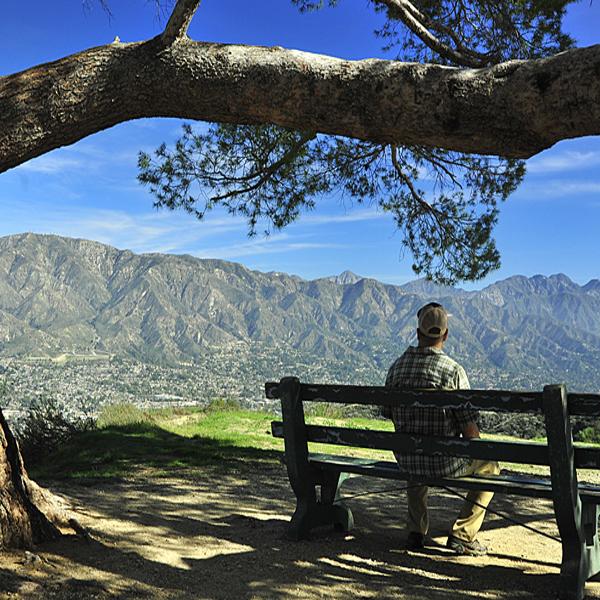
National Park Service officials are proposing that Santa Monica Mountains NRA be expanded by roughly 173,000 acres/© Tom Gamache Photography
A long look at whether a landscape that generally includes the mountains encircling San Fernando, La Crescenta, Santa Clarita, Simi and Conejo Valleys of Los Angeles and Ventura counties in California should be designated a unit of the National Park System is suggesting that 173,000 acres be added to Santa Monica Mountains National Recreation Area.
The Rim of the Valley Corridor Special Resource Study, which came out in draft form Tuesday, explores how public lands in the region should be managed and how area residents want those lands to be used. The Rim of the Valley study area described in the 2008 legislation that directed the National Park Service to complete the analysis covers more than 650,000 acres of mountainous landscape. The study area also includes the majority of Santa Monica Mountains National Recreation Area and portions of the Angeles National Forest that serve as the headwaters of the Los Angeles River. Approximately half of the acreage of the study area is publicly owned.
Under the preferred alternative in the draft document, "areas included in the boundary adjustment generally include the portions of the study area bordering the most populous areas of the Los Angeles region, including the mountains surrounding the San Fernando and La Crescenta Valleys, and the Los Angeles River and Arroyo Seco corridors. The boundary adjustment would not include any area of the Angeles National Forest or San Gabriel Mountains National Monument. SMMNRA would be authorized to partner and provide technical assistance to land managers and private landowners to protect habitat connections to the national forests and to assist local communities in planning for recreational opportunities."
Approximately 40 percent of the 173,000 acres proposed for addition to Santa Monica Mountains NRA currently is protected by other land-management agencies and organizations for purposes that include conservation, open space, and/or recreation, the Park Service said. Inclusion in the NPS boundary would give NPS the authority to expend funds on creating trails and other facilities where appropriate.
Initially, existing SMMNRA staff and operations would support the newly added areas. Initial staffing needs would primarily be for park planning, outreach, and coordination with other agencies and organizations. Increased staffing for the expanded SMMNRA would happen incrementally over time as implementation planning specifies objectives and as the NPS acquires land. Following completion of a management plan that would identify more specific goals for land protection, resource management, facilities, education, and outreach, more detailed operational costs and staffing needs would be identified. The annual NPS operating budget for the expanded SMMNRA in alternative C could range from $9.5-$10.5 million, an increase of $900,000-$1.9 million above SMMNRA's 2012 operating budget.
The National Parks Conservation Association, The City Project, and a network of Los Angeles-based organizations known as the Rim of the Valley Coalition called Tuesday for action to advance the study's findings.
'As a lifelong Angeleno and national park advocate who has worked to connect youth and diverse communities to our treasured outdoor spaces, I proudly support the Rim of the Valley proposal,' said Dennis Arguelles, NPCA's Los Angeles program manager. 'From the Santa Susana Mountains to the heart of the city at El Pueblo de Los Angeles, the Rim of the Valley is an area rich in historic and cultural sites and critical wildlife corridors, waterways and landscapes worthy of national recognition and protection by the National Park Service.'
With more than 17 million people, the Los Angeles metropolitan area is the second-most populated region of the country, yet has less open space per capita than all other large cities on the West Coast, according to NPCA.
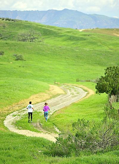
More recreational opportunities would be realized through the Rim of the Valley proposal, according to proponents/© Tom Gamache Photography
"The Rim of the Valley proposal represents an opportunity to better protect and manage some of the region's last wild lands, open spaces-- including habitat for threatened species ranging from the mountain lion to the red-legged frog'and historic sites that will allow the National Park Service to tell the story of Los Angeles's rich and nationally-significant history," the group said in a release. "The expanded presence of the National Park Service will also facilitate new partnerships with schools, local governments and community-based organizations to improve outreach and park service-led interpretive programs, better connect youth and families to the outdoors, and build a new generation of national park enthusiasts."
At The City Project, Founder Robert Garcia said expanding the NRA would increase "access to healthy green land use for underserved communities.'
'Expanding national recreation areas would advance environmental justice, human health and local green jobs by creating recreation opportunities for park poor, income poor communities and communities of color," he added in a prepared statement. "Diversifying access to and support for healthy green land use appeals to the diverse values at stake for all people of Southern California.'
The draft document will remain open for public comment for at least 60 days. If no significant environmental impacts are identified, and no major changes needed to the preferred alternative, a Finding of No Significant Impact would be made. That document would include a final decision by the Park Service on which alternative to support. From there, the Interior secretary would transmit the final study report consisting of the FONSI, including the selected alternative, and any technical corrections to the draft study report, to Congress, along with the Secretary's recommendations for the study area. At that time, the final recommendations will be made available to the public.


Add comment