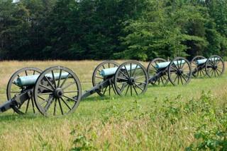
Nearly $1.2 million in grants have been dispersed to battlefield sites across the National Park System/Kurt Repanshek file photo
Editor's note: The following is an unedited release from the National Park Service.
The National Park Service has announced $1.19 million grants to support 20 projects at significant battlefields across the country. The projects will research, document, or interpret dozens of battlefields representing more than 300 years of history.
"From the shores of the Mariana Islands, to an old Dutch fort in Delaware, to a man-made mountain defense in Vermont; these places hold important clues to our past," said National Park Service Director Jonathan B. Jarvis."Preserving and understanding these sites allows us to better understand the complex history of these conflicts, as well as stories of sacrifice and heroism that ultimately shaped our nation today."
This year's grants provide funding for projects at endangered battlefields from the Hawaiian Civil Wars, Indian Wars, Revolutionary War, French and Indian War, World War II, War of 1812, and the Civil War.Awards were given to projects in 14 states entailing archeology, mapping, cultural resource survey work, documentation, planning, education, and interpretation.
The grants are administered by the National Park Service's American Battlefield Protection Program. Federal, tribal, state, and local governments, nonprofit organizations, and educational institutions are eligible for the battlefield grants, which are awarded annually.Since 1996, the American Battlefield Protection Program has awarded 559 grants totaling $18,442,955 to help preserve significant historic battlefields associated with wars on American soil.
More information about the American Battlefield Protection Program Battlefield grants is available at: www.nps.gov/abpp/grants/planninggrants.htm.
Below is a list and description of the grant recipients:
Multiple States
Civil War Trust $162,900
This project will compile, map and index key ABPP data pertaining to battlefields of American conflicts beyond the Revolutionary War, the Civil War, and the War of 1812. The sites range from 16th-century contact encounters with Native Americans to World War II actions in the Pacific. A planned battlefields guide will aid in the prevention of future harm to battlegrounds which have too often gone unrecognized and unheeded by surrounding communities. Landowners, developers and local governments will be able to employ this guide as they seek to pursue growth in context-sensitive ways, with a better understanding of the significance of the historic landscapes in their midst.
Delaware
New Castle Historical Society $71,500
This project will identify and delineate the boundaries of the Fort Casimir Battlefield as well as determine the extent of subsurface remains of both the fort and related sites in the surrounding area. The fort was built in present-day New Castle by the Dutch in 1651 and was the site of a decisive battle between the Dutch and English in 1664 that helped establish English control of the Delaware Valley. Conducting ground penetrating radar and select subsurface testing will help locate any artifacts. A final report will be distributed to the public and used to develop future educational materials.
Hawaii
Barbers Point Riding Club $63,000
This project will delineate the boundary for the Ewa Field Revetment District and prepare a nomination to the National Register of Historic Places. Ewa Field was at the center of the Japanese attacks on Pearl Harbor, Hawaii, in December 1941, which brought the United States into World War II. Several concrete domed revetments were built to protect planes from future aerial attacks, and are the largest such grouping still extant in the Pacific. The delineation will better place the District within the community, and the nomination will draw attention to the battlefield resources for better protection.
The Kohala Center Inc. $75,000
This project will create a cultural resources management plan for the Kuamo'o Battlefield and Burial Grounds, a 47-acre parcel of land in Keauhou-Kona on Hawaii Island where one of the most significant battles in Hawaiian history was fought in December 1819. Kekuaokalani, the nephew of Kamehameha I who created a unified Kingdom of Hawaii in 1810, led an unsuccessful revolt against the Hawaiian Royal Army to preserve the ancient Hawaiian conduct code called Kapu. The plan will include a physical resource map, a narrative roadmap created with community members and those with ancestral ties to the land and the battle, and a funding strategy for the protection, stabilization, restoration and management of the land.
Kentucky
Kentucky Civil War Sites Association $35,000
By gathering data at approximately 15 Revolutionary War and Civil War battlefields and associated sites across Kentucky, this project will conduct a statewide economic impact study to demonstrate their economic importance. Two to four regional public meetings will be held to help build community consensus. A summary of the study will be printed and presented to government officials at all levels and other stakeholders in the state. The objective is to generate more support and funding for battlefield preservation statewide.
Mariana Islands
Ships of Exploration & Discovery Research, Inc. $64,600
This project will both expand the regional understanding of the World War II "Operation Forager" in the Mariana Islands and monitor the Saipan Underwater Maritime Heritage Trail. The Operation, conducted between June and November 1944, was punctuated by American victories at the Battle of Saipan and the Battle of Tinian. The project will conduct baseline identification of maritime heritage in the area, and assess photogrammetric data to identify long-term impacts at the sites related to climate change. Public meetings and a robust media presence will help educate the communities about these historic resources.
Massachusetts
Town of Montague $81,000
This project will conduct archeological fieldwork at the Battle of Great Falls (Wissantinnewag-Peskeompskut) fought in May 1676, in northwestern Massachusetts as part of the King Phillips War. This battle was part of an armed conflict between Native American inhabitants of present-day New England and English colonists and their Native American allies fought between 1675 and 1678. The primary objective of the fieldwork will be to locate, sequence, and document battlefield actions to create a preservation plan and an assessment of the site's eligibility for listing on the National Register of Historic Places.
New York
City of Plattsburgh $54,000
This project will evaluate the needs and assets of six key northern New York battle sites from the Revolutionary War (Valcour Bay) and War of 1812 (Crab Island, Plattsburgh Bay, Fort Brown, Fort Moreau, Fort Scott). The Battle of Valcour Bay, fought in October 1776, is considered one of the first naval battles of the Revolutionary War. The other five sites are related to the Battle of Plattsburgh, fought in September 1814, which was a deciding battle in ending the War of 1812. Through regional planning, public engagement, document review, and archeological assessment, this project lays the foundation for a strategic preservation blue print and a coordinated plan for heritage tourism for the Plattsburgh region.
Raymond W. Harvey American Legion Post 703 $80,000
This project will conduct an archeological study to determine the integrity of the Battle of Fort Anne's defining features. In July 1777, early during the Saratoga Campaign of the Revolutionary War, a larger British army defeated a Continental force that was retreating from a loss at Fort Ticonderoga days earlier. Through an archeological study and development of an overall preservation plan, the project will engage the public and present a history of the battle for future visitors and researchers.
Seneca Nation of Indian Tribal Historic Preservation Office $46,000
This project will document the location and boundaries of the Battle of Bucktooth, believed to be the northernmost skirmish between American General Daniel Brodhead and the Seneca Tribe during the Western Campaign of the Revolutionary War. Fought between August and September 1779, knowledge of the battle is based on Seneca oral histories.Through archeological survey, the office aims to verify those histories and set aside the battle site as a historical landmark. The site can then be preserved and interpreted for the Tribe and surrounding communities.
SUNY Buffalo Research Foundation $23,200
This project will conduct an archeological survey to assess and preserve the site of the Battle of Scajaquada Bridge, fought in August 1814 during the War of 1812. An outnumbered American force defended Buffalo against a British force trying to destroy provisions and supplies stored in the city. The project will work with government agencies in planning for the ecological restoration and redevelopment of Scajaquada Creek and surrounding properties, and raise community awareness of the battle.
Town of Lake George $50,000
This project will compile an inventory of sites and features associated with Fort George, the site of several battles of the French and Indian War and the Revolutionary War.The Fort was the site of the Battle of Lake George in 1755, where a combined British and Colonial force defeated the French.The Americans captured the site in 1775 only to have the British take it back in 1780. Period maps and primary documentary sources, coupled with non-invasive archeological field reconnaissance and Geographic Information System (GIS) technology, will assist in the final report. It will include a recommendation of town-wide signage to enlighten the public on the battlefield and its associated sites.
Oregon
Southern Oregon University $92,600
This project will produce multiple property nominations to the National Register of Historic Places for sites related to the Rogue River War (1855-1856) in southern Oregon. Increased white settlement in the area caused ire among the native Rogue River people, leading to several conflicts. The project will conduct historical research, an archaeological survey, and GIS mapping to determine conflict boundaries. It is part of a long-term commitment by regional partners to interpret the Rogue River War in a holistic way for the public and interested scholars.
South Carolina
Salve Regina University $39,000
This project will conduct site documentation for the Sadkeche Fight and its associated sites.In April 1715, at the beginning of the Yamasee War (1715-1717), an outnumbered South Carolina militia defeated a Yamasee Indian force which was advancing towards Charleston.Using GIS software with light and survey radar (LIDAR) data, the project will also conduct a military terrain analysis to produce a map of the battlefield. A research design for future archeological testing and a phased preservation plan will help educate the community about the Yamasee War and the importance of battlefield preservation.
South Carolina Battleground Preservation Trust $72,800
This project will verify and adjust battlefield maps for 21 high priority Revolutionary War battles in North Carolina and South Carolina. Input and evaluation will be sought from public and private organizations, state agencies, and the National Park Service. These maps will serve as the foundation for preservation efforts now underway led by the Civil War Trust in their "Campaign 1776" initiative.
South Carolina Battleground Preservation Trust $76,000
This project will create a master database of 16 Revolutionary War battlefields and associated sites in Beaufort and Colleton Counties in South Carolina. These counties are located along the coast and were a main thoroughfare for British troops moving between Savannah and Charles Town. The Trust will map the visible sites using aerial light and radar (LIDAR) survey, conduct military terrain analysis, and record property information for each site. The Trust will coordinate with the State to nominate qualifying sites for listing on the National Register of Historic Places. The project will seek input from the public and hold several meetings to educate the communities about the battles.
Spartanburg Area Conservancy, Inc. $32,000
This project will facilitate the formation of a preservation committee with a new "Friends of the Southern Campaign" group headquartered at Cowpens National Battlefield in South Carolina. The Southern Campaign of the Revolutionary War was where the British focused their efforts after their Saratoga Campaign failed in the North. Several decisive battles, such as Cowpens, Kings Mountain, and Yorktown, contributed to the end of the British fight. The project will develop and implement a preservation outreach strategy for landowners whose property is adjacent to battlefields, and develop a communications plan to promote battlefield preservation and public outreach.
Vermont
Vermont Department of Housing &Community Affairs $24,000
This project will create a comprehensive geospatial map of the southern portion of Mount Independence, which represents one of the largest defenses built by the Americans during the Revolutionary War. Completed in 1777, Mount Independence was a critical site in the naval defense of Lake Champlain and points south. The project will map all landward features using GIS software, and the data will be compared to historic maps and archives to assess the engagements along the defenses. The resulting product will be crucial for the proper stewardship of these resources and will provide an important platform for future site interpretation and public education.
Virginia
Piedmont Environmental Council $35,000
This project will research the history of two previously undocumented Civil War battles, Jacks' Shop and James City. The Battle of Jack's Shop, fought in September 1863, was a small but bloody cavalry engagement that ended inconclusively. The Battle of James City, fought a month later, involved a series of failed cavalry charges on both sides.Research will include documenting the extent of the battlefields on the landscape using GIS mapping, and create three archeological research designs. This information will be used to inform future archeological investigations of the battlefields, as well as provide justification and context for preservation planning and land conservation.
Shenandoah Valley Network (Piedmont Environmental Council) $20,000
This project will help improve local land use planning and increase private land conservation in Rockingham and Shenandoah Counties to preserve the rural character, agricultural base, and natural and historic resources for six nationally-significant Civil War battlefields. The Network will work with local conservation and preservation partners, providing strategic public outreach materials and interpretive maps to take advantage of immediate planning and outreach opportunities to protect the integrity of these battlefields.
Total $1,198,000


Add comment