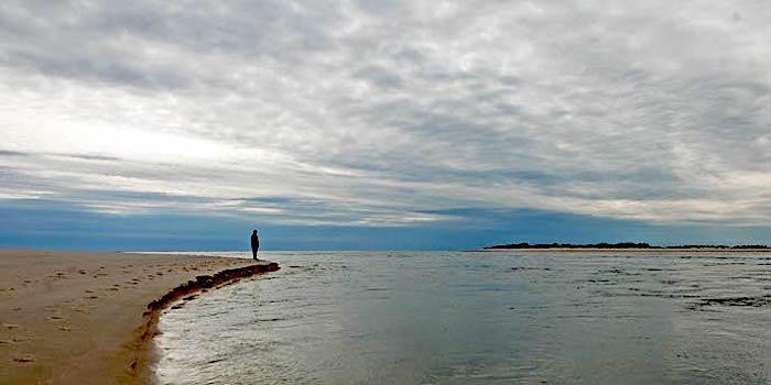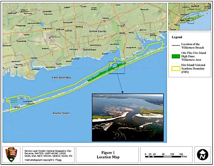
National Park Service officials are proposing that a breach in the Otis Pike Fire Island High Dunes Wilderness be left to manage itself/NPS
Natural processes, specifically the ebb and flow of the Atlantic Ocean, should be allowed to continue at Fire Island National Seashore, where the National Park Service is willing to let a breach in the Otis Pike Fire Island High Dunes Wilderness open and close as the waves dictate.
In most cases at the national seashore, breaches such as the one at Old Inset in the Otis Pike wilderness caused by Hurricane Sandy back in 2012 are filled in under the guidelines of the seashore's Breach Contingency Management Plan. That's how the breach at Smith Point County Park, which lies within the seashore's boundaries and also was created by Sandy, was quickly repaired. But the breach in the wilderness area has been allowed to manage itself, and now the Park Service is proposing to allow it to continue that way.
Under Alternative 3 in the seashore's draft Island Wilderness Breach Management Plan/Environmental Impact Statement, "the evolution, growth, and/or closure of the breach would be determined by natural barrier island processes, and human intervention to close the breach would occur only 'to prevent loss of life, flooding, and other severe economic and physical damage to the Great South Bay and surrounding areas.'"
Geologic studies have determined that "erosion-resistant clays" bound both the east and west ends of the breach, and so serve as sort of "geologic controls" that act as impediments to enlargement of the breach, the draft plan notes. A benefit of the breach has been greater water movement and "mixing" in the Great South Bay between the national seashore and the New York mainland. That has led to higher salinity levels in the bay, higher flows, cooler water temperatures in the summer and warmer in the winter, and more diverse sealife passing between the open ocean and the bay.
"Prior to the wilderness breach, ecosystem maturity in the bay had declined over the last 120 years, but the formation of the breach has triggerd an increase in ecosystem maturity in Great South Bay," the draft report states. "This is demonstrated by direct evidence showing an increase in several attributes of ecosystem maturity, including total biomass and species diversity due to greater connectivity with the ocean.
"Several other attributes of ecosystem maturity, including an increase in food web complexity, diversity of feeding relationships, upper trophic level predators, and migratory fish species are also possible, but there are not yet any data to indicate that these factors have increased," it went on. "More mature ecosystems are healthier, more stable, and more resilient to disturbance. The Great South Bay ecosystem is home to a diverse array of fauna and flora that interact dynamically in the variety of habitats in the bay, and a suite of processes that operate in the system such as nutrient cycling and decomposition."

In seeking comment on what should be considered during development of this plan, the seashore received more than 350 comments that ranged from calls to leave the breach open and to close it as well as more 'creative' approaches for managing the situation. Far and away the bulk of the comments -- 154 -- suggested the breach remain open and left to the Atlantic's currents. Some suggested ongoing dredging to ensure it remains open.
Public comment is being taken on the draft proposal from October 28 through December 12.


Comments
Let nature take its course.