Voyageur National Park's waterway system, consisting of four large island-studded lakes connected by narrows, was once the route of the French-Canadian voyageurs. A large peninsula with a glaciated, boreal forest landscape completes the ensemble in this Canadian border-hugging Minnesota park.
Here are some of the park's significant numbers.
253,891
Recreational visits in 2010. Since there was a major counting instruction change (now using Creel survey), comparison with previous years requires special adjustments.
218,200
The park's acreage, which is fairly large by eastern standards. Voyageurs is slightly bigger than Shenandoah National Park.
10,000 years
Approximate time since the most recent continental (ice sheet) glaciers melted in this part of North America, leaving a landscape mantled with sandy soils, boreal forest, abundant lakes and ponds, and numerous glacially-sculpted rock outcroppings.
655
Miles of shoreline in the park, which has four major lakes (Rainy, Kabetogama, Namakan, and Sand Point), 24 smaller ones, and more than 500 islands. Thirty-eight percent of the park (83,808 acres) is water-covered, making water a defining feature of the park.
~150
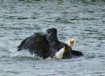
Black bear population of Voyageurs, which also has wolves (several packs), bald eagles, white-tailed deer, and many other species that visitors love to see.
27.9 miles
Length of the park's Kab-Ash Trail, a moderately difficult trail used for summer backpacking and (ungroomed) winter cross-country skiing and snowshoeing. Voyageurs has eight other hiking trails, including some short, easy ones like the Blind Ash Bay Trail, a half-mile loop.
26 feet
Length of the big canoes used to take visitors on North Canoe "voyages" available by reservation at the park's Rainy Lake and Kabetogama Lake Visitor Centers. The sturdy craft is similar to the "North Canoe" (Canot du Nord) that the voyageurs used for hauling supplies, trade goods, and furs on rivers west of Lake Superior.
3
Boats used for guided tours and charters in the park. The Voyageur and Otter are used for cruises on Rainy Lake and Kabetogama Lake, respectively. The Borealis is used when water levels in Lake Rainy are too low for the Voyageur. All three boats can all be chartered for school outings, family reunions, weddings, and other special events.
0
Developed campsites with road connections. All of Voyageurs' campsites are accessible only by boat or (in some cases) floatplane. Even the hike-in campsites on the Kabetogama Peninsula are on trails with boat-accessible trailheads. Many of the park's more than 200 camping areas have food lockers, picnic tables, tent pad sites, fire rings, and a privy.
0
Floatplanes allowed to land on Kabetogama Peninsula lakes. Floatplanes are allowed to land only on the waters of Rainy, Kabetogama, Namakan, and Sand Point Lakes. This restriction is meant to prevent the introduction of aquatic-based exotic species and fish diseases, in particular the spiny water flea (Bythotrephes longimanus), into waters free of exotic or invasive species and fish diseases.
-8 ºF
Average daily low temperature in January. Although summer afternoons typically have comfortable temperatures, the park has the cold winters characteristic of higher-latitude continental interior locations. Durable snow cover and ice (up to two feet thick on some lakes) support a wide range of winter recreation activities, including cross-country skiing, snowmobiling, snowshoeing, and ice fishing.


Comments
Favorite memories from little-known Voyageurs, several years ago when our kids were still in school:
Seeing the Northern Lights
Big Canoe "voyage", with guides dressed as French Voyageurs
Boat ride to Kettle Falls, and looking south to Canada at one spot
Personally, I prefer the Quetico Wilderness just across the border in Canada. They offer only 10% as many wilderness permits and you'll see more moose than people. The fishing is outstanding due to lack of pressure. I pulled a 60 inch musky up to my canoe in Lake Kawnipy, caught and released 9 smallmouth bass on 9 consecutive casts with 9 different lures on the St Mary's River, and caught all the Lake Trout I needed for a party of 8 on St Mary's Lake. It's a tough portage to get in there but it is well worth it.
The Northern Lights are outstanding, but the mosquitos are feroscious at dusk and the biting black flies can be hell biting through cotton socks at the bottom of your canoe as you paddle across open water.
R Stefancik -- You were lucky they only went after your socks. Those black flies bit a hole in the bottom of my canoe. Darn near sank us.
But what wonderful places, Voyager's and Quetico. I wonder if the flies and mosquitos go away in September?
They go down considerably after the 1st freeze, usually mid September. But by that time the winds are kicking up and you can get quite a lot of cold rain.