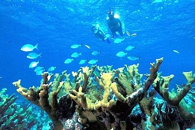
Imagine being in charge of a national park where fish stocks are reeling, coral reefs are declining, and boaters are damaging both reefs and seagrass beds. Toss in sea-level rise, climate change impacts, and ocean acidification, and you've got quite a mess on your hands.
That's the case at Biscayne National Park, where officials are working on an update to their General Management Plan to better manage the park's resources under these issues.
When Biscayne National Monument was established in 1968, South Florida was a very different place. There were far fewer people living here, and having a boat was even more of a luxury than it is today. Old-timers tell stories of enormous snook, grouper and other 'good eatin' fish, and about spiny lobster carpeting creek bottoms. The monument (which became a National Park in 1980) was established to protect those resources from two very real threats: the planned City of Islandia on its Keys, and the planned SeaDade petrochemical plant and oil refinery on its shoreline. Thanks to a long, hard-fought effort by a very persistent group of citizens, the area was saved from development.
Over 40 years later, though there is no Islandia and no SeaDade, things are far from perfect. Fish stocks are not what they used to be. Neither is coral cover. Over a half-million people visit the park every year, most of them by boat. Seagrass beds and reefs are scarred from groundings. Sea level rise, ocean acidification and other effects of a changing climate threaten all that so many worked so hard to protect.
Through October park officials are taking public input on how best they can manage the park and its resources. Folks at the South Florida Wildlands Association are cautiously optimistic about the plan being proposed by Biscayne's managers, particularly the sections covering boating in the park.
“As part of the General Management Plan review, the park is evaluating various marine zones offering opportunities for divers, snorkelers, kayakers and other visitors to experience unexploited marine environments," says Matthew Schwartz, the group's executive director. "Some would provide full protection from extraction while others would prevent disturbance or habitat damage from motorized vessels.”
Under the preferred alternative in the draft GMP, park officials are proposing the following for boaters:
* 2,461 acres designated “slow speed motor zone”
* 4,843 acres (inshore and onshore) designated “nature observation zone”
* 10,522 acres designated “marine reserve zone”
* 2,792 acres designated “non-combustion engine” use zone
"South Florida Wildlands Association is currently reviewing all proposals - including the even more protective Alternative 5 (e.g. the marine reserve “no take zone” covering sea grass and coral reef habitats on the park’s eastern side doubles from 10,522 acres to 21,812 under that plan)," said Mr. Schwartz. "However, we applaud and support Biscayne National Park Superintendent Mark Lewis and his staff for taking this important and courageous step.
"The National Park Service has little say on numerous projects outside park boundaries which can and will impact the health of Biscayne Bay in the future. These currently include: cutting through the bay’s northern coral reefs to allow larger ships to enter the Port of Miami; the proposed construction at Turkey Point (the southern end of the bay) of two new nuclear generators cooled by millions of gallons a day of recycled Miami-Dade sewage; and increased acidification caused by absorption of excess CO2 into the oceans," he continued. "Unlike these threats, over-fishing and damage to shallow seagrasses and coral reefs by powerboats inside park boundaries are under the direct control of the National Park Service. They are impacts the agency not only can control but must. Let’s support that effort."
You can find additional background on the draft GMP, and comment on it, at this site.


Comments
We need no-take zones.