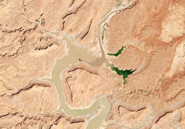
As of mid-May, Lake Powell was about half-full, judging from this photo provided by the NASA Earth Observatory.
Books have been written about the waning waters of the Colorado River drainage, and roughly $1 million has been spent to deepen boat channels at Lake Powell, but perhaps the best evidence symbolizing the plight of the once-majestic river is a photo from Space.
Taken on May 13 of this year by a satellite associated with the NASA Earth Observatory, the image shows a muddy river snaking through Glen Canyon National Recreation Area in southern Utah and northern Arizona. According to officials, the image shows Lake Powell being just half-full. Fourteen years ago the late was at 94 percent of its capacity, the Earth Observatory reported. Since then, there have been 11 years of drought conditions.
To put some perspective to the lake's current level, if you were on a boat bobbing on the surface, "full pool" of the reservoir would be 117 feet above you, the Observatory notes.


Comments
This a photo of Hite at the upper end of the lake. It has been high and dry for several years now. There also has been an enormous amount of siltation filling the lake in this area. When I was there last year, a maintenance worker -- one of a skeleton crew maintaining buildings and other facilities there -- said that siltation means the water will be 40 feet shallower when it refills. Siltation extends as much as fifteen miles down lake from Hite, gradually tapering off until the lake is as deep as before. It will be interesting to see if anyone can determine how long it will be until Lake Powell is completely full of mud.
Here's a link to an article about that subject from High Country News.
http://www.hcn.org/issues/43.6/muddy-waters-silt-and-the-slow-demise-of-...