Having not played golf in at least 15 years, I couldn't tell if the miserly elevation of the Furnace Creek Golf Course was responsible for my lackluster drives, or whether they were simply the product of operator failure.
Set at 214 feet below sea level, the course nestled near the center of Death Valley National Park carries a 70 par, which I was in no danger of eclipsing.
Though some no doubt will be confounded by the presence of a golf course in a national park (there's also one at Yosemite National Park, another at the Presido in Golden Gate National Recreation Area, and some in the D.C. area), the Furnace Creek links actually predate the national park. The course was launched back in 1927 when three holes were installed. In 1931, two years before Death Valley National Monument came into being, the course was expanded to nine holes, and in 1968 another nine were added. The entire course underwent a substantial upgrading (with full irrigation installed) in 1997 under the guidance of Perry Dye.
Beyond the historical context, the golf course also happens to be on private property. The land on which the Furnace Creek Ranch and the nearby Furnace Creek Inn sit on actually is an inholding now owned by Xanterra Parks & Resorts.
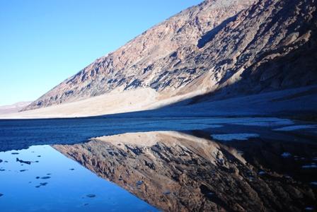
But Death Valley shouldn't be viewed simply as a golf resort. Rather, it is one of the most incredible geological displays in the Northern Hemisphere. Indeed, Death Valley is not even a true valley, one created by a river, but rather a "rift valley" created by the downward movement of the valley floor that separates two mountain ranges. Here's how Robert J. Lillie, in his book, Parks and Plates, The Geology of Our National Parks, Monuments, And Seashores, explains it:
Extreme topographic relief in the park, from the top of Telescope Peak at 11,049 feet to the bottom of Death Valley (Badwater Basin) at 282 feet below sea level, is a consequence of offset along normal faults. At least 2 miles of young rift strata cover Death Valley, so that vertical fault displacement is at least 4 miles.
While the Mesquite dune field is the most popular sandbox at Death Valley, no doubt due to its easy access at Stovepipe Wells, it's just one of a handful scattered around the 3.3-million-acre park. You've got the Eureka Dunes near the northern tip of the park that not only offer the largest dunes in the park, at upwards of 600 feet, but also some of the largest dunes in the country.
Not far from the southern boundary of the park rise the Ibex Dunes, while along the western border north of Panamint Springs sprawls the Saline Valley Dunes. The Panamint Dunes, meanwhile, are just a nudge or so north of Panamint Springs.
* * *
It's all about marketing.
While there are interesting place names throughout the National Park System, one does wonder if Death Valley would have been tagged with so many had the Park Service been in charge since the '49ers left the place. After all, only one pioneer died, and yet those who drop names jumped on the bandwagon to create the, hopefully marketable, link to death and the devil.
For instance, aside from the over-arching name, you've got Devils Cornfield, the Devil's Golf Course, Deadman Pass, Coffin Peak, Hells Gate, and, of course, the Funeral Mountains.
* * *
Death Valley's cultural history is well-known. At least from 1849 on. Native Americans did live here, at least part-time, and throughout the park there have been artifacts and petroglyphs discovered down through the years.
But perhaps the most impressive cultural imprint on this dry landscape is in upper Grapevine Valley where you'll find Scotty's Castle. Though it requires a 53-mile, one-way ride from the intersection of California 190 and California 374 near Stovepipe Wells to visit the "castle," this is one stop you shouldn't overlook if you make it all the way to Death Valley.
Not only is this Spanish-influenced mansion seemingly out of place in the high desert, but it's design seemingly pushed the technological limits of the 1920s. Not only did Albert Johnson see that there was a solar heating system at work, but he also had a Pelton water wheel turbine installed to generate electricity for the place. Too, an evaporative cooling system employed indoor waterfalls and even wet burlap to keep things inside the castle relatively cool on those 100-degree summer days.
* * *
Fake grass. 500 square feet of the stuff. That's what the folks at Xanterra Parks & Resorts in late October put around their swimming pool at the Furnace Creek Inn. And to tell you the truth, it looks pretty good.
Some imitation grass looks, well, imitation. Take Astroturf, for instance. Not the kind of stuff you'd put down on your yard with hopes of fooling folks into thinking it was real grass. But this stuff looks like a thick blanket of short-cropped grass blades, with a few tan-colored ones mixed to add some reality. After all, who doesn't have thatch in their yard?
About the only way I could tell it was fake was by drilling my finger down into it in an effort to strike dirt. Not a chance.
"Our main motivation for installing it at the Inn pool was guest convenience and lower maintenance costs," says Patrick V. Keene, the director of engineering for Xanterra's Death Valley operations. "Can’t cut grass early in the morning as it wakes the guests and cannot cut the grass during the day because it disturbs the guest experience around the pool, plus clippings and dirt get into the pool."
Whether the concessionaire decides to rip up the sod on its 18-hole golf course at the Furnace Creek Ranch and put down this stuff remains to be seen.


Add comment