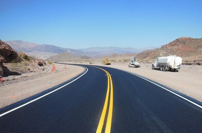
The Jubilee Pass section of Badwater Road was recently reopened in Death Valley National Park/NPS
Badwater Road, the primary paved road through the southern end of Death Valley National Park, has fully reopened nearly 10 months after a series of flash floods washed it out, the park recently announced.
With the road repaired, traffic from the gateway towns of Shoshone and Tecopa, California, can enter the park via state Highway 178, the primary southern entrance. National Park Service road crews cleared large amounts of dirt and rock to open the northern section of Badwater Road by early November, providing access to popular destinations such as Badwater Basin, the lowest elevation in North America at 282 feet below sea level.

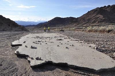
Badwater Road after flash flooding last year/NPS
However, the section of Badwater Road near Jubilee Pass was extensively damaged, with about a half mile of pavement and road base washed away in multiple sections. The Federal Highway Administration funded the repair work, with William Kanayan Construction starting repairs in May. Much of the work was done at night so that temperatures would be cooler.
While most other park roads are open, work remains to be done in other areas of the park to repair damage caused by the Oct. 4-18 flash floods. In one location, 2.7 inches of rain fell in just 5 hours, which exceeds Death Valley’s average precipitation for a year.
The Grapevine Canyon section of Scotty’s Castle Road was the most heavily damaged road and is still closed. Design work and environmental compliance are likely to take some time, so construction probably won't start until 2017.
“The flood was about a quarter the size of the Colorado River. It was so huge that it changed the shape of the canyon floor,” park spokesperson Abby Wines said in a release. “That means it wouldn’t be smart to just replace the road like it was. Engineers are redesigning sections of the road.”
Scotty’s Castle and Grapevine Canyon are currently closed to all public entry. Park managers are targeting 2019 to have repairs done and reopen the historic district to visitors. About 120,000 visitors annually traveled through Grapevine Canyon, and over 50,000 visitors per year took an hour-long ranger-guided living history tour of Scotty’s Castle each year before the flood.
“There was a flurry of work in the first months after the flood,” Wines said. “We borrowed trail crews and fire crews from other parks and got the mud shoveled out of the historic buildings. That made the site look a lot better.”
However, most of the work is still to be done and needs to be carefully planned. Several historic buildings were damaged, including the Garage/Longshed, which houses the Scotty’s Castle Visitor Center.
“The damage to the visitor center is obvious,” Wines said. “It looks like a monster punched the wall. We had to dig out 4 feet of mud and rocks.”
Other damage is less obvious but just as critical to repair before the site can be opened to the public. The flood destroyed the water system and washed away 4,000 feet of waterline that was buried in the wash. Repairs have started on the water system. Southern California Edison replaced over 20 power poles, but repairs to electrical wiring in the district will start in a couple weeks to restore power to the buildings. The sewer system was also partially washed away and needs to be replaced.
The estimated cost of recovering from these floods, including road repairs, is $31 million. Major funding is coming from federal sources via the National Park Service and Federal Highway Administration. Death Valley Natural History Association, a nonprofit park partner, is coordinating donations to assist with Scotty’s Castle projects through their website.
Death Valley is considering raising entrance and campground fees to help fund the repairs, and the park may add a tour to Scotty’s Castle before construction projects are completed to show the power of the floods.


Add comment