
Sea level rise and increased tropical storm intensity pose a serious risk to the long-term sustainability of historic Fort Jefferson at Dry Tortugas National Park. National park managers have several resources they can turn to to cope with sea level rise/NPS, Kelly Clark
By the end of the century, sea level rise is expected to inundate many coastal communities and more than a few National Park System sites. With that in mind, the National Park Service has developed a handbook for park managers to turn to as they work to adapt their sites to cope with sea level rise.
Coastal Adaptation Strategies Handbook offers "a range of potential adaptation strategies developed for climate-sensitive ecosystems," but also acknowledges that "(T)here is not yet a clear way forward to know which adaptation options will be most effective, and implementation is an active research field. The scientific resources to support adaptation are varied and growing."
* Adaptation is most effective when it is intentionally and deliberately designed as a response to anticipated effects associated with climate change.
* Climate change adaptation is not a stand-alone plan, but should be addressed in ongoing, routine planning processes such as foundation documents, general management plans, resource stewardship strategies, and preparedness planning.
* Adaptation strategies may require a series of decisions and actions that will change over time.
* Preparing for natural disasters includes planning for uncertainty and allows for adaptation opportunities post-incident.
Knowing that conditions could change, the Park Service complements the handbook that was released in 2016 with an online site that provides updates with available. A section in the handbook addresses "lessons learned from Hurricane Sandy," which in 2012 roared up the East Coast and damaged nearly 70 park units, from Cape Hatteras National Seashore all the way north to Fire Island National Seashore.
Cape Lookout Lighthouse, Cape Lookout National Seashore/Kurt Repanshek
A more recent report from the Park Service, Sea Level Rise and Storm Surge Projections for the National Park Service, says parks in the Northeast, National Capital, and Southeast regions of the National Park System will face the highest rise in sea level by 2100, in large part due to "anthropogenic climate change."
"Recent analyses reveal that the rate of sea level rise in the last century was greater than during any preceding century in at least 2,800 years," the authors note in the study's introduction. "Human activities continue to release carbon dioxide (CO2) into the atmosphere, causing the Earth’s atmosphere to warm. Further warming of the atmosphere will cause sea levels to continue to rise, which will affect how we protect and manage our national parks."
At this site you can find some case studies on how individual park units are preparing for sea level rise.
How might sea level rise further impact parks and other coastal areas? The following resources were compiled by the U.S. Geological Survey.
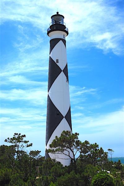
1. Historic Sites & Sea Level Rise: Some coastal cultural and historical sites, like Cape Lookout National Seashore and Jamestown, Virginia, are threatened by rising seas. With rising sea levels come elevated storm surges and an increased risk of flooding and shoreline erosion. The Northeast and Southeast Climate Adaptation Science Centers are working with the National Park Service to pinpoint specific impacts to coastal cultural resources, such as the Cape Lookout Lighthouse (c. 1859) and Jamestown Church (c. 1639). Using projections of future climate conditions, managers can make important adaptation decisions, for example prioritizing sites that are most vulnerable to changing conditions and targeting these with adaptation efforts - such as relocating artifacts further inland or using more storm-resilient materials. Learn more at Cape Lookout and Jamestown.
2. National Wildlife Refuges: Coastal National Wildlife Refuges (NWRs) provide habitat for wildlife, offer storm surge protection, and improve water quality, but are threatened by sea-level rise and extreme events. These threats ultimately can impact the ability of NWRs to protect the country's natural resources and to sustain their many beneficial services. Southeast CASC researchers developed tools to help staff at NWRs in North and South Carolina understand potential future climate conditions and to inform the creation of management objectives based on these scenarios. This information can allow managers to more effectively adapt to the complex challenges facing the NWR system.
Whooping Crane/Diane Nunley, USFWS
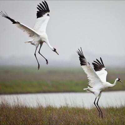
3. Tipping Points for Coastal Wildlife: As coastlines change, many species may be pushed to reach "ecological thresholds" - the tipping points at which changing conditions will disrupt their life cycle or habitat. For example, high salinity levels in marsh habitats can negatively affect the growth and survival of the mottled duck, a species that depends on marshes along the Gulf Coast. The Northeast CASC and partners synthesized scientific information on ecological thresholds for 45 species along the Atlantic and Gulf Coasts, offering insights to managers on potential strategies for managing coastal resources and protecting natural systems that sustain wildlife and the health and well-being of people and communities.
4. Sea-level Rise Handbook: The Sea-Level Rise Modeling Handbook compiles complex information into a user-friendly guide to help managers plan for the impacts of rising seas. Scientists have developed a wealth of information and resources to predict and aid decision-making related to sea-level rise. To make this information more accessible and usable, Southeast CASC-supported scientists developed a detailed handbook and shorter quick-guide that summarize the available tools and data currently available for forecasting future scenarios of sea-level rise. These tools can guide resource managers and science users in determining which information is best suited to their specific needs.

High tide erosion, Cape Romain National Wildlife Refuge/Jennifer Koches, USFWS
5. Mapping Coastal Processes: Unmanned Aerial Systems can be used to monitor changes in coastal ecosystems and understand the impacts of extreme storms and sea-level rise. Because more traditional monitoring methods can be costly and time-consuming, and involve working in sensitive environments, a project supported by the Northeast CASC tested the utility of Unmanned Aerial Systems (UAS) for mapping and monitoring changes in coastal ecosystems. The study found that UAS provide a low-cost, low-risk means of acquiring high-resolution imagery. The scientific information gathered from these monitoring efforts are important for helping coastal managers understand impacts of storms and sea-level rise and plan for the future.
6. Submersed Aquatic Vegetation & Waterfowl: Saltwater intrusion due to rising seas is threatening the availability of vegetation that supports waterfowl. Sea-level rise has the potential to increase salinity in fresh and brackish wetlands, changing the distribution and composition of submersed aquatic vegetation (SAV) communities comprised of aquatic plants found in shallow waters. A project supported by the South Central CASC found that salinity and water depth are primary factors in determining the amount of SAV resources in marshes. This work is currently being used by the U.S. Fish and Wildlife Service in their restoration work on the Chandeleur Islands in the Gulf of Mexico and can help managers forecast the effects of future changes in SAV on waterfowl and other fish and wildlife species.
7. West Coast Tidal Wetlands: As climate conditions change, some tidal wetlands in Washington, Oregon, and California may be lost by the end of the century. Pacific tidal wetlands provide numerous services for coastal communities, such as filtering water, protecting communities from storm surges, providing habitat to endangered species, and supporting local fisheries. In a recent study, scientists supported by the Northwest and Southwest CASCs found that even the lowest predicted rates of sea-level rise could cause significant losses of some Pacific tidal wetlands by the end of the century. Information from this study offers insight for resource managers into a range of possible futures for tidal wetlands in this region.
Arctic ice flow/Patrick Kelley, USCG
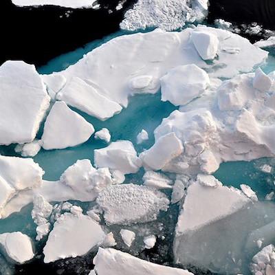
8. Glaciers & Coasts: Rates of glacier loss are increasing in Southeast Alaska, causing significant impacts to coastal ecosystems in Alaska and the Pacific Northwest. Scientists and managers supported by the Alaska CASC are taking an “icefield to ocean” approach to understanding these changes. The team synthesized the impacts of glacier change on coastal ecosystems and found that as glaciers melt, their contents – namely, large quantities of freshwater, sediment, and nutrients – are released into streams and the ocean. The Northwest and Alaska CASCs also supported scientists to develop a tool to simulate future glacier melt and runoff into coastal environments. These efforts provide valuable information to managers concerned with the economy and ecology of this region, such as those in the fishing and tourism industries.
9. Coastal Erosion & Flooding: Beach loss negatively impacts habitat for rare and endangered species and increases the exposure of coastal infrastructure to flooding and storms. On the Hawaiian island of Kauaʻi, the rate of coastal erosion is expected to double by 2050. Scientists supported by the Pacific Islands CASC developed interactive maps that show which areas of Kauaʻi’s coastline are most vulnerable to future erosion. In another project, scientists are evaluating the impacts of sea-level rise on Majuro Atoll in the Marshall Islands. Majuro’s highest point is just 10 feet above sea level, and residents are already experiencing significant flood events that damage infrastructure and contaminate freshwater supplies. Information from these projects is supporting hazard preparedness and adaptation planning in the Pacific Islands on state and local scales.

Surgeonfish on a coral reef/KevinLino, NOAA
10. Coral Reefs: Coral reefs are sometimes called “rainforests of the sea” because of their immense biological diversity and economic value, but many reefs are threatened by changing conditions. Pacific Islands CASC-supported scientists collaborated with local managers to survey reefs at 78 locations throughout the Commonwealth of the Northern Mariana Islands (CNMI) to evaluate their resilience to changes in the environment, such as changing water temperatures or chemistry. Their findings help managers highlight priority sites for management action and identify which management actions - such as fisheries regulation, pollution reduction, reef restoration, and monitoring - could best support natural resilience at each site.


Add comment