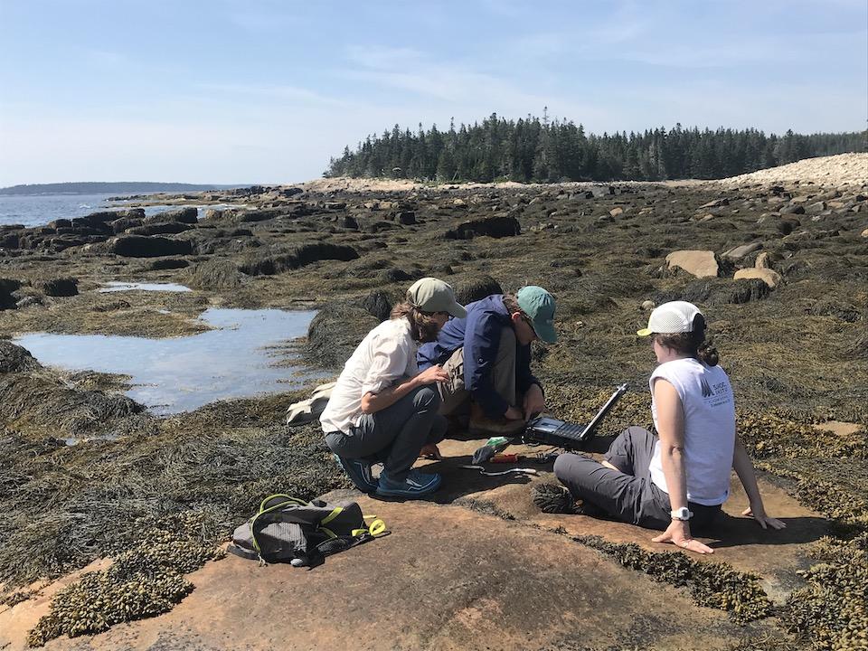
Rockweed that coats the Maine coast is a valuable commercial crop. Scientist Hannah Webber (left) and her interns want to understand how to ensure harvesting is sustainable/Kurt Repanshek
“Watch your footing,” Hannah Webber cautioned as we headed towards Frenchman Bay’s waterline on the Schoodic Peninsula of Acadia National Park.
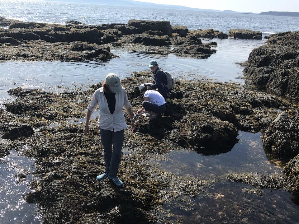
Walking Maine’s coastline at low tide is tricky business, as each step can be an adventure as your foot seeks firm footing. Thick mats of rockweed, a type of seaweed that lies across slabs of granite bedrock like a soggy shag rug, are slicker than a luge course.
Surprises, of course, can be had, if you carefully, but mistakenly, place your foot on rockweed that is floating on water, not coating a rock. I made careful note of that, and doubled my odds of remaining dry and upright by following closely behind Webber as she led two research students and me into the “ribbon of mystery” that is the intertidal zone.
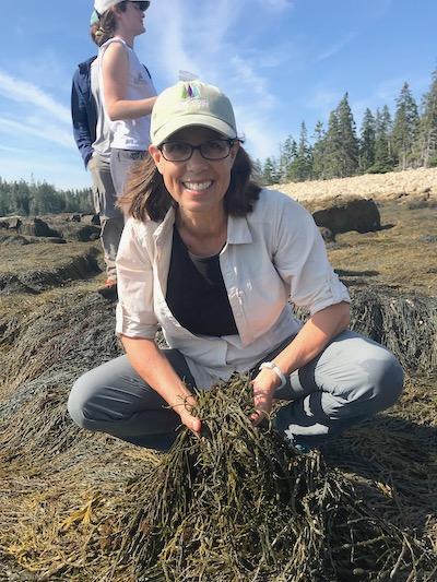
Webber is the marine ecology director at the Schoodic Institute, a nonprofit science-focused organiztion that both conducts research important to the national park and trains tomorrow's scientists. She hikes regularly down to, and across, the intertidal zone in a bid to unlock the mysteries of rockweed. Though to most it appears as just another seaweed that we’d never step barefoot on, for Webber this variety of algae (Ascophyllum nodosum) is a foundation species that protects and nourishes a kaleidoscope of marine life.
“We call something like rockweed a foundation species in that it really controls and affects what the environment, where it is, how that environment works,” she says. “The light intensity in this location, or the temperature, or the way the water moves. A foundation species is just something that’s going to control the environment where it is.”
For decades, Maine coasters have turned that foundation species into a livelihood. Once dried out and ground up, rockweed is used as a nutritional supplement for pet foods, horse feed, even humans. It also plays a role in fertilizers, as it retains water; shows up in some pharmaceuticals, and; even appears in some seasonings for your meals.

Rockweed is a foundational species, an ecosystem engineer, to Hannah Webber because of the many roles it plays/Kurt Repanshek
Rockweed at high tide typically is harvested not unlike wheat on land. As combines are used to go back and forth across a field to cut off and gather wheat, on coastal areas harvesting boats employ “cutting heads” that slice off rockweed fronds that are then captured by a net.
There are some, though, who still harvest by hand, with a rake.
In 2014 this industry in Maine harvested about 17 million pounds of rockweed. Though harvesting of rockweed is not allowed within Acadia National Park, what Webber learns from her research can be applied elsewhere in Maine and along the coastal Northeast all the way down to New Jersey, which is roughly the southern boundary of the algae's habitat. Part of her research is aimed at determining how the algae can be sustainably harvested without adversely impacting the numerous species that it helps survive.
The question is not being asked in a vacuum. The Rockweed Coalition/Save Our Seaweed works to promote “conservation of intertidal marine habitat, including rockweed, to protect Maine’s fisheries and wildlife.”
On its website, the coalition boils down the controversy around rockweed harvesting to questions Webber is working to answer: “Whether repeat harvests allow ecological functions to continue. Full physical recovery (regaining rockweed bed biomass, stature, density) indicates that pre-harvest ecological function has likely recovered. But if rockweed height and bed density do not recover, the harvest cannot be said to be sustainable. Because of rockweed’s low rate (2-3 inches per year) of regrowth in stature, a 4-foot tall rockweed needs 11 to 16 years to fully recover from harvest.”
As we wander the Schoodic coastline, Webber, who is working on her doctorate in ecology and environmental science, explains why it is such a good laboratory for her work.
“The neat thing about the intertidal zone for people who don’t live near the ocean is the area is exposed at low tide and is completely covered by the ocean at high tide,” the scientist explained. “Here on the Gulf of Maine we have some really good tides. The ones around here are about 10 to 12 feet, so between high tide and low tide we have a lot of space that’s exposed.
“At high tide everything is in the ocean, and it’s bathed by beautiful ocean water. But at low tide, it’s just on the rock and exposed to the sun beating down on it in the summer, or in the winter it’s exposed to freezing cold temperatures and ice,” Webber told me. “And when you have a species like rockweed in the mix, rockweed really at low tide protects all of the organisms underneath it.”
While rockweed can lose about 97 percent of its water content when exposed at low tide, Webber said, it’s still serving as an insulator of sorts for the species beneath it. Snails, crabs, barnacles, blue mussels, and other marine life are protected from the hot summer sun as well as the cold winter air and ice.
“If the rockweed weren’t there, they wouldn’t be there,” she said of the marine creatures.
When the tide comes back in, rockweed floats up in the water column, suspended thanks to bulb-like air bladders along its fronds. Though not vegetation, Webber used a tree analogy to describe the algae. At high tide it’s “standing up in the water and it's acting like an underwater tree in that it's controlling light that comes through, sort of through the algal canopy to the floor of the intertidal, and so anything that’s living under there has to be able to deal with low light.”
The countless acres and acres of thick growth (in Maine alone there are roughly 3,000 miles of coastline with rockweed, according to Webber) also affects how water moves.
“If you were in a forest, and there was a blizzard, you would be in an area of calm wind movement in the forest, whereas if you stepped out you would be blasted,” she said.
With that understood, you can appreciate how this somewhat protected zone at high tide serves as a refuge for marine life.
“There are a number of different species of fish that will forage and also seek shelter, especially when they’re small. So Pollock, cod, rock gunnels. And then we get some of our non-invasive crabs, so the Jonah crab, and the rock crabs, as well as the occasional lobster and American eel,” said Webber. “So there are a number of species that do take advantage of this algae being in the intertidal zone.”
Because of rockweed’s commercial appeal, the researcher is working to identify sustainable levels of harvest.
“What does sustainable harvest look like, what happens to those foundation aspects when we harvest?” asked Webber. “Rockweed is harvested such that the whole algal isn’t taken. Harvesters leave about a 40 centimeter (roughly 16 inches) part of the rockweed behind, and that regrows. It changes what it looks like when it regrows. It is sort of more bushy than it had been before, and so when we have this foundation species, how does that harvest impact that foundation aspect?”
Since rockweed gets bushier growth after it’s harvested, Webber wants to know how that affects fish that swim through it at high tide, how the algae controls temperature, light penetration, and wave motions.
With that primer in mind, I followed Webber and her interns – Sally from New Jersey and Henry from Virginia – into the intertidal zone to search for sensors that, every 15 minutes, were collecting light intensity, water and air temperatures, and even water motion data for the scientist’s study.
While we concentrated on keeping our feet on the slippery rockweed and searched for the sensors, herring gulls that had plucked crabs from the water-filled cracks and crevices between the granite slabs rose 20 or so feet into the sky and dropped their meals to crack them open on the granite. Some gulls, Webber said, have been known to use different heights to drop crabs of different sizes, and some of the birds even had favorite rocks to get the job done. After all, she said, they didn't want to lose their seafood to a crevice.

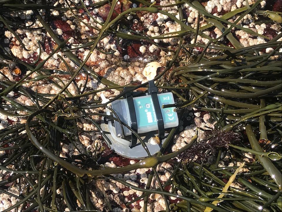
Finding a sensor the size of a 9-volt battery in a landscape of rockweed is not easy/Kurt Repanshek
Finding a sensor the size of a 9-volt battery under a thick mat of rockweed isn’t too far removed from searching for a needle in a haystack. While Webber had photos on her laptop that showed each sensor’s location in relation to a landmark, such as an oddly shaped stack of rocks, that was just an approximation. Fortunately, newly arrived for our foray was the “carrot,” a metal detector in the shape of an orange wand that Sally used to pinpoint the devices.
After the rockweed was cleared away from the sensors, Henry used a cable to connect them to the laptop to download their data.
“We’re really grateful to the park for being here for researchers,” said Webber. “The nice thing about working in the park is this is a protected space and so I don’t have to worry about things happening to this space as a research site, and that’s exceptionally good for researchers of a lot of different strands of research.”
Webber’s research can go beyond rockweed and the communities that depend on it. Since her sensors capture temperature data, and since the Gulf of Maine is “warming faster than 99 percent of the rest of the ocean,” she hopes to determine whether she can detect “ocean heat waves” from the data.

When low tide arrives, the researchers go in search of sensors that track water and air temperature, sunlight intensity, and water motion/Kurt Repanshek
“My sensors are here to understand rockweed, but they can serve these other purposes. Can we use the data that we’re getting to pick up that signature of an ocean heat wave?” she explained. “These sensors are not terrifically expensive, they’re easy for us to look at the data, almost in real time, and so that can be a powerful tool for us to work with collaborators throughout the Gulf of Maine to really understand how the Gulf of Maine is changing."


Add comment