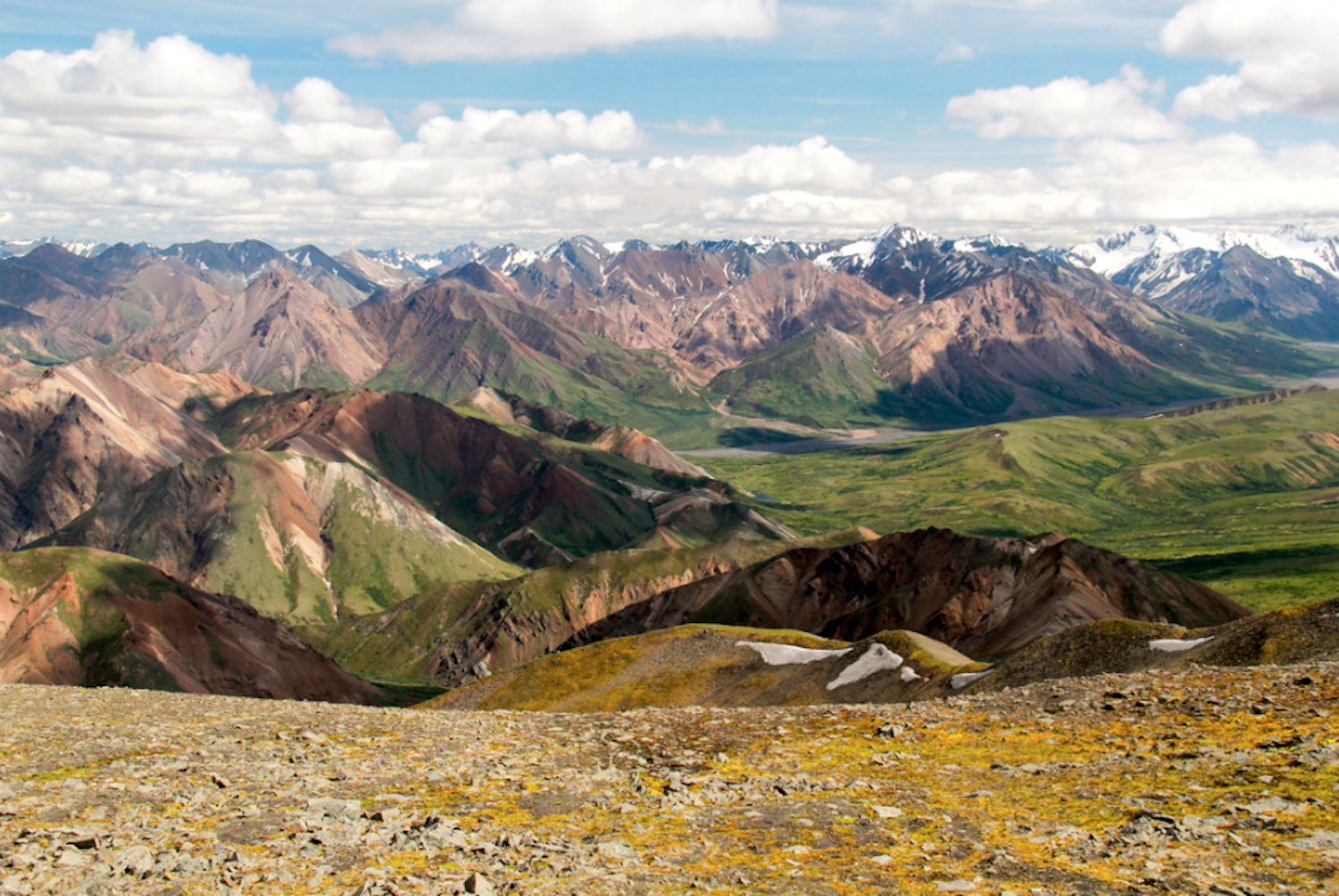
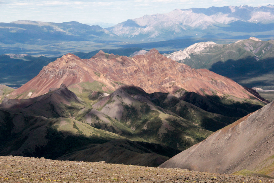
View from the final saddle to the summit of Sable Mountain, Denali National Park and Preserve.
A Little Mountain In A Big Park
By Robert Pahre
The bus came to a stop on the gravel along the road. My son and I stood up, grabbed our packs from the overhead racks, and started down the aisle. The other passengers stared as we left the bus and slung our packs on our backs. They seemed surprised that anyone could get off the bus at a place like this. There was no sign, no trail, and no comfort stations – just a culvert to allow Tattler Creek to pass under the Denali Park Road.
Every national park has its typical experience. The typical visitor to Yellowstone will drive around trying to find a wildlife jam, watch Old Faithful erupt, and perhaps explore the boardwalk in a thermal area or two. Visitors to one of our cave parks will take a cave tour lasting an hour or three. Weekend visitors to Indiana Dunes will relax on the beach.
In Denali National Park and Preserve, one of our great wilderness parks, a visitor may sit on the park bus most of the day. The bus travels down the Wonder Lake Road, a long gravel road with very few private automobiles allowed. The road goes through a narrow corridor of non-wilderness, with federally-designated wilderness on both sides. That makes it an unusual example of a road that goes through a big roadless space.
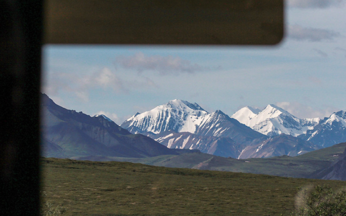
View from the bus/Bob Pahre
The bus can give you some amazing views of scenery and wildlife, and there are popular spots for stretching your legs or joining a ranger walk. There’s a nice group of short hikes in the area around the visitor center. There’s another attractive group of hikes at Savage River, the last point you can reach by private car. All of those are marked trails, and they range from wheelchair-accessible to strenuous day-long hikes. Most are pretty popular.
Beyond the beaten path, there’s a lot more room for exploring Denali National Park. Beyond Savage River, you need to be comfortable hiking off-trail. That doesn’t need to be a scary experience. Some off-trail routes go from the road along a gravel bar, or across open country with views of the park road. If it’s your first time hiking off-trail, choose an option where you can stay mostly in sight of the road. Don’t forget that bears and other wildlife use these areas, and take appropriate precautions.
My son and I decided on a somewhat more challenging hike. We were lucky, and the park delivered a beautiful, clear day for us. Using Ike Waits’s guide book, we found a set of options that would require a bus ride of about two hours each way – Igloo Mountain, Cathedral Mountain, Sable Mountain, and a group of ridge hikes around Polychrome Mountain. Based on Waits’s book, and our views of the other routes, any of these would be a great day hike for people who have some off-trail experience in the Lower 48.
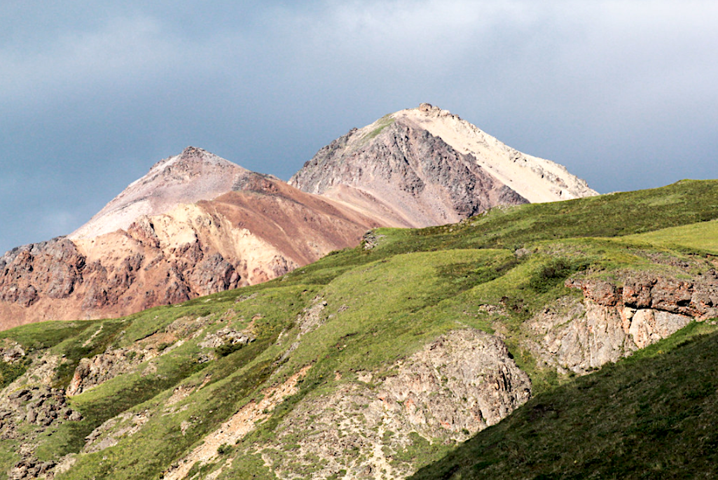
view of Igloo Mountain from Tattler Creek as we climbed Sable Peak (5923 feet)/Bob Pahre
We ended up choosing Sable Mountain, which would give us excellent views of Igloo and Cathedral, and (we hoped) views of other peaks throughout this part of the park. The route is a five-mile round trip with a climb of 2,500 feet. Our bus departed at 9:30 a.m., and arrived at our trailhead at 11:30 a.m. We spent six hours on the trail, including two long breaks to enjoy the scenery. We had to wait an hour for the return bus, and got back at about 8 p.m.
The basic idea of the route is simple: go up Tattler Creek until you run out of creek, and then continue to the top of the saddle ahead of you. Turn left and go up the mountain. There are a couple of false summits, so don’t get too excited right away. The final summit ridge provides great views in all directions.
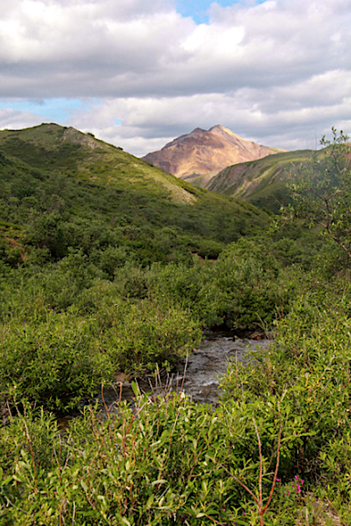
Just follow the creek to the mountain/Bob Pahre
Before you get on the bus, ask backcountry rangers about trail conditions. Once you’re on the bus, talk to your driver at the Teklanika rest stop. Ask to be dropped off at Tattler Creek. Our driver needed no reminding, but you can follow the road in Waits’s book if you want to remind the driver if you have to.
Once you get off the bus, start on the left side of the creek. You’ll find multiple paths in a braided creek bed, and I don’t think it matters which choices you make. There were three hoppable branches of Tattler Creek when we hiked this route in July. You’ll eventually run out of space as the creek goes through a narrow gap or canyon at about a half-mile from the road. You’ll want to be on the right-hand side of the creek by then. Look for an easily-visible social trail, and go up the bluff, which is much less than about 100 feet high (30 meters).
We had our second breakfast atop the bluff and enjoyed the views. From there, follow the social trail down the other side and back to the creek bed. You’ll have easy route-finding and light bushwhacking up the creek bed. We had the best luck on the far left and on the far right sides of the drainage as the brush tended to be thicker close to the creek. The far right side hugs the edge of a talus field.
There’s perhaps another half-mile through the bush after the bluff. Be sure to make noise to warn bears and moose of your presence. Despite making plenty of noise, we still ended up surprising a caribou (and vice versa).
After that, you face a gradual transition to open tundra as the trail gains elevation. This open space had a mix of wildflowers and grasses, making it popular with Arctic ground squirrels. We found ourselves jumping the creek a few times to follow intermittent social trails. When Tattler Creek forks, stay to the right for a gentler route. Ike Waits describes another, steeper route up a ridge to the left, but you’ll probably find the easier route steep enough.
Take Tattler to the saddle, and enjoy the view a while. To your right is Igloo Peak. It looks impressive from the road but you will get to look down on it once you reach the top of Sable Mountain.
Looking down on Igloo from Sable Mountain/Bob Pahre
You can also admire the Big Creek drainage straight ahead and below you. Across the drainage you’ll see an impressive unnamed ridge ahead. You’ll also see the Wyoming Hills to the northwest. Waits describes these regions as “seldom explored,” but he doesn’t say why. Whatever the reason, that makes the country here a classic example of “wilderness”—untrammeled by humans, with visitors who seldom remain.
From the saddle, just take the steep direct route up the ridge to your left. You’ll be hiking up to the summit ridge, which looks like a false summit from the saddle. From that point, you’ll continue to hike uphill along the summit ridge. The ridge has two high points, and the higher one is, inevitably, the one farther away.
The summit delivers big views of the Alaska Range (top photo), looking over the Toklat Valley. You’ll also see the road winding along the high ground above the river, with an occasional bus. We had peekaboo views of Denali and clear views of Mount Foraker (17,400), a somewhat smaller mountain next to the Great One. We took some time to enjoy the views with an energy bar and some berries.
As clouds moved in, we lost our views of the high peaks and decided it was time to go. We spent some time with a large group of friendly ptarmigans on the way back down, but otherwise moved quickly downhill.
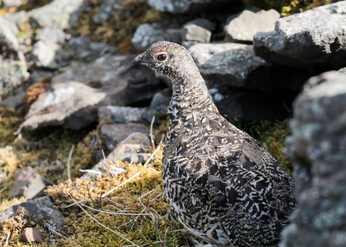
Personable wildlife that won't threaten your life can be found in Denali/Bob Pahre
It’s ironic, but the Denali bus system probably delivers the best wilderness experience most national park visitors will ever have. You can spend a long day on the bus and expect to see impressive wildlife.
There are some options for ranger-led hikes, or for exploring short, maintained trails. While the road itself is not part of the designated “wilderness,” for most of the route the Denali Wilderness boundary is close, and parallel to the road.
If you’re willing to push yourself a bit more by going off trail into Denali’s wild side, the rewards are even greater.
Robert Pahre is a Professor at the University of Illinois, where he teaches and writes about national parks and other environmental issues.
Suggested Reading
Ike Waits, Denali National Park, Alaska: Guide to Hiking, Photography and Camping. Wild Rose Guidebooks.
Support National Parks Traveler
National Parks Traveler is a small, editorially independent 501(c)(3) nonprofit media organization. The Traveler is not part of the federal government nor a corporate subsidiary. Your support helps ensure the Traveler's news and feature coverage of national parks and protected areas endures.
EIN: 26-2378789
A copy of National Parks Traveler's financial statements may be obtained by sending a stamped, self-addressed envelope to: National Parks Traveler, P.O. Box 980452, Park City, Utah 84098. National Parks Traveler was formed in the state of Utah for the purpose of informing and educating about national parks and protected areas.
Residents of the following states may obtain a copy of our financial and additional information as stated below:
- Florida: A COPY OF THE OFFICIAL REGISTRATION AND FINANCIAL INFORMATION FOR NATIONAL PARKS TRAVELER, (REGISTRATION NO. CH 51659), MAY BE OBTAINED FROM THE DIVISION OF CONSUMER SERVICES BY CALLING 800-435-7352 OR VISITING THEIR WEBSITE WWW.FRESHFROMFLORIDA.COM. REGISTRATION DOES NOT IMPLY ENDORSEMENT, APPROVAL, OR RECOMMENDATION BY THE STATE.
- Georgia: A full and fair description of the programs and financial statement summary of National Parks Traveler is available upon request at the office and phone number indicated above.
- Maryland: Documents and information submitted under the Maryland Solicitations Act are also available, for the cost of postage and copies, from the Secretary of State, State House, Annapolis, MD 21401 (410-974-5534).
- North Carolina: Financial information about this organization and a copy of its license are available from the State Solicitation Licensing Branch at 888-830-4989 or 919-807-2214. The license is not an endorsement by the State.
- Pennsylvania: The official registration and financial information of National Parks Traveler may be obtained from the Pennsylvania Department of State by calling 800-732-0999. Registration does not imply endorsement.
- Virginia: Financial statements are available from the Virginia Department of Agriculture and Consumer Services, 102 Governor Street, Richmond, Virginia 23219.
- Washington: National Parks Traveler is registered with Washington State’s Charities Program as required by law and additional information is available by calling 800-332-4483 or visiting www.sos.wa.gov/charities, or on file at Charities Division, Office of the Secretary of State, State of Washington, Olympia, WA 98504.
Add comment