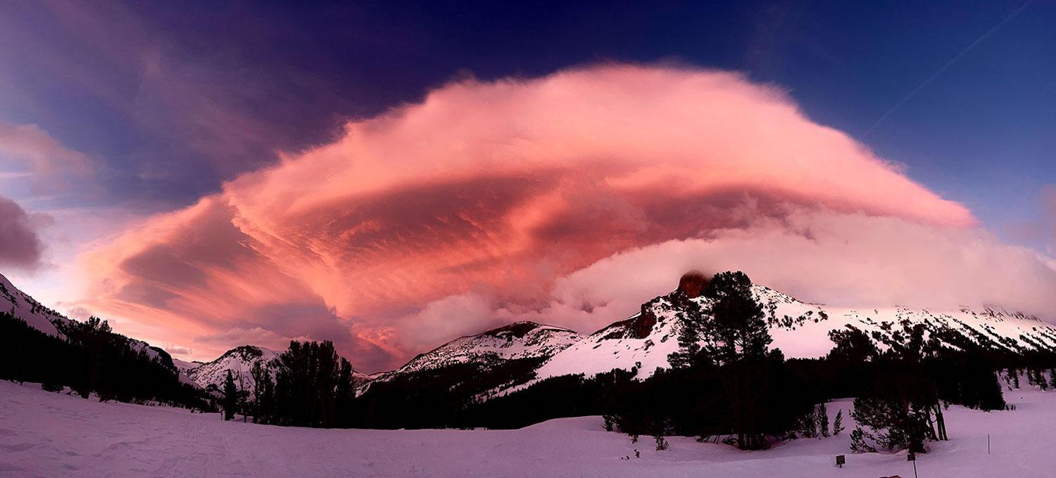
There's a lot of snow in Yosemite National Park's high country that still has to melt/NPS photo of Mount Dana, April 20, 2023
Editor's note: This updates with Yosemite Valley reopening.
California's Mountain Parks: When All That Snow Melts
By Rita Beamish
Pummeled this year by some of California’s biggest, battering snowfalls on record, mountain national parks are now enmeshed in digging out and damage repair ahead of a summer that will veer sharply from the drought mentality that gripped the state just an eye-blink ago.
The pivot from being blasted by snow and pelted by rainstorms is speeding straight to the next challenge — a powerful melt that can engorge waterways and send torrential flows down wildfire-scarred mountainsides just removed from the driest three years on record.
Warm weather this week got the melt rolling and prompted the National Park Service to close most of Yosemite Valley as of Friday night. Changing runoff forecasts for the Merced River had the valley opening during the day Sunday, and fully reopening Monday. The Merced, traversing the valley where visitorship approaches 2 million people in summer months, is likely to exceed flood stage off and on into July, the park says.
The speed and destruction of the massive snowmelt will depend on how sustained the heat wave is and whether cooler periods come along to slow down the pace. But Yosemite, Sequoia, Kings Canyon, and Lassen Volcanic national parks are on high alert, even while still clearing piled-up snow, landslides and storm-driven erosion that’s undercut and buckled principal roadways.
Fast-moving, swollen streams are expected to make backpacker trail crossings treacherous possibly until the end of summer, officials warn. Even as lower–elevation areas like Yosemite Valley and Sequoia’s foothills are now mostly snow free, higher-elevation structures, roads, trails and parking lots still remain in various degrees of snow burial.
“You can’t make this up,” Clay Jordan, superintendent of Sequoia and Kings Canyon national parks, said at a March community meeting. “Exceptional drought, major fires -- and then we swing over to the other end of the spectrum.”
Looking ahead, officials expect lingering snow, as well as damage from avalanches and debris flows, to keep major park roadways restricted or closed to cars for longer than usual, into the summer.

A series of storms in late February buried the Yosemite Valley under feet of snow, almost hiding Curry Village tent cabins/NPS
Also delayed in opening will be specific damage sites and popular visitor attractions, including the world’s largest tree, the General Sherman in Sequoia National Park. Among the impacts:
- Sequoia’s Giant Forest, home to the world’s most massive trees will not open until after Memorial Day.
- Yosemite’s Tioga Road, crosses through the Tuolumne Meadows to the eastern Sierra, will open late, perhaps end of June or early July.
- To the north, Lassen Volcanic National Park, at the southern end of the Cascades range, expects its cross-park road to open in mid-July, a month later than usual.
- “Many trails will remain snowy, flooded and/or muddy well into the summer,” Yosemite’s website predicts.
- Even Devils Postpile, the national monument featuring towering basalt columns on the east side of the Sierra, will have to delay its summer opening due to snow blocking its entry road from the town of Mammoth Lakes. The snow has exceeded levels of 2017, and that year the road didn’t open until July 21, officials said, a disappointment to summer visitors who shuttle in to see the unusual geologic formation in June or earlier.
Park officials don’t know the full extent of the winter’s damage, with backcountry still snowed in. Also unknown is the extent to which the heavy soil saturation and wildfire-denuded landscapes will cause the melt to be more destructive.

Landslides, and rock slides, closed some Sequoia National Park roads/NPS photo, April 27, 2023
A preliminary review in Sequoia National Park estimates damages totaling “well over $10 million” just for buildings and roadways in the front country, including fallen trees and structural impediments like water intrusion and mold, with vast areas, including remote Mineral King, still to be assessed, said spokesperson Sintia Kawasaki-Lee.
“Even our wilderness crews won’t be able to go up to their stations until July,” she predicted.
That means repairs on remote trails and bridges, including along popular routes like the John Muir Trail and Pacific Crest Trail, will have to wait. The PCT Association posted a photo of a snow-laden, steel footbridge, smashed and sagging, that hikers rely on to cross the South Fork San Joaquin River.
On major park roads, officials anticipate federal emergency highway funding to help with repairs.
Closed Gates
Typically open to visitors year-around, notwithstanding wildfire and COVID pandemic interruptions, the mountain parks saw rare closures during the storms.
Damage forced Yosemite to close its gates on February 25, reopening only after 21 inches of precipitation and heavy snows pelted the park over three weeks. Park officials counted 22 storm-caused rockfalls, debris flows, and slope failures needing to be fixed.
“I've been here for 27 years now. … I have not ever seen this much snow,” Yosemite National Park spokesman Scott Gediman told the Traveler. The consensus of other Yosemite longtimers: “Biggest year ever,” he recounted.
Measurements confirm an all-time record: snowpack at 241 percent of average in the Merced River basin, and 244 percent of average in Yosemite’s Tuolumne River basin.
Trying to even access Yosemite from the east side remained “a mountaineering experience” with ice axe and crampons recommended for the hard, steep snow, Tuolumne Meadows winter rangers wrote on April 18, in their last web post of the season,
In years with similar snowpack the cross-mountain Tioga Road didn't open until late June or early July, instead of the more typical late May or early June.
Glacier Point Road, leading to one of Yosemite’s most popular vistas, will stay closed likely beyond July due to snow and construction. Sections of other key Yosemite roads have been operating with single-lane access.
“We’ve got some damage that … is going to take more than just a patch,” with the need to clear avalanche zones as well as remove snow, said Gediman. “You've got to go and basically dig it all out and rebuild the roadway,” and that work is ongoing.
“We know that people are really anxious to get up here” but there are safety issues, he said. “We've got an extraordinary snow here, which is going to result in later openings. … that's just the situation.”
Storm impacts also forced closure, on March 9, of Kings Canyon and Sequoia, adjoining national parks that together sprawl across 866,000 acres of the Sierra. They reopened — partially — on April 7 and 14, respectively.
Sequoia’s scenic Generals Highway emerged with 20 locations needing repair, so much damage from downpours, debris flows, and avalanches that just a six-mile stretch was open, in the foothills area, with limited parking available.
“There is no access to sequoias in Sequoia National Park due to road closures,” the park website warns.
That closure includes the park’s major front-country attraction, the Giant Forest, where the General Sherman and its fellow giants tower along a walking loop from a parking lot. Anyone approaching the General Sherman in recent weeks would have stood 10 or so feet higher than usual atop snow that buried its low protective fence, said Kawasaki-Lee.
Nor can people get through to the Giant Forest from the partially plowed Kings Canyon side. The park website consoles visitors that they can see giant sequoias in Grant Grove, in the other direction from the Kings Canyon entrance.

Lassen Volcanic National Park saw more low-elevation snow this winter than in recent memory/NPS photo, March 30, 2023
North Of The Sierra
Lassen Volcanic also had a closure — 2 days, due to snow pile-up — not that long but still unprecedented, according to Superintendent Jim Richardson. The partially plowed 30-mile Park Highway for now allows snow-play visitors to drive as far as visitor center areas less than two miles in from gates at either end of the highway.
Though snowpack did not break Lassen’s record, measuring just shy of 21 feet at the lower Lassen Peak measuring station compared to the 1983 record of 27.6 feet, it was enough to delay the full opening of the highway until mid-July, about a month later than usual, Richardson said.
“We’re one of the snowiest places in the entire state of California, and we’re essentially prepared for that,” Richardson told the Traveler. “Our facilities are built for that … and we're staffed for plowing for heavy snow years.”
But this year’s deluge was different, he noted. High-elevation snowfall was similar to record years, but precipitation falling at the park’s lower regions, still around 6,000 or more feet, was colder than usual, meaning more snow and less rain than what is normally seen.
The Sierra Nevada parks, on the other hand, experienced numerous atmospheric river impacts that drove more rain than usual, with downpours falling on top of snow, and propelled soggy, powerful slides onto roads. Erosion carved out gaping caves beneath the Generals Highway in Sequoia, causing pavement collapse and slippage.
“It was these warm storms — the amount of rain was what caused so much destruction on our highway and our hillsides,” said Kawasaki-Lee. “And in the areas where there was snow, the rain on top of snow was what was causing the culverts to get clogged with rocks and debris and causing damage.”
Digging Out, Fixing up
Aside from road damage, the brutal winter downed tree branches that damaged staff housing roofs at Yosemite, and snow weight knocked down rail fences and signs, Gediman said. The park does now have housing to meet staff needs after diligent repair work over recent weeks. Yosemite Hospitality, the concessionaire, rented equipment and snowblowers to make sure their facilities and housing in the valley were ready for employees and visitors.
In Sequoia, a ranger office was severely damaged when a tree crashed onto its roof. The sheer weight of snow cracked the walls of some staff residences, officials reported.

Crews in Sequoia National Park have been working since March to repair storm-related damage/NPS
In the Sequoia foothills area, popular trails remain closed to springtime hikers, with flooding and rockslide damage.
The winter’s detritus prompted Sequoia and Lassen to pull in outside contractors to help clear and repair — “the first time we’ve ever financed and brought in additional staff” for pre-summer cleanup, said Richardson.
A pair of plow operators at Lassen started in mid-April clearing outlying roads that connect county arteries to remote areas such as Butte and Juniper lakes.
The unrelenting winter undercut the road near the Sulphur Works area in Lassen Volcanic National Park/NPS
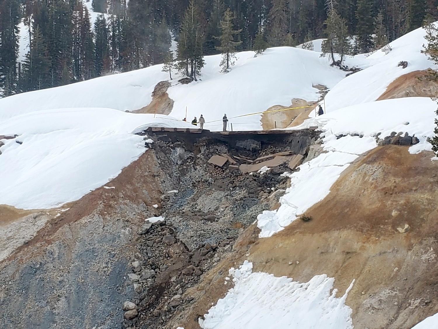
Meanwhile, Lassen is devising a repair plan, Richardson said, for a yawning road and sidewalk gap at the popular Sulphur Works hydrothermal area, which features volcanic gas vents and boiling mud pots. A broad viewing sidewalk broke away when the Park Highway was undermined, and tumbled down the slope.
At Sequoia, an emergency contractor started repairs on the Generals Highway in April. A second will tackle the section between Kings Canyon and Sequoia parks, where a 50-foot avalanche blocks the road, the biggest in longtime park employees’ memory, Kawasaki-Lee said. Extra heavy-duty equipment had to be commissioned to dig through the icy snow.
On the narrow Mineral King Road that winds into the backcountry, a huge collapse this winter sent a chunk of the road cascading down the steep slope, adding work to an already planned rehab project.
“We were already gearing up for a very busy year with fire damage repairs. Now we need to revisit that in next coming weeks to add in a large workload for storm recovery. We’re looking at all available ways to increase our capacity, whether that’s hiring outside firms for project management, contracting out whatever we can, because our permanent staff already has a lot on its plate,” said Kawasaki-Lee.
Melting Out
All that water gushing from the snowpack has to go somewhere.
State water experts say downstream communities will be at risk as water pours out of the mountains across heavily saturated soils, especially in the Sierra-fed southern San Joaquin River Valley.

By late April, warm weather had grass greening up in Cook's Meadow and Yosemite Fall roaring, but flooding was forecast for the Yosemite Valley heading into May/NPS
In Yosemite, past experience offers some guidance on flood-prone areas, Gediman said, although it’s a dynamic situation given the record snowfall and weekly decisions being made about closures and other issues based on conditions, flood forecasts and historical experience.
Visitor safety is a high concern. Park visitors expecting their usual dips, for instance, in the Kaweah River and Kings River in Sequoia-Kings Canyon, for instance, will need to be extra wary of depth, flows, and unseen danger. Officials note the inviting waters have taken lives in the past. Yosemite intends to ramp up messaging about hazardous waters and posting more volunteers with safety information at popular trail areas, such as at the Mist Trail.
Wildfire Legacy
Officials also are closely watching how the hardened burn scars from wildfires will impact the snowmelt. Soil is unstable on denuded slopes and carries rocks and debris with it when runoff washes it downslope. That dynamic played a role this year when debris flows from the scorched footprint of the 2021 KNP Complex Fire, including terrain near the Giant Forest, descended onto the Generals Highway, Kawasaki-Lee said.
“We saw more impacts from flooding because the soil didn’t have its natural vegetation to hold it together, that’s what’s causing a lot of the slides off the hills and trees coming down,” she said.
The devastating 2021 Dixie Fire, California’s biggest wildfire ever, left large burn scars in Lassen Volcanic National Park when it blasted across 69 percent of the park’s area, more than 73,000 acres, on its rampage through 1 million acres of California wilderness and rural terrain.
Less than half of the Lassen burn was at high intensity, however, Richardson said, partly due to fuel reduction strategies and firefighting use of the Park Highway as a fire line. While those low and moderate burn areas are not a major concern, the more dramatic burn areas are worrisome, he said.
“We are concerned about some of those known high intensity burn areas. Those soils are not likely to hold. Those are highly erodible soils and could come down,” he said.
Yosemite’s mud and debris flows this year came both from burn scar areas and places that did not burn, with saturated soils playing the most noticeable role, said Gediman.
One of the wettest winters in modern times has mercifully restored reservoirs from near-record low levels, and spectacular upsides include vibrant wildflower sprays and stunning views of Yosemite waterfalls pounding powerfully over the cliffs. But with the snowpack holding some of the highest water content the state has ever seen, the mountains still have a lot to unleash.

Add comment