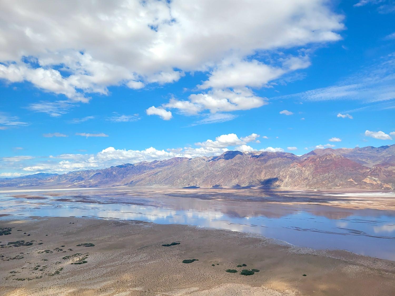
Ponds in Mesquite Flats Sand Dunes created by Hurricane Hilary/NPS
Reopening Of Death Valley National Park Will Take Time
By Kurt Repanshek
There is no date for reopening storm-battered Death Valley National Park, and it might take until December to fully repair all the damage to roads done by the remnants of Hurricane Hilary last month.
"That is a moving target," Abby Wines, the park's management analyst, told the Traveler on Friday when asked when the park might reopen. "A section of California 190 will probably open first, but Caltrans doesn't even know which section and they haven't given us a timeline on that. They're trying to reopen all of 190 by early December. Don't hold them to that, it's not a promise. It depends on what happens between now and then. But a portion of the park might open before that (December)."
Spanning more than 3.4 million acres and rimmed by towering mountains with rocky flanks that don't easily absorb rain, Death Valley on August 20 overflowed with runoff from Hilary's torrential rains that had nowhere to go but down to the mostly flat floor of the park.
"Think about how rain falls on the roof of a house, and it runs down to the gutters because the roof is not permeable," explained Wines. "That's what our mountain slopes are like here in Death Valley. They're mostly rock or hardpacked earth with very few plants that have broken up the soil to make it more permeable. So all of those mountainsides here in Death Valley, the water just runs down to the canyons, and the canyons are like the rain gutter and the rain spout on a house, channeling that water moving quickly, except in this case it is carrying with it large amounts of mud and rocks and boulders."
Spewing from canyons, gullies, and washes, the floodwaters with their muddy slurries washed across, and in some cases through, the park's 1,400 miles of paved and unpaved routes. Lakes and ponds temporarily formed in Devils Cornfield, the Mesquite Flats Sand Dunes, and at Badwater, which is the lowest point in North America at 282 feet below sea level, while brown waterfalls and streaming torrents swept across several places along California 190, which runs east and west across the park from Panamint Springs to Death Valley Junction, and at Zabriskie Point.
The runoff also recharged the Amargosa River, an intermittent stream that drains into Badwater Basin.

A shallow lake temporarily filled part of the Badwater Basin/NPS
In a park world-renowned for its high heat — a world-record 134° Fahrenheit was recorded there back in 1913 — of late it has become a park known for floods and you can now write a chapter on record rainfall into the park's history.
- Eight years ago, in October 2015, a storm of historic proportions pounded Death Valley's Grapevine Canyon and did extensive damage to Scotty's Castle, an elaborate 1927 mansion that is an icon of hte park. The popular the popular tourist attraction still has not reopened as repair work continues, and it might not fully reopen until 2026 or 2027. That storm was described as a once-in-a-thousand-years storm.
- A year ago, rain storms again pounded Death Valley. In roughly three hours nearly 1.5 inches of rain fell at Furnace Creek and did considerable damage to roads and water systems and shut down the park. That storm also was described as a once-in-a-thousand-yers event.
- Now Hilary, which likely qualifies for another once-in-a-thousand-years storm, dropping 2.2 inches of rain at Furnace Creek, making it the rainiest day on record in the park. For some perspective, during a full year the park usually sees only 2.15 inches of rain.
Water, as these recent storms proved, is a powerful force of nature, humbling human infrastructure.
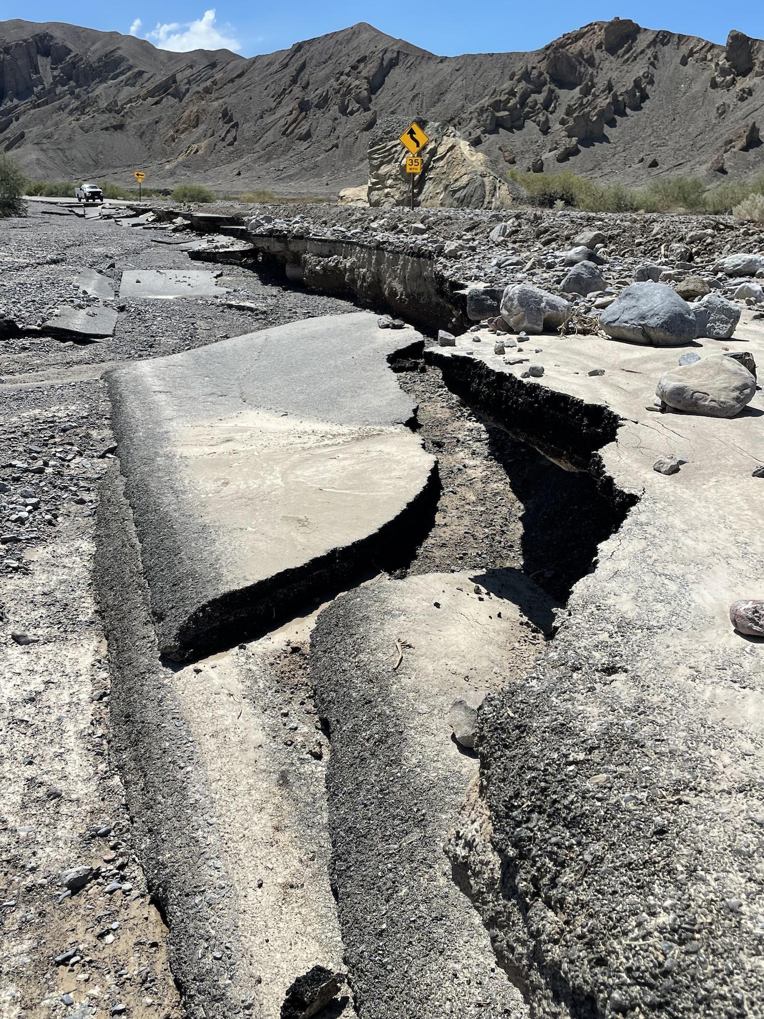
Death Valley is "[M]assive when you're talking about a park the size of the state of Connecticut, but every single one of the paved roads that are the major arteries through the park, all of those are damaged. Most of them had pavement loss," Wines said while recording Traveler's weekly podcast. "Others have debris up to five feet thick on them. But the debris is not the real problem. The pavement loss is the problem. Our road crew, especially supplemented with the employees from other national parks that are here helping us, we can handle debris on the road by pushing it off into those shoulders. We can handle places where the shoulders are dropped off because they've eroded away.
"What we don't have the capability to fix ourselves with our own staff are times when a flash flood went across the top of a road and then created a small waterfall on the downhill side, eroded out the shoulder, and then scoured under the pavement and eventually breaks through the pavement. So there are multiple places where that happened whether there's either a pavement over nothing, or a drop-off in the middle of the road and we need contractors to help us with that."
Evidence of long ago floods can be seen in the alluvial fans — geologic half-circles of gravels, rocks, and boulders — that torrents spit from the mouths of canyons across Death Valley. Their presence explains why the park's infrastructure is so prone to flooding when storms like Hilary appear.
"All of the roads that we have go either around or across these alluvial fans," said Wines, "so there is no place that we could put roads in the park where they would not be impacted by flash floods."
While work is ongoing to clear roads and make needed repairs, those efforts could be complicated by monsoonal weather that continues to flow into Death Valley at this time of year. Last year's August 5 storm, which saw gravel slurries damage cars in Furnace Creek parking lots, was followed by nine other storm events in the ensuing three months, said Wines.
"The climate change models all predict that storms in this area are going to get more violent and more frequent. So that may be what we're seeing," she said.

The Wildrose Road near the Wildrose Campground/NPS

Artists Drive/NPS

A broken section of California 190 in the park/NPS

California 190 east of Furnace Creek/NPS
While no cost estimates have been publicly attached to the damage from Hilary, it's no secret that the National Park Service struggles financially. That situation was abated, somewhat, by Congress last year when it appropriated nearly $2 billion to the Park Service for dealing with emergencies, such as Yellowstone National Park's historic flooding in June 2022, the loss due to earth slippage of a section of the Denali Park Road in Denali National Park, and issues at Glen Canyon National Recreation Area related to the Southwest's long-running drought. While some of the funding also went to Death Valley to help it recover from last summer's flash floods, whether a similar appropriation will be made this year remains to be seen.
"That [2022] funding has been amazing for us with the flood recovery from last year's flood. I don't know if there will be similar things for this year," said Wines. "But that really has been a great thing that the Park Service has had, at least in recent years, a disaster recovery fund, which we didn't have before."
Traveler footnote: Catch Episode 238 of the National Parks Traveler's podcast series for the entire conversation with Abby Wines.

Comments
It's too early to know. The Caltrans contractor is working from Death Valley Junction towards Towne Pass. Meanwhile, another contractor is working from US-395 to Towne Pass. Caltrans is targeting having CA-190 fully open by December 1, but are likely to open segments earlier than that. So, a solid "maybe" that the '49er Encampment can happen in early November.
Joshua Tree got a lot less damage.
Here in Death Valley, we can't promise, but hope to have some sections open by Thankgiving. Caltrans is targeting fully opening CA-190 by December 1, with segments opening earlier.
I'm really sorry to hear about the damage. I'm visiting from the UK in October and had planned to be in Death Valley on 11th-13th October - is there any chance anything will be open by then? Thanks
We have a family reunion event at Oasis ranch hotel on November 17 for Thanksgiving week? Does it look like any possibility to get there from Vegas side?