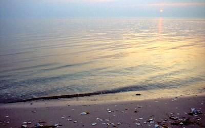
The farther away something is, the more people want to get there. That’s the way it can seem with Ocracoke Island, one of the most inaccessible, but inviting, parts of North Carolina’s Cape Hatteras National Seashore.
To reach this idyllic little isle it takes a longish drive down the barrier islands of the northern Outer Banks to Hatteras Island, and then it's a short ferry hop south over to Ocracoke. Two other, more recommended, ferry routes link this wonderful island with the rest of the state. Each offers a 2-hour cruise across Pamlico Sound from “mainland” North Carolina that perfectly set the stage for Ocracoke's appearance over the bow.
Either way, the little village with sandy streets bakes under spreading live oaks. In harborside pubs tourists sip and watch the sun set into the watery horizon—an unusual sight in the East. Above it all, North Carolina’s oldest operating lighthouse caps the scene. It’s a tad reminiscent of Key West years ago.
This 13-mile island boasts one of the East’s highest-rated beaches—a frequent favorite of beach-rating guru, "Dr. Beach," aka Dr. Stephen P. Leatherman, director of the Laboratory for Coastal Research at Florida International University.
"Beach" says, "Ocracoke is a special place; it is my favorite getaway beach. Here you will find some of the finest wild beaches in the country, and the water quality is at the top of the charts..."
On Ocracoke, marsh grass-lined inlets alternate with coastal dunes. Ocracoke Village and its picturesque harbor named Silver Lake sit at the southern end where the island wraps around Teach’s Hole (yep, the pirate Edward Teach—Blackbeard—sheltered there and died not far away).
Tip: If you're smart, or lucky enough to spend a number of days here, and you're camping at the Park Service campground or staying in a condo or house—you don't have to catch your own seafood to enjoy the freshest seafood. Be sure to check out the Ocracoke Fish Market, run by the Ocracoke Working Watermen's Association, to get "straight-off-the-boat" fresh seafood and help sustain the local fishing fleet. The market sits on the shore of Silver Lake.
The Seashore’s awesome campground is three miles north of the village on the eastern, seaside edge of the island. Just across the road, the Hammock Hills Nature Trail starts on the west side of NC 12. It’s a great place to step into the shade and see how trees gain a foothold in the battle to build a young maritime forest on a barrier island. Maritime forests are much more established on nearby Hatteras Island, at Buxton Woods, and farther north at Nags Head Woods.
The trail begins its 0.8-mile journey to the marshy grass-lined edge of Pamlico Sound and back in a scrub thicket woodland. It crosses a boardwalk and splits into its loop just past a small, freshwater branch of Island Creek—a rare surface accumulation that shows how the fresh water table sustains the salt wind-stunted forest ahead. Go right and the trail passes an open dunescape where you’ll notice low-growing prickly pear cactus. The path swings into a pine forest where an accumulating layer of soil and greater distance from the ocean invites less salt tolerant species to take hold and mature.
After more scrub thicket a view platform appears on the edge of the Sound. Along the marsh, vegetation varies from the saltmeadow hay found above the highest tide lines to black needlerush and saltmarsh cordgrass. A rich organic stew of minerals, muck, saltwater and decaying sea and plant life creates the perfect nursery for fish and crustaceans such as clams, crabs, and oysters.
The black skimmer, a gull-like bird, is often seen swooping low to use its large lower bill to scoop fish and other food from this fertile marsh. Look west. The setting sun might be dipping into the waters that obscure the distant shore of North Carolina.
The trail swings back away from the marsh among thickets and then re-enters the pine forest. This low, protective cover is the key to survival for the forest’s population of rabbits, black racers, skinks, mice, and tree frogs. It protects them from owls and the northern harriers often seen circling overhead. As you walk these ridges back near the parking area keep in mind—these are actually dunes slowly being clothed in young forest.
Tip: The least buggy time of year also has great bird watching—from October to March. If you come in spring or summer, bring some good insect repellant and plenty of sunscreen.


Comments
GREAT piece!