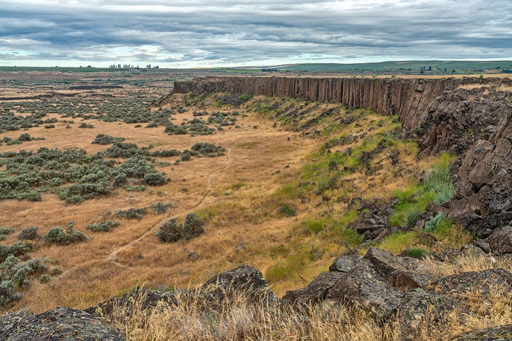
A National Natural Landmark, "the Drumheller Channels are the most spectacular example in the Columbia Plateau of basalt "butte-and-basin" channeled scablands. This is an erosional landscape characterized by hundreds of isolated, steep-sided hills surrounded by a braided network of (usually) dry stream channels. The landscape is the result of dramatic modification of the Columbia Plateau volcanic terrain by late Pleistocene catastrophic glacial outburst floods—the Missoula Floods. These floods occurred at a scale remaining unparalleled on earth, either in the geologic record or in historical account."
Drumheller Channels Landscape along the Channeled Scablands, Ice Age Floods National Geologic Trail
Rebecca Latson
Thursday, July 14, 2022

Support Journalism about National Parks!
National Parks Traveler is a 501(c)(3) nonprofit.
The Essential RVing Guide

The National Parks RVing Guide, aka the Essential RVing Guide To The National Parks, is the definitive guide for RVers seeking information on campgrounds in the National Park System where they can park their rigs. It's available for free for both iPhones and Android models.
This app is packed with RVing specific details on more than 250 campgrounds in more than 70 parks.
You'll also find stories about RVing in the parks, some tips if you've just recently turned into an RVer, and some planning suggestions. A bonus that wasn't in the previous eBook or PDF versions of this guide are feeds of Traveler content: you'll find our latest stories as well as our most recent podcasts just a click away.
So whether you have an iPhone or an Android, download this app and start exploring the campgrounds in the National Park System where you can park your rig.
Add comment