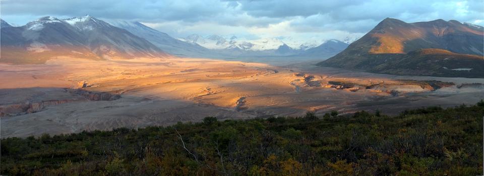
Valley of Ten Thousand Smokes, Katmai National Park and Preserve/NPS
Bears -- big, brash coastal brown bears -- often are what most come to mind when there's mention of Katmai National Park and Preserve in Alaska. And that's understandable thanks to the Brooks River and the bear viewing opportunities there. But if that's all you consider when researching a trip to this national park, you'll kick yourself later.
That's because one of the most intriguing volcanic landscapes in the National Park System lies within Katmai's 4-million-plus acres. Indeed, it was the Valley of Ten Thousand Smokes that led to creation of this park back in 1918. That was six years after the Novarupta Volcano erupted early in June of 1912. They say it was the largest volcanic eruption in the 20th century, and among the top five eruptions in recorded history.
June 6, 1912 dawned clear and calm. Residents of the area were busy getting ready for the upcoming fishing season, but for at least a week people had felt earthquakes. Earthquakes are common in Alaska, a region long known for geologic instability, but people living and working in what would later become Katmai National Park and Preserve noticed that these earthquakes were unusually frequent and getting stronger. These earthquakes had prompted the two remaining families at Katmai Village to evacuate their homes two days earlier. They were wise to do so. Around 1 PM on June 6, the skies darkened over Katmai and for the next 60 hours the sun disappeared. The greatest eruption of the 20th century had begun. -- National Park Service
For those who think the eruption of Mount St. Helens in 1980 was big, geologists say the Novarupta eruption spewed more than three cubic miles of magma, or 30 times that spewed by Mount St. Helens.
The summit of Mount Katmai, some 6 miles (10 km) distant from Novarupta collapsed as magma was drained from underneath it and vented at Novarupta. The former site of Mount Katmai’s summit is now occupied by a 1.9 mi (3 km) wide and 2000 ft (600 m) deep caldera.-- NPS
That eruption put this part of Alaska on the proverbial map. The National Geographic Society sent expeditions to the area that today is known as Katmai National Park and Preserve. One of those expeditions, in 1916, culminated in the naming of the area known as the Valley of Ten Thousand Smokes. Botanist Robert F. Griggs voiced that description in a narrative he wrote.
“The sight that flashed into view...was one of the most amazing visions ever beheld by mortal eye. The whole valley as far as the eye could reach was full of hundreds, no thousands--literally tens of thousands--of smokes curling up from its fissured floor…It was as though all the steam engines in the world, assembled together, had popped their safety valves at once and were letting off surplus steam in concert."
You can see this landscape for yourself. The park offers day-long ranger-led tours to the area. You could hitch a ride on this tour to begin your own backcountry exploration. The Buttress Range on the west side of the valley offers some great places to camp, according to the park's website, while the Katmai Pass area access from Katmai Bay still can be traversed to reach the valley. (Email the park staff for detailed information on this route.)

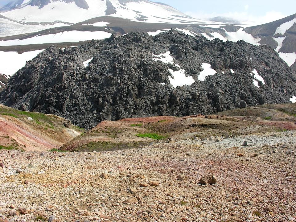
Novarupta Dome, Katmai National Park and Preserve/NPS
Those who reach the valley can gaze upon the site of the Novarupta eruption. Today it's marked by a roughly 200-foot high volcanic dome. Additional information on reaching, and exploring, the Valley of Ten Thousand Smokes can be found on the park's website.
Katmai also has intriguing archaeological history, one that shows human life there dating back at least 4,500 years. Research at a site dubbed "Cutbank" concluded that large houses probably were used by family groups, and that the society was similar to one living at the same general time on Kodiak Island more than 150 miles to the east.
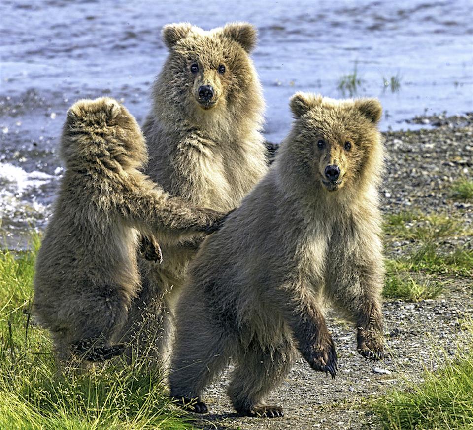
Most Katmai visitors, however, make a beeline to the Brooks Lodge area, where the brown bears make a show of fishing for salmon in the Brooks River. The river water is shallow enough at the bridge for people to see the silver flash and silhouettes of the migrating salmon, Traveler Contributing Photographer Rebecca Latson noted following her 2013 visit to the park.

Cubs at Katmai National Park and Preserve/Rebecca Latson
Getting to the park can be an adventure itself, Latson noted.
From Anchorage, one flies approximately 1-1/2 hours on a PenAir turboprop to the “bush community” of King Salmon (there are no roads to this place from any major city). Upon reaching King Salmon, you and your luggage are bused a short distance to the Katmai Air building where you and your luggage are weighed, loaded onto the floatplane, and flown out to the park.
Your floatplane will land on one of two lakes, depending upon weather conditions. During good weather, planes land on Naknek Lake, where the walk from beached floatplane to visitor center is maybe 50 - 100 yards. If the weather is too inclement, though, the plane will land on Lake Brooks, where you and your luggage are then ATV’d to Brooks Lodge or Brooks Camp.
Brooks Lodge and Brooks Camp are next door to each other with access to the same lodge lobby, mess hall, bar, lodge office, trading post, freezing room, food storage locker, and outside eating area (which is surrounded by an electric fence).
Stays at the lodge itself are limited to four days during the peak viewing months of July and September, she added. For any stay longer than that, you should make arrangements with the National Park Service to reserve a tent spot and transfer to the campsite located approximately a half-mile from the lodge
Floating the American River for a week or longer is another enjoyable pastime for some who are lured to Katmai for its fishing.
Katmai is a big, wild, potentially dangerous but also breathtakingly beautiful and interesting park. It's worth the extra effort it takes to reach this land.


Comments
We camped in the valley of 10000 smokes in 2002, took the bus from the lodge out there and got off. Rangers said there shouldnt be much worry about wildlife in the valley as there was nothing really there but ash. Woke up the next morning and while cooking breakfast saw an enormous brown bear walking towards us. He walked up to us withing 15ft or so and stared for a bit. We had no option other than hold our ground as there is literally nothing there but ash and a fast flowing ice cold glacier stream. He eventually walked off and we ate our breakfast.