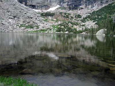
Contrary to the impression you might have gotten from the popular press, the whole state of Colorado is not burning. In particular, the popular areas of Rocky Mountain National Park are open and ready for hiking. A visit to Black Lake is a great introductory hike to the park. It shows off several iconic lakes and waterfalls. It's a progressive hike and you can decide how far you want to go.
This hike is a good place to get a feel for the three natural environment of the park.
The montane ecosystem (5,600 feet to 9,500 feet) is the lowest in the park, characterized by ponderosa pines with their red barks, lodgepole pines, and quaking aspens. Further up in the subalpine area (9,000 to 11,000 feet,) you'll see more spruce and firs, some bent in weird shapes by the wind. The Alpine Ecosystem (11,000 feet and above), also called tundra, seems to be empty of vegetation but is full of low growing plants.
The Hike
Park your car at Beaver Meadows Visitor Center and take the hiker shuttle to Bear Lake at 9,475 feet above sea level. A VIP (Volunteer in the Park) or a seasonal ranger is at each shuttle point to answer questions and direct groups of visitors on the bus in an organized manner.
Once at Bear Lake, pick up a free Bear Lake Area Hiking map. It will give you ideas for several other outstanding hikes in the area.
At Bear Lake, signs direct you to Alberta Falls (0.8 mile, 160 feet ascent), the first highlight. The waterfall is a rushing torrent that attracts a lot of visitors. The water cut a large swath through gray granite rocks. People climb all over the rock trying to get the best picture of the falls and themselves. After Alberta Falls, most visitors have turned around. If you're coming from sea level and this is your first day in the park, you may decide that this is as high as you want to get.
Otherwise follow the signs to Mills Lake, your next destination. The lake is named after Enos Mills, the John Muir of Rocky Mountain National Park. The trail becomes a little steeper. According to locals, this is a poor year for wildflowers. Still you'll find columbine, the state flower, Indian paintbrush, elephant ear, blue bells, purple asters, and cinque foil, a small yellow flower that could be mistaken for a butter cup, and. On a clear day, one can see Longs Peak.
Mills Lake (2.8 miles, 750 feet ascent from the trailhead), a large lake in a glacier valley, is close to timberline at 9,950 feet. Here the trail levels off and continues to the left of the lake with obstructed views. Again, you could have lunch here and make this your final destination.
After Mills Lake, the trail is almost empty of visitors. It’s another 2.2 miles to Black Lake following Glacier Creek but it’s worth the walk. Continuing on to Jewel Lake, the next lake in the sequence, you'll see several beaver ponds. Moose have been known to hang out at Jewel Lake. Boardwalks have been placed so you can avoid the marshy trail.
The trail crosses large swaths of granite and the rock steps are superb. Trail crews use llamas to bring in trail maintenance equipment; llamas create less damage on the trail than horses.
Last November, a micro-burst with strong winds that might have reached 100 miles an hour hit this area and brought down whole trees. The trail had been cleared but the cut stumps and large root balls will be around for years. It's almost fun to go under and over logs, knowing that the trail is cleared and still well-defined. You'll follow Ribbon Falls for the last half-mile of the hike.
Close to the lake, the trail is a short and steep path across granite. Black Lake, with a rocky shore line, lies at the base of McHenrys Peak. The lake is not as desolate or bleak as the name implies. Black Lake may have been named for the black reflection of McHenrys Peak in the water.
Interesting Tidbit
When you first start on the trail to Alberta Falls, the bridges are high and solid with railing on both sides. Then it switches to a split log bridge with a handrail. Finally it’s just a log across the water and lots of boardwalks across the muddy parts.
If You Go
Trailhead: Bear Lake or Glacier GorgeTrail Length: 5.0 miles one way if you go all the way to Black Lake. Roundtrip, it's about 1,700 feet of ascent.
Difficulty: Easy to Alberta Falls, very moderate to Mills Lake, a bit of a challenge to Black Lake. However, the difficulty is also due to the altitude.
Payoff: Waterfalls, lakes and outstanding scenery
Resources
Rocky Mountain National Park, National Geographic Trails Illustrated map #200
Rocky Mountain Nature Association, the cooperating association which publishes material on the park and manages the bookstores.


Add comment