
The telltale work of glaciers -- moraines -- can be seen from West Bluff at Devils Lake State Park along the Ice Age Trail/NPS
I helped my traveling companion get his backpack on, and then we hit the trail. Within the first half mile, a few signs had us imagining thousands of tons of dirt falling from the sky.
The signs were not quite as dramatic as our imagination, though. They described the top of a glacier a mile or two over our heads. The glacier surface might have had lakes with sediment resting on their bottom. The glacier also had dirt and gravel that shaped the flow of water into streams and lakes on top of the ice. Having seen similar features in Alaska, I could imagine these glacial landscapes fairly well. As the glaciers melted, those different shapes of dirt and gravel would descend, or slide off the side of the ice sheet. Then they finally reached the ground—forming the landscape we saw.
We’re hiking a short section of the Ice Age National Scenic Trail in northern Wisconsin’s Chippewa County. We started at the David R. Obey Ice Age Interpretive Center on top of an ice-walled lake plain. Surface debris here filled cracks in the ice as it melted, leaving a bunch of ridges when the glaciers withdrew. Our trail weaves among many small “kettle” lakes on this “hummocky” landform.

The Ice Age National Scenic Trail entices hikers near its trailhead in Wisconsin/Bob Pahre
This makes the landscape very different than what we see back home in central Illinois. We have several terminal moraines, gravel and dirt that got shoved to the end of these ice sheets. One local park features an outwash plain, where meltwater flowed off the glaciers and left behind the raw material for a sand and gravel mine. We don’t have dirt falling from the sky, however.
Congress established the Ice Age National Scenic Trail in 1980. It’s one of America’s long trails, with a planned length of 1,200 miles. The route still requires some road walks, and our trip would require two short road segments of a couple tenths of a mile. The trail roughly follows the edge of the final ice sheet in Wisconsin, featuring a mix of glacial geology – dells, drumlins, eskers, ice-walled lake plains, kames, kettles, moraines, outwash plains, potholes, and till plains. We certainly enjoyed the varied landscape, though we moved at only a glacial pace.
Congress designated the National Park Service as the lead agency for the Ice Age Trail. The NPS manages many national trails, but so do the U.S. Forest Service and some other agencies. In addition to national scenic trails like the Ice Age, national trails include historic trails like the Oregon Trail and about 1,300 national recreational trails of local significance. The system also includes some connector or side trails. One of those side trails will take you to Timms Hill, the high point of Wisconsin, from the Ice Age Trail.
These trails depend on the work of park partners. The Ice Age Trail is fortunate to have a strong volunteer organization, the Ice Age Trail Alliance, and a supportive Wisconsin Department of Natural Resources. We saw evidence of their work throughout our three-day backpacking trip – excellent signage, benches, boardwalks across wetlands, and various trail maintenance projects including a detour around a washed-out road crossing. A few projects honor people who played a key role in establishing or maintaining the trail.
The Ice Age Trail also depends on cooperation from many different land managers and private landowners. We would pass through lands of the Chippewa Moraine National Scientific Reserve, Chippewa County Forest, Chippewa Moraine Lakes State Natural Area, and a short stretch of private lands whose owner has given the trail permission to cross a field.
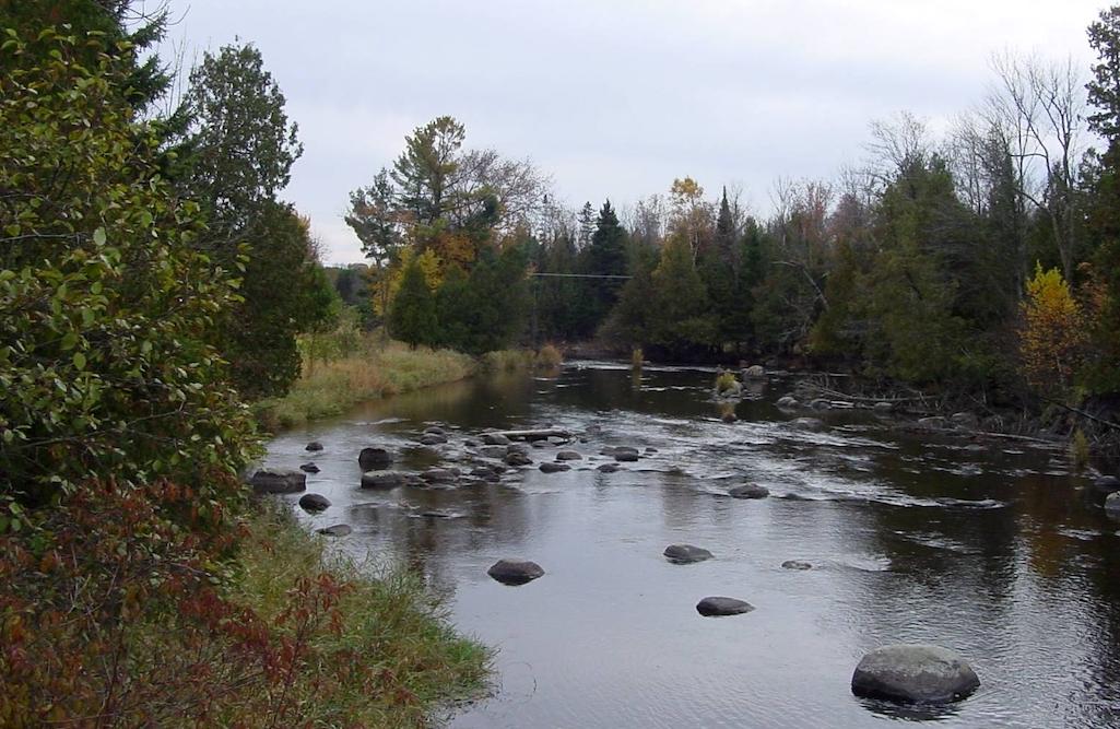
Erratics in the Plover River are another calling card of the region's glacial past/NPS
Each of these units has different rules about camping or off-trail travel. We did not see those rules posted, so do your research in advance. We found one unofficial campsite that clearly gets regular use, on a hill above Dam Lake. We spent our second night at an official campsite on a peninsula between the two Harwood Lakes. That offered a spectacular location for sunrise and sunset over the lakes on either side.
Working with everyone to get trail access, and to make sure that the trail includes a reasonable number of camping zones and campsites, provides ongoing challenges for managers. For the lead agency, I suspect that “management” sometimes feels like herding cats. When it works well, you get a well-designed and well-managed trail with seamless transition from one landowner or manager to the next. The segments we hiked fell into the “working well” category. I’ve done some day hiking on two other segments that were less interesting than this one, in more suburban areas than this backpacking trip. However, the conditions of all three trails were very good, a testimony to the work of all the partners.
If you’d like to explore the Ice Age Trail, start with the Ice Age Trail Alliance webpage. They offer a guide to the trail on the website and in print. At least in northern Wisconsin, I wouldn’t count on internet access when you’re on the trail, so you probably want the printed guide. That includes detailed maps of every segments, information about camping options, and brief explanations of the geology.
Whether you choose a day hike or aim for the full 1,200 miles, the Ice Age Trail offers great Midwest scenery and a geological education as you explore the glories of the Badger State.
Robert Pahre is a professor of political science at the University of Illinois who teaches and conducts research on environmental politics, especially in and around the national parks.
Traveler postscript: You can help the Ice Age Trail Alliance secure access to more miles of trail and provide trail improvements with a donation.


Add comment