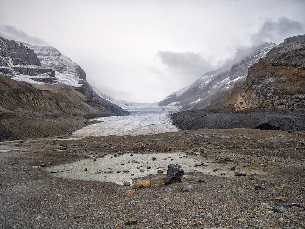
The view toward the Athabasca Glacier, Jasper National Park / Rebecca Latson
The Great White North has some pretty awesome national parks: Kootenay, Yoho, Banff, Jasper, Mount Revelstoke, and Glacier. These national parks located within the snaggle-toothed mouth of Canada’s mountainous west are the subject of this month’s quiz and trivia piece. See how much you know before checking the answers at the bottom. You might even learn something new!
1. As you hike the trail toward the toe of the Athabasca Glacier, located just off the Icefields Parkway in Jasper National Park, you will probably feel a cool wind blowing your way from the glacier (no matter what season of the year). This wind is called a/an ___ wind.
a) Katabatic
b) Anabatic
c) Acrobatic
d) Williwaw
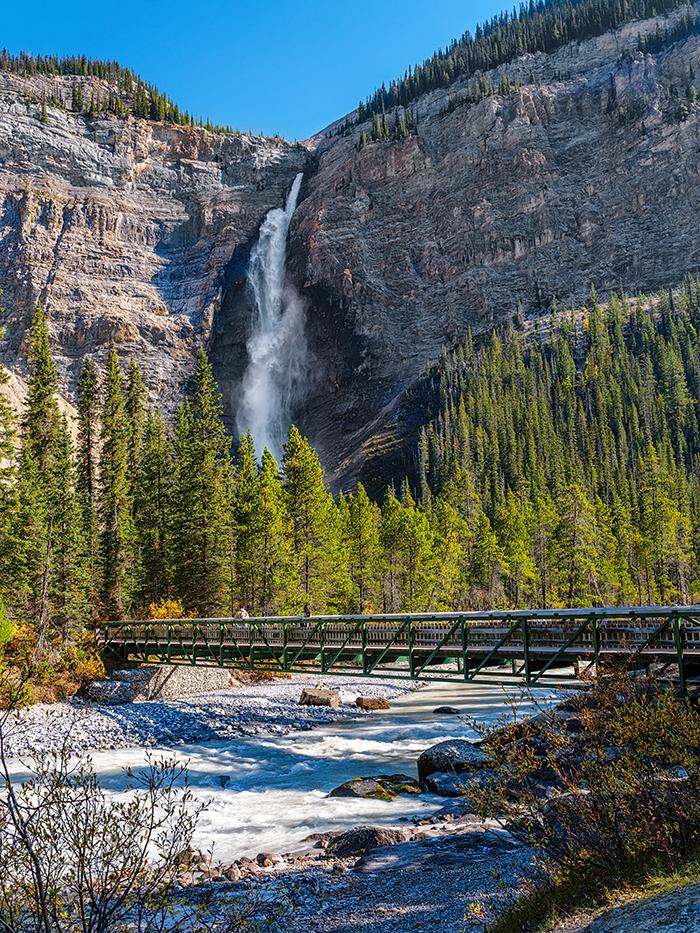
Takakkaw Falls, Yoho National Park / Rebecca Latson
2. Takakkaw (Tak – uh – kaw) Falls is a must-see sight when visiting Yoho National Park. With a height of 1,224 feet (373 m), this waterfall is the second-tallest in Canada. “Takakkaw” is a Cree word for ___.
a) Mighty
b) Wonderful
c) Magnificent
d) Thundering
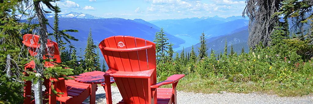
A red chair view of the landscape at Mount Revelstoke National Park / Parks Canada
3. Mount Revelstoke National Park is located entirely within the ___ Range.
a) Selkirk
b) Queen Elizabeth
c) Winston Churchill
d) South Jasper
4. True or False: Mount Revelstoke is the only mountain in Canada’s system of national parks that can be summited just a short walk from your car.
a) True
b) False
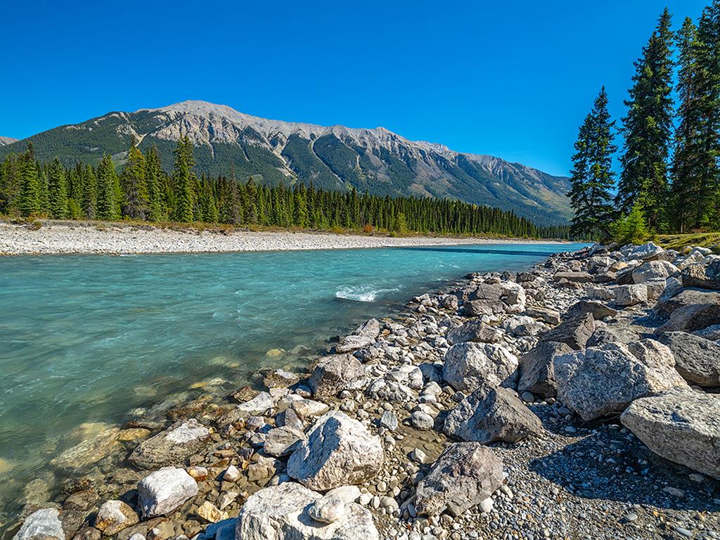
The cold, turquoise water of Kootenay River, Kootenay National Park / Rebecca Latson
5. True or False: In British Columbia, Kootenay River, which flows through Kootenay National Park, is the Columbia River’s main tributary.
a) True
b) False
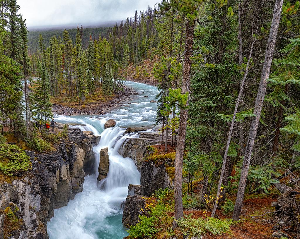
Sunwapta Falls on a rainy September day, Jasper National Park / Rebecca Latson
6. Sunwapta Falls in Jasper National Park originates from the ___ glacier.
a) Stutfield
b) Coronet
c) Athabasca
d) Maligne
7. True or False: Jasper National Park was once the site of a World War II internment camp.
a) True
b) False
8. True or False: Banff National Park’s largest lake is man-made.
a) True
b) False
9. Glacier National Park, located in British Columbia (not to be confused with the Glacier National Park in Montana, U.S.A.), has three distinct vegetation zones: subalpine, alpine, and ___.
a) Temperate grassland
b) Interior rainforest
c) Temperate broadleaf and mixed forests
d) Boreal forest
10. True or False: Banff National Park is home to the highest-elevation town in Canada.
a) True
b) False
Trivia
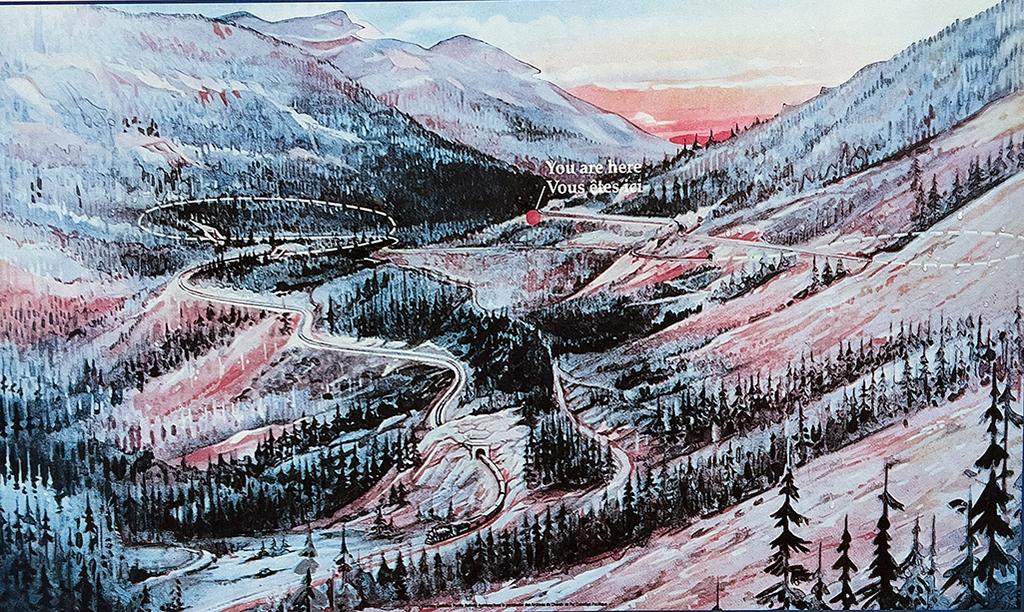
An explanation of the Spiral Tunnels, Yoho National Park / Parks Canada
“As trains snake their way up the Kicking Horse Pass [in Yoho National Park] and the continental divide, they circle deep into the mountains on both sides of this valley. The two giant underground loops they follow are the Spiral Tunnels … A tunnel in Cathedral Mountain and a lower one in Mount Ogden allow trains to make their turns in giant, spiraling loops … Because each tunnel makes a complete spiraling turn, trains actually cross over themselves. The trains did not always have the benefit of that gentle, winding grade up to the pass. From 1885 until the Spiral Tunnels opened in 1909, steam engines inched up a treacherously steep track. Coming down was a nightmare. Plunging at the rate of 45 miles to each kilometer, this was the steepest part of the entire Canadian Pacific mainline. Wrecks and runaway trains were common on the aptly named ‘Big Hill’.”
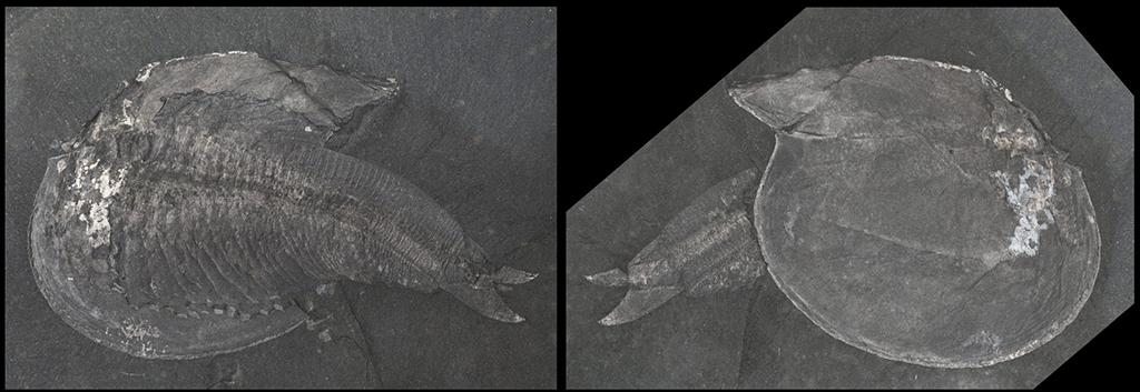
Branchiocaris pretiosa, one of the weird and wonderful fossilized denizens of the Burgess Shale, Yoho and Kootenay National Park / Royal Ontario Museum Photo
“High in the mountains of Yoho and Kootenay national parks, the Burgess Shale fossils are the oldest evidence of complex life on Earth. The amazingly detailed preservation shows us a complete marine ecosystem that existed long before the dinosaurs. The Burgess Shale fossils provide the link between modern day species and those from over 500 million years ago. These fossils are so important that they have been recognized as a key part of the UNESCO Canadian Rocky Mountain Parks World Heritage Site. Scientists are still making new discoveries and finding new animals, which are changing our understanding of early life and evolution! The Burgess Shale is part of the larger Canadian Rocky Mountain Parks World Heritage Site.” To learn more about the Burgess Shale and it’s fossilized denizens, click here.
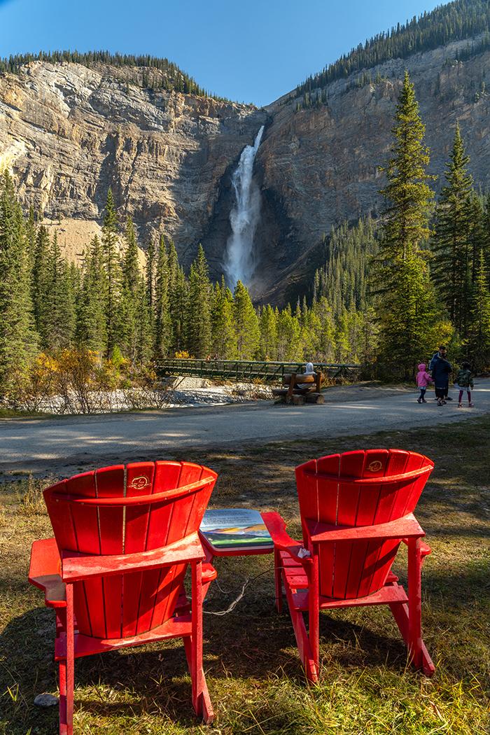
Red chairs at Takakkaw Falls, Yoho National Park / Rebecca Latson
Hey, what's with these cool red Adirondack aka Muskoka chairs in Canadian national parks? According to Parks Canada, there are over 400 of these red chairs placed in scenic locations from coast to coast (not necessarily in national parks, but all over). Some are easy to get to - like the chairs at Takakkaw Falls in Yoho National Park or Maligne Lake in Jasper National Park, while others take a little bit more effort to access. How did the red chairs begin? "In 2011, team members at Gros Morne National Park came up with the idea to place 18 sets of Adirondack chairs in lesser-known, but just as stunning locations, inviting visitors to enjoy and share on social media. They even ran a contest where the first people to find all 18 pairs won their very own red chairs to enjoy. Today, the iconic red chairs can be found in over 100 locations administered by Parks Canada." DYK those red chairs are made from 100 percent recycled plastic "saved from Canadian landfills"?
Quiz Answers
1a
“Icefields produce their own weather … Air passing over the icefield is cooled by the ice. Cold air is denser and heavier than warm air, so it slides downhill creating what is called a katabatic wind. Katabatic winds are strongest in the fall. That’s when the temperature difference between the icefield and the lower valleys is the greatest.”
2b and/or 2c
“Takakkaw” is the Cree word for “magnificent” or “wonderful.” This waterfall is fed by the meltwater of the Daly Glacier from the Waputik Icefield. If you wish to visit Takakkaw Falls, you should arrive prior to 10 a.m. or after 5 p.m. as the parking lot fills quickly. You might also want to leave your tow trailer behind, as the narrow Yoho Valley Road to this waterfall has a couple of really tight hairpin switchbacks. Vehicles longer than 24 feet are not recommended.
3a
“Mount Revelstoke National Park is located entirely in the Selkirk range of the Columbia Mountains. Formed 250 million years ago by the collision of the North American and Pacific Plates, the Selkirk range was covered by the Cordilleran ice sheet until as recent as 6,000 years ago. The ice sheet was up to 4,593 feet (1400 m) thick and covered all but the highest peaks of the Selkirks.”
4a True
“From the Trans-Canada Highway, most summer visitors drive up the 16 mile (26 km) Meadows in the Sky Parkway. This winding, paved mountain road leads to the Mount Revelstoke summit, and is the only opportunity in the Canadian national park system for private vehicles to access a mountaintop environment.”
5a True
In British Columbia, the 485-mile (781 km) long Kootenay River is the main tributary to the mighty Columbia River. Beginning high in the Canadian Rockies, the water of Kootenay River drops 6,562 feet (2,000 m) before joining with the Columbia River.
6c
Sunwapta Falls in jasper National Park originates from the Athabasca glacier.
7b False
Jasper National Park was once the site of a World War I internment camp. “During the First World War, the [Canadian] federal government interned 8,579 Canadians as prisoners of war in camps across the country. Known as ‘enemy aliens,’ they originated from the countries Canada was at war with, namely Germany, Austria-Hungary, Turkey, and Bulgaria. Four of these camps were set up in national parks: Banff, Jasper, Mount Revelstoke, and Yoho. The Jasper camp opened in February 1916 and closed seven months later. During that time, the prisoners were primarily tasked with building a road to Maligne Lake.” To learn more about these internment camps, click here.
8a True
Lake Minnewanka, Banff National Park’s largest lake (yes, some websites list Bow Lake as the largest lake) is man-made. “Spread across 22 square kilometers / 8.5 square miles, Lake Minnewanka is the biggest lake in Banff National Park. It’s also the second-longest lake in the Canadian Rockies. Sourced from glacial waters from the Cascade River, many people are surprised to learn that the beautiful lake is artificial. The river was originally dammed in the early 1900s to ensure an adequate water supply. In the 1940s, a bigger dam was built, which created the expansive body of water.”
9b
Canada’s Glacier National Park has three distinct vegetation zones: interior rainforest, subalpine, and alpine. The interior rainforest “extends from the valley bottom to about 4,265 feet (1,300 m) in elevation. This zone is characterized by western red cedar and western hemlock trees up to 1,000 years old and measuring up to 13 feet (4 m) in diameter.” The subalpine vegetation zone extends above 4,265 feet where the “snow lingers longer than in the valley bottom. This zone features subalpine fir and Englemann spruce trees as well as subalpine meadows with vibrant displays of wildflowers in the short summer months.” The alpine vegetation zone extends “above 6,234 feet (1,900 m) [and] the trees disappear altogether and patches of lichen, heather and sedges cling to the rock and thin soil near permanent ice and snow.”
10a True
“The Banff townsite covers 3.93 square kilometers (2.5 square miles) and has an elevation of 1,383 meters (4,537 feet) making it the highest town in Canada.”
References:
https://en.wikipedia.org/wiki/Takakkaw_Falls
https://thebasin.ourtrust.org/geography/rivers/kootenay-river/
https://www.thecanadianencyclopedia.ca/en/article/largest-national-parks-in-canada
https://www.thecanadianencyclopedia.ca/en/article/jasper-national-park
https://www.canadashistory.ca/explore/historic-sites/park-prisoners
https://canadiantrainvacations.com/blog/banff-national-park-facts
https://parks.canada.ca/pn-np/bc/revelstoke/info/faites-facts
https://parks.canada.ca/pn-np/bc/glacier/activ/edu/faits-facts

