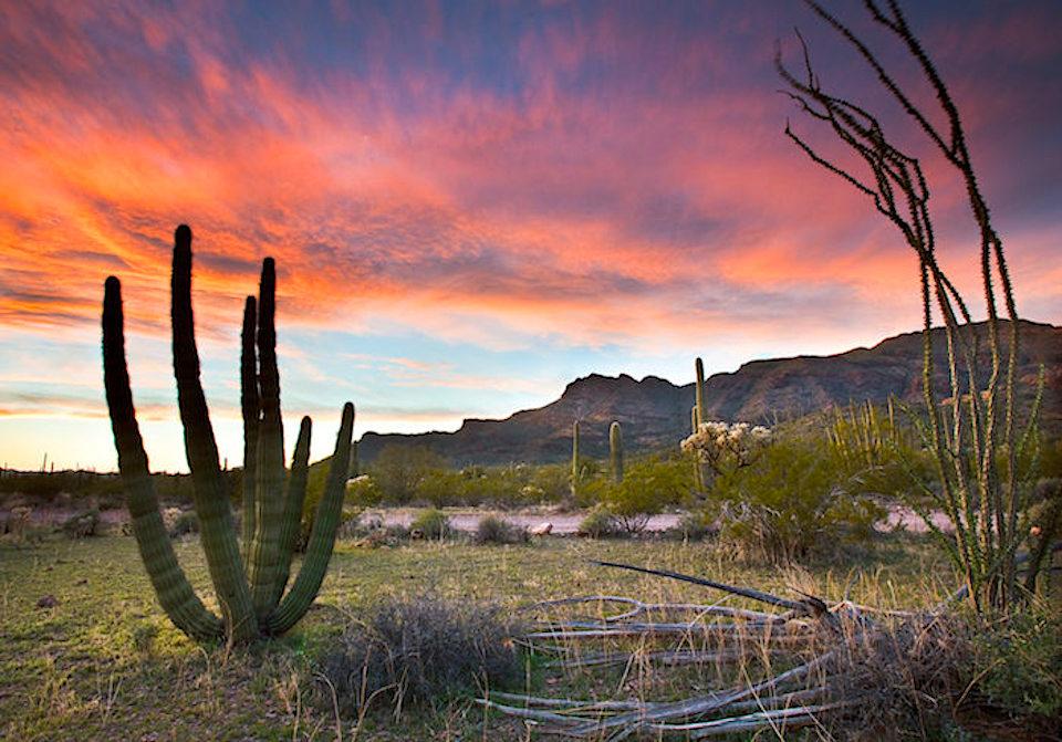
Organ Pipe Cactus National Monument in Arizona likely to face irreversible damage from border wall construction/NPS file
Organ Pipe Cactus National Monument is home to a thriving community of plants and animals. In fact, this national monument is also an International Biosphere Reserve, recognized for its conservation of the unique resources representing a pristine example of an intact Sonoran Desert ecosystem. But the health and continued protection of this irreplaceable ecosystem is at risk from a man-made intrusion; the border wall.
On May 16, 2019, the U.S. Customs and Border Protection announced that approximately 63 miles of existing border barriers would be upgraded with vehicle and pedestrian barriers in the form of a bollard wall. The proposed design of the new bollard wall includes 18- to 30-foot, concrete-filled steel bollards that are approximately 6 inches x 6 inches in diameter. The proposed project also includes improvement or construction of roads, the installation of lighting and the installation of other detection technology. And the proposed project would impact numerous national public lands, including Organ Pipe Cactus National Monument.
This is an incredibly invasive and destructive project, and CBP has not indicated publicly what level of environmental analysis it would prepare for its border wall proposal. In most instances, the requirements of the National Environmental Policy Act have been waived in the interest of expediting wall construction. This means that significant desert vegetation and wildlife habitat could be destroyed without taking the time to truly study the impacts and ramifications. And we know it’s happening already, as you can see in this video of a bulldozer knocking over a decades-old Saguaro.
The existing barrier at Organ Pipe Cactus National Monument and Coronado National Monument was constructed between 2004–2006. According to the NPS documents for that project, the barrier was to be “wildlife friendly” and include mitigation measures to protect threatened and endangered species. With the new border wall, there will be little, if any, provisions to allow wildlife to access water and habitat.
In addition, the effectiveness of the new wall is also in question. There have been numerous instances where the wall has been constructed, yet illegal border crossing still occurs. We should not risk our irreplaceable cultural and natural resources until the effectiveness of the existing wall, as well as the new proposed wall, have been disclosed to the public and thoroughly analyzed by federal, state and tribal officials.
The damage being done to Organ Pipe Cactus National Monument by the construction of this border wall will last for centuries; in fact, it may very well be irreversible. If the effectiveness of the existing barrier and its impacts have not been disclosed to the public, how do we know that a new border wall is necessary? What we do know is that a wall will threaten the delicate balance of a critical ecosystem. So is building a wall that may not be successful worth impacting national parks and harming threatened and endangered wildlife? It is not.
Rick Smith served the National Park Service for decades, retiring as the Associate Regional Director for Resources Management. Rick continues to stay involved in NPS issues and is an active member of the Coalition to Protect America’s National Parks. He and his wife, Kathy, live in Tucson, AZ.


Comments
Even if the wall is removed, the saguaros will need a couple of years to grow back
In a couple of years the saquaros will hardly be the size of a French Fry. But then given the wall is impacting less than 1/10 of one percent of the acreage of the Park its not meaningful anyway.
And you got out there and measured this when? Your repeated minimizing of your Trump's horrific and ongoing damage to the environment will never reflect well on you.
No Rick, I took the disturbance acreage as identified on this and other sites and divided by the total acreage of the Park. Really quite simple for someone that cares about the facts.
I always verify anything that a land salesman claims about acreage, hence my skeptacism over your unsubstantiated claims.
Perhaps you should do a little homework before embarassing yourself.
Statistics that are true can nonetheless be misleading. This is not a single, random, tenth-of-a-percent, out-of-the-way spot on which the wall is being built. That tenth-of-a-percent is instead strung out all along the southern boundary of the monument, where it is fronted much of the way by Puerto Blanco Scenic Drive barely a stone's throw away. That scenic drive is one of only three passenger-vehicle-passable such drives in the monument (the others being the Ajo Mountain and Alamo Canyon drives) and provides access to about a quarter, depending on how you count, of the monument's frontcountry attractions (including Senita Basin and Quitobaquito Oasis right next to where the wall will go). Now, this "scenic" drive shall be scenic no more because of this godforsaken ugly wall, thus ruining access to a quarter or more of the monument's main visitor attractions, as well as ruining one of only three scenic drives in the park. Just from a visitor impact stance alone, the impact is far more than the tenth-of-a-percent statistic lets on.
Oh the irony Scott, you complain of a wall while driving on a road that destroyed far more of the monument. Meanwhile, looking south - out of the park, you are looking at Highway 2 across the boarder and its assoicated utility poles both of which destroyed even more. Not to mention the radio towers. This is far from pristine wilderness.