
Trekking through the upland forest at Pictured Rocks National Lakeshore/Robert Pahre
Exploring Pictured Rocks’ Beaver Basin Wilderness
By Robert Pahre
Those of us who live in the western Great Lakes know the glories of Michigan’s Upper Peninsula. It borders three of the five Great Lakes, and it holds a surprising number of inland lakes, rivers, and wetlands. It has a few small primeval forests of the original North Woods but mostly consists of second-growth forests. Those are now a century or so old, and the trees have become tall. To most people, these newish forests will still seem pretty old.
At the end of a challenging stretch at work, I decided to escape into the North Woods for a quick backpacking trip. After considering some options, I chose Pictured Rocks National Lakeshore. Having been there a few times before, I knew that Pictured Rocks would offers great views from the bluffs above Lake Superior, interesting geology, and a classic North Woods experience.
Based on previous visits, I also expected to see a lot of day hikers from a few popular trailheads as well backpackers hiking out to several lakeside destinations. That’s not what I experienced this time. Instead, most of the people I met were following the same basic itinerary. They began with a night in Munising and then took Alger County’s shuttle to Grand Marais at the other end of the lakeshore. There they hit the trail, spending five days to hike the 42 miles of the North Country Trail that lie inside Pictured Rocks National Lakeshore. Because almost everyone I met lives within a day’s drive of the park, that makes for a good seven-day vacation.
Of course, you could do it differently. You could spend a night in Grand Marais at the east end of the park and take the shuttle west to Munising for a hike back to Grand Marais. Though fewer people do this, you’ll meet more people that way—all those folks going from east to west. You could also divide those 42 miles into six days of seven miles, or four days of ten miles. I know someone who put in two 21-miles days on the trail here as part of a much longer hike, so you could also do something like that. Despite the many options, the five-day plan characterized almost all the backpackers I met.

View of Lake Superior from the North Country Trail/Robert Pahre
Being a contrary sort, I decided not to use the shuttle. Instead of thru-hiking Pictured Rocks, I would build a “butterfly” itinerary. I would hike to Lake Superior from my car, then complete a “wing” to the east and a wing to the west. Because I couldn’t get the campsite permits I wanted for this plan, I ended up with a surrealist butterfly—a stick arm to the west and two stretched-out, misshapen wings on the east, ending in a curved witch’s finger on the east. I came to think of this butterfly as a lepidoptera salvador dali.
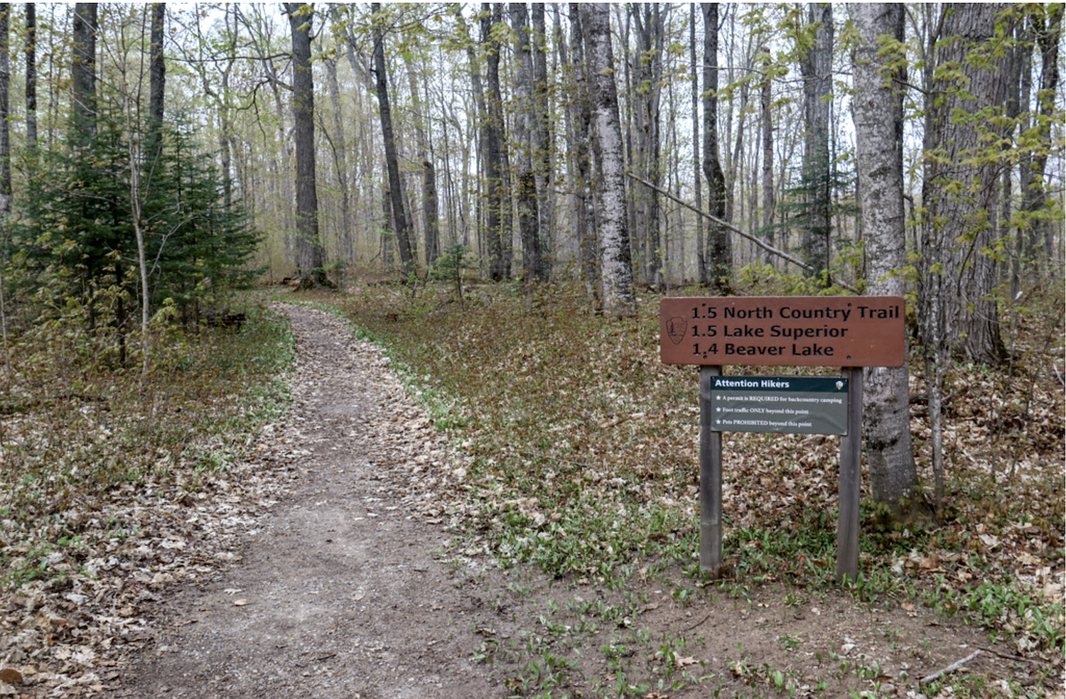
My route would feature the Beaver Basin Wilderness, which Congress designated in 2009. While joining through-hikers the lakeshore trail, I would add side trips in the interior, around Beaver Lake, Little Beaver Lake, and up to the Beaver Basin Overlook. All these destinations lie within the official wilderness area.
The start of the adventure/Robert Pahre
These inland areas showed off the attributes that helped justify the wilderness designation. Inland lakes, clear streams, and extensive wetlands provide good habitat for wildlife in the wilderness area, creating a soundscape dominated by birds, small mammals, and running water.
The inland trails also offered plenty of solitude. I never met anyone in these areas; everyone else stuck to the shoreline. When taking beach walks after dinner, I also had the shoreline to myself. Of course, chilly weather may have kept people from the beaches; temperatures only reached the 50s on one of my four days, and the first night may have reached freezing. If you like solitude, mid-May is a good time to explore the Upper Peninsula.
While enjoying the inland solitude, my itinerary also took me to all the “tourist” sights in the middle of the park—from Spray Falls to Log Slide at the top of the Grand Sable Dunes. I would also hike about half of the park’s shoreline. My route left out popular day destinations like Miners Castle and the Mosquito Beach–Chapel Beach area, as well as the cliffs between them and Munising. Those had been the core of our visits when the kids were younger, so I didn’t mind taking a pass on them this time.
Spray Creek marks the western border of the Beaver Basin Wilderness, and the western-most point of my trip. Spray Falls breaks in two as it hits a ledge and then drops off the tip of a bluff into Lake Superior. When you visit, take a few minutes to enjoy both the falls and the bluffs from a viewpoint just east of the creek.
As you continue east from that bluff, you’ll enter the “Coves” section of the trail. This involves several up-and-down sections that are steep enough to require steps. In some cases, erosion has moved the cliff close to the trail. Some queasy hikers have chosen to bushwhack a little bit back from the edge, providing an unofficial route away from the cliff. This stretch will show you a series of picturesque coves where the lake has broken through the bluffs.

A small cove along the lakeshore/Bob Pahre
After your last descent, the trail takes you along miles of beach. Every so often the trail will dip into the woods for a bit before coming back to the bluff. If you’d like to explore the Beaver Basin Wilderness away from the shoreline, use the trails heading south to Beaver Lake. Alternatively, you can camp at Trappers Lake, which also connects to the trails around Beaver Lake and up to the Beaver Basin Overlook. After making camp at Trappers Lake, I used this area as an afternoon hike with a light pack.
Two nights at Trappers Lake would give you a good day for exploring these inland trails. Beaver Basin Overlook provides a spectacular view over the forests to Lake Superior; it’s on the edge of an old beach ridge when water levels were much higher. In the basin below, Beaver Lake, Little Beaver Lake, and Trappers Lake are all lovely lakes with trail access. Little Beaver Lake has a developed campground, so auto campers can use that as a base for exploring this region.
East of Trappers Lake the trail stays inland for a couple miles before returning to the lakeshore. You’ll leave the wilderness area a little before you reach Twelvemile, which has a drive-in campground.
After Twelvemile the trail crosses the highway into a patch of old-growth hemlock forest. After crossing the highway back to the shoreline, you’ll hike through a drive-in campground at Hurricane River. If you’d like to explore the area without carrying a backpack, both Twelvemile and Hurricane River give you attractive sites near the beach—though I’m sure the reservations disappear quickly on summer weekends.
This part of the trail includes some short stretches on park roads. If you don’t mind a steep climb, you can use the White Birch Nature Trail to go around one stretch of road. This will take you up an escarpment to the ancient shore of Lake Nipissing, a much larger version of Lake Superior after the last glacial period. Grab the small booklet at the trailhead if you’d like to learn more about how the timber industry logged the forest out about a century ago. The booklet points out both the signs of recovery and the lasting damage to the already-poor soils.
After Hurricane River, you’ll reach a gate to keep non-park vehicles out. From here, the Au Sable Light Station is only a mile and a half away on this wide, level path. Along the way, you can follow signs down to the beach to see the remains of a shipwreck.

Au Sable Light/Bob Pahre
The Au Sable Light Station would make a great day-hike destination. In addition to the historic buildings, it offers great views of Lake Superior from the bluffs, and a distant view of the Grand Sable Dunes to the east.
After exploring the light station for a bit, I continued to my furthest campsite, at Au Sable Point East. This was my most frustrating backpacking campground because it doesn’t have enough room for the number of groups it’s supposed to hold. My assigned site was atop the access trail on the top of a small ridge. Fortunately, the neighbors were friendly and interesting companions.
After an early dinner in camp, I went for a hike. The trail east of camp involves climbing from lake level to the top of the Grand Sable Dunes. I lingered with my camera as the warm late light brought out the yellow-brown of the dunes. Then I returned to camp for dessert—my usual dehydrated peanut butter with crushed cocoa beans. (Don’t knock it ‘til you’ve tried it.)
Dessert also gave me a chance to ponder the remarkable set of national park units around Lake Superior. Isle Royale NP, Grand Portage NM, Keweenaw NHP, Apostle Islands NL, Pictured Rocks NL, and the North Country Trail all provide great places to explore the North Woods and the Great Lakes. In addition to the national park sites, the region also includes many great state parks and national forest lands, as well as a few wildlife refuges.
My butterfly route gave me plenty of views along Lake Superior while highlighting the more subtle joins of the inland forests and lakes of the Beaver Basin Wilderness. While I understand the achievement orientation of the thru-hikers along the lakeshore, Pictured Rocks provided a great opportunity to take the path less traveled by.
Robert Pahre is a professor of political science at the University of Illinois who teaches environmental politics and the national parks. You can see more photos of his photos from Pictured Rocks here: https://www.flickr.com/photos/rpahre/albums/72157656966347930/
Comments
This West Coast guy had a nice time viviting Pictured Rocks NL some years ago with Michigan friends . Although we didn't backpack, but camped for a few nights, we saw quite a bit inluding the Au Sable lighthouse, and went canoeeing along the rocks east from Miner's Beach. Sunsets over Lake Suprior were fantastic. It was great!
Glad you had a good experience at Pictured Rocks, Mike! As West Coast born and raised, I have enjoyed getting to know the parks of the Great Lakes over the years.