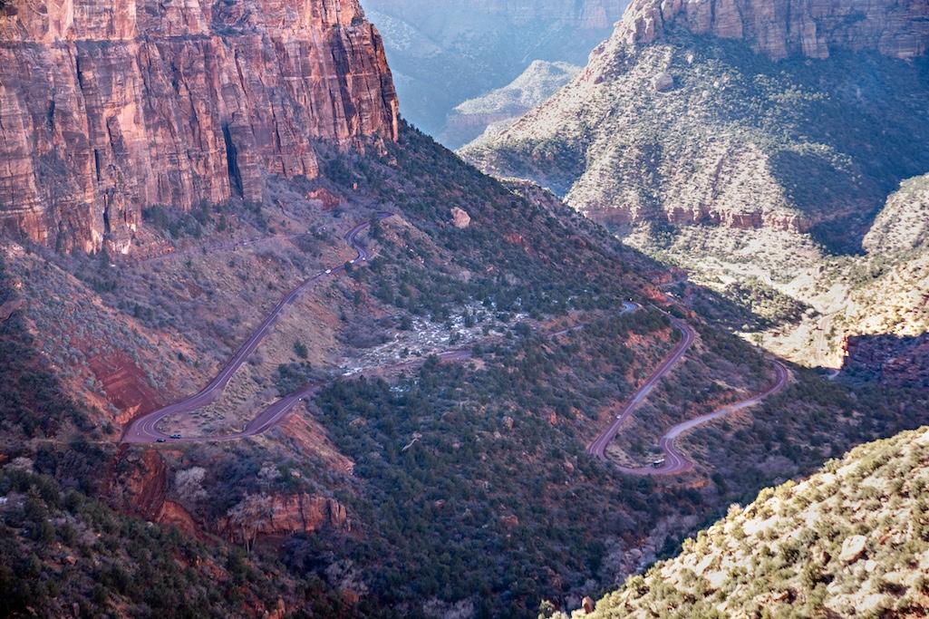
The Zion-Mt Carmel Highway view from the Canyon Overlook trail/NPS, Ally O'Rullian
Zion National Park staff has begun engaging with neighbors, elected officials, and other stakeholders to discuss operational changes on the Zion-Mt. Carmel Highway. The changes are expected to help the park meet safety requirements in order to reduce:
collision likelihood.
overweight transits on road bridges.
lane-crossing due to vehicles being too large and/or long to negotiate turns.
“We want to collaborate with members of our community to address these safety and operational concerns,” Zion Superintendent Jeff Bradybaugh said. “We need to work together to protect drivers, meet safety parameters and ensure the integrity of the road and tunnels so that we continue to enjoy scenic drives on the historic Zion-Mt. Carmel Highway.”
Engineering and traffic studies regarding contemporary road use show that unmitigated travel by large vehicles can exceed legal requirements and present public safety concerns. While driving on the Zion-Mt. Carmel Highway, for example, large vehicles like buses cross the centerline in 18 locations where the road’s turning radius cannot accommodate long vehicles, which becomes problematic when they exceed 35 feet 9 inches.
Weight is also a factor that may be damaging the road. Multiple bridges along the route are rated for a 50,000-pound capacity, so vehicles heavier than that are prohibited. Additionally, the Zion Mt. Carmel Tunnel requires its own restrictions. Vehicles wider than 7 feet 10 inches and taller than 11 feet 4 inches cannot pass through the tunnel while maintaining two-way traffic and require a tunnel escort. Vehicles taller than 13 feet 1 inch cannot pass through the tunnel and are prohibited.
Historic Zion-Mt. Carmel Highway
The Zion-Mt. Carmel Highway is a landmark listed on the National Register of Historic Places and is designated as a Historic Civil Engineering Landmark. This historic road was originally designed and constructed in the 1920s and 1930s. To conform with the landscape, the road’s designers had to build:
tight turns.
some steep grades.
a large number of switchbacks.
relatively narrow lanes.
two low and narrow tunnels.
bridges.
These design elements make the road more compatible with the landscape but also hard for modern, larger vehicles to travel safely.
When the road was designed, vehicles were smaller, moved at slower speeds, and weighed far less. Expanding the historic road is not feasible because of the terrain. New construction could be prohibitively expensive and harm the park’s landscapes, plants, animals, and impact the historic values of the road itself. To reduce the likelihood of collisions and fulfill the Park Service's responsibility to take care of the historic road, Zion has been actively collaborating with community stakeholders so it can present solutions that improve driving conditions and reduce the likelihood of structural damage.

