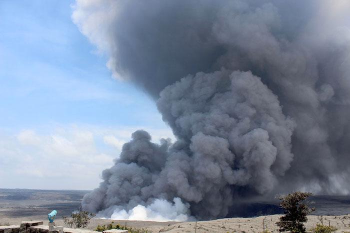
Large plume of ash from Halema‘uma‘u, the summit crater of Kīlauea Volcano, following earthquake May 25, 2018/NPS
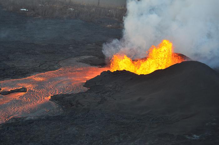
Lava fountaining continues at fissure 8, although overnight crews reported reduced heights of 40-50 m (130-164 ft). The fountain has built a 35 m (115 ft) high cone, and an actively-growing spatter rampart on its eastern side. The lava channel leading from the cone is full to its banks/USGS
With no end in sight to the volcanism within Hawai'i Volcanoes National Park, there's no firm date for when most of the park will reopen. Earthquakes have cracked and broken roadways in the park, and damaged the infrastructure of the Jaggar Museum, while clouds of ash have settled across the landscape.
“We understand and commiserate with our community and visitors about the prolonged closure, but we cannot provide safe access to the Kīlauea section of the park as long as these very unpredictable dangers threaten the safety of park staff and visitors,” said park Superintendent Cindy Orlando. “Unlike lava, which you can see coming and avoid, we cannot see or predict earthquakes, nor can we foresee a summit explosion, but both threats continue.”
What is visible throughout the park is ash and earthquake damage. Layers of acidic volcanic ash coat picnic tables, roads and overlooks, and ash has caused poor visibility on Highway 11, creating dangerous driving conditions at times. Hundreds of shallow earthquakes beneath the summit of Kīlauea have damaged at least three park buildings, fractured park roads, and snapped water lines. On Sunday, June 3, a magnitude 5.5 earthquake rattled the summit area at 3:50 p.m., cracking the overlook deck at Jaggar Museum.
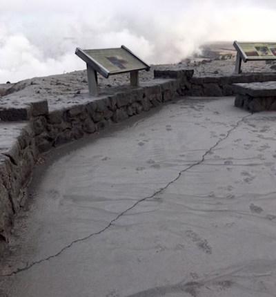
Damage to Jaggar Museum overlook following 5.5 earthquake on June 3, 2018/NPS
Last weekend alone the U.S. Geological Survey Hawaiian Volcano Observatory reported more than 500 earthquakes in a 24-hour period – the most ever measured by HVO scientists.
In addition, the park remains without running water. Newly formed earth cracks observed near Hōlei Sea Arch on a recent overflight concern park officials. Crater Rim Drive and Hilina Pali Road near Kulanaokuaiki Campground are impassable in places.
Although U.S Geological Survey aerial footage last week revealed that the former eruption site (unofficially called the “overlook vent”) within Halema‘uma‘u appears to be plugged with rock and other volcanic debris, explosions and resulting ash fall continue. The vent expanded from about 12 acres to more than 100 acres in May, following the ongoing explosions and collapses.
“Unfortunately, there’s no way to tell when we can reopen the Kīlauea section of Hawai‘i Volcanoes National Park. We’ll only reopen when it is safe to do so, and we will need time to assess, make repairs and clean up,” Superintendent Orlando said. “In the meantime, we ask for your understanding and support.”
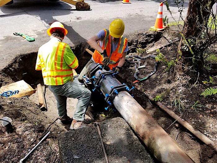
Park facilities and maintenance staff work on damaged water lines/NPS
Although two-thirds of the park has been closed since May 11, everyone is invited to visit the park’s Kahuku Unit, located an hour south of the main entrance on Highway 11 near mile marker 70.5. The Kahuku Unit is open Wednesday through Sunday, from 9 a.m. to 3 p.m., but can be impacted by poor air quality depending on wind direction.
Park rangers are also serving visitors and the community at Mokupāpapa Discovery Center in downtown Hilo Tuesday through Saturday, 9 a.m. to 4 p.m. and are on site at the Volcano Art Center’s Niaulani Campus in Volcano Village from 9 a.m. to 4 p.m. Rangers are also at the Hilo Airport most days, and at the Naniloa Hotel Sundays and Mondays to answer questions about the park and current eruption conditions.
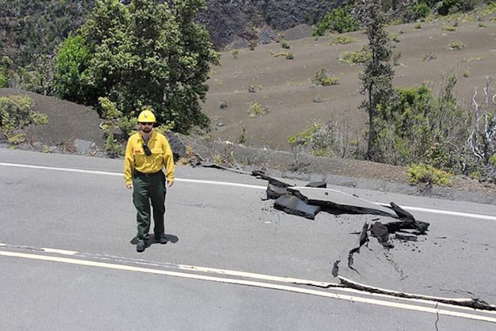
Damage to infrastructure within Hawaii Volcanos National Park. Primarily road damage caused by earthquake activity/NPS Photo/Mike Johns


Comments
I think that you should reopen the area of the park on the mauka side of Highway 11, to include Mauna Loa (Strip) Road, Kipuka Puaulu (Bird Park), and Tree Molds area. This section is a safe as (and just adjacent to) the Volcano Golf Course community where hundreds of people live. This area of the park is vital to access of hiking trails on Mauna Loa, and also serves as a primary recreation area for bicyclists and dog walkers who live in Volcano, as well as picnic area and easy hiking loop for visitors. There is no damage in this area, and keeping it closed, as well as fining and jailing people who want to enjoy it, is not very community-friendly :(
I agree with Jillian Marohnics comment. NPS administration should address this publicly. A vast majority of the park is safe, everything on Mauna Loa side for instance. The Mauna Loa alert level was downgraded by HVO from Advisory to Normal on June 21, 2018. It had been in Advisory since 2015 and that portion of the park was still open until the shift in Kilauea active. Now that Mauna Loa is trending in baseline normal, it should absolutley be open to the public and community users. No one knows how long the current Kilauea eruption is going to last. Life must go on and can not be placed on hold indefinitely. Please reopen the portions of the park that are safe to visit so that we can enjoy the island we live on or commit to a timeline for reopening.