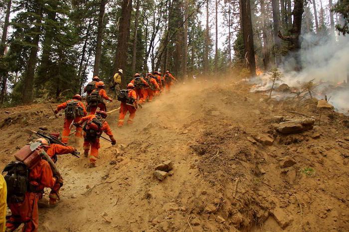
Firefighters on the Ferguson Fire, 8-2-18/USFS, Jim Bartlett
One of the most iconic vistas in the National Park System, the Yosemite Valley, was ordered evacuated Friday due to firefighting efforts related to the Ferguson Fire outside the park's borders. The valley itself was not threatened by the fire "at this time," Yosemite National Park staff said.
The order was issued for residents and employees in the valley due to limited road access into the valley because of firefighters working along park roadways, and road hazards along the El Portal, Big Oak Flat, and Wawona roads. Due to those conditions, the valley and other impacted areas of the park would remain closed through Sunday, park staff added. Also affected was the road between the Big Oak Flat Entrance and Crane Flat Junction, and from Crane Flat Junction to Yosemite Valley. These closures may be extended or change based on current conditions, a park release said.
As of Friday morning, the Ferguson Fire covered an estimated 73,560 acres, and was 41 percent contained. Fire bosses hoped to have full containment of the blaze by August 15. Its cause had not been determined.

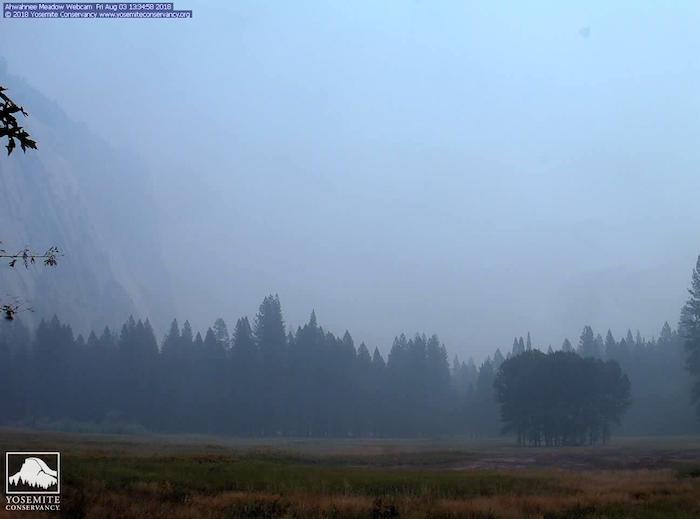
Heavy smoke filled the Yosemite Valley on Friday/NPS webcam
Yosemite National Park remained open from Highway 120 East via U.S. 395. Tioga Road remained open from Tioga Pass to Crane Flat. All trails, campgrounds, and facilities along Tioga Road were open, including Tuolumne Meadows Campground, the Tuolumne Meadows Store, and the High Sierra Camps.
Yosemite Valley has been temporarily closed since July 25 due to smoke impacts and for firefighting operations due to the Ferguson Fire.
Since the Ferguson Fire began on Friday, July 13, several other park facilities and roads have been closed due to fire impacts and the need to support firefighting operations. These closures include Glacier Point Road, Bridalveil Creek Campground, Tamarack Campground, Wawona Campground, and the Merced Grove of Giant Sequoias.
Yosemite National Park continues to work closely with the Incident Management Team and continues to assess park conditions daily. You can find current fire information at this site.


Comments
This seems more than just a bit far-fetched. Uproot employee families? How many of those family members are working in some capacity on the fire? Where do they go? Who pays for motels and other expenses -- heaven knows NPS (and even most concession) employees are not wealthy by any stretch of the imagination.