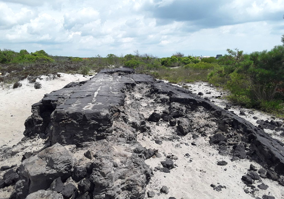
Abandoned road asphalt is being removed from areas of Assateague Island National Seashore, where the staff is restoring the landscape/NPS
Sometimes, when a national park is established it occupies land that previously might have been considered for another purpose. For instance, at Assateague Island National Seashore there was a plan to build nearly 6,000 homes on the barrier island before the park was established. Today, park staff continues to work at restoring acres damaged by infrastructure related to that development.
Private developers installed a network of roads and ditches that were intended to support as many as 5,800 private housing lots and related infrastructure. Baltimore Boulevard was established mid-island as the primary north-south roadway corridor. Although these development plans failed, many of these manmade features remain today as scars on the natural landscape.
A three day nor’easter in March of 1962 - known as the “Ash Wednesday Storm” - devastated the mid-Atlantic region and destroyed much of the initial development along Assateague Island. At that point, the feasibility of future intensive development along Assateague was questioned and the national seashore was established in 1965.
An abandoned asphalt roadway is one of the most significant manmade features that remains in the park's backcountry. Portions of this roadway extend south from the Life of the Dunes nature trail all the way to the Maryland/Virginia state line. The roadway detracts from the visitor experience throughout the backcountry, interferes with natural barrier island processes, and serves as a potential source of pollution to the surrounding natural landscape.
To mitigate the remaining impacts of the roads and restore native habitats, the National Park Service began removing sections of this roadway in 2017 as part of a Federal Lands Recreation Enhancement Act project. Successful removal of this feature and restoration of the impacted area will improve the visitor experience, restore barrier island processes and enhance habitat conditions for wetlands and wildlife.
Strong winds from recent coastal storm events have exposed expansive sections of this abandoned roadway, providing convenient access to what was previously covered by several feet of sand. Future storm events could dislodge and scatter the remnants of this roadway across extensive areas of island, thereby changing the appearance and natural conditions of the Assateague beach that visitors value and enjoy today.
Strategic removal of this material now will eliminate the need for multi-million dollar asphalt and road debris cleanup efforts later. Removal of the abandoned road surface will:
- Eliminate a physical obstruction to natural barrier island overwash processes
- Restore wetland connectivity and sheet flow
- Enhance native habitats for wildlife species, including two federally threatened species; Piping Plover and Sea Beach Amaranth
- Facilitate native plant revegetation and build island resiliency
- Restore natural conditions to the barrier island landscape and enhance the visitor experience
Specialized equipment is used to capture and remove targeted sections of the road surface. Sifters are used to separate as much sand as possible from the non-native material before it is removed from the site. Areas where the roadway has been removed are quickly showing signs of renewal. Native vegetation has returned to 100 percent of these sites.
Traveler footnote: To learn more about this project and see associated photos and maps, visit this site.


Comments
An old unused asphalt and sub-base roadway has been a historic part of the island's Life of the Dunes Trail and other locations. I feel removal may distract from physical evidence of the past. Exhibits in the VC reference former Baltimore Blvd. I played on this old road in the early 60's, before the National designation. Mixed in my feelings agree that these road sections are out-of-place in the natural environment. I have missed the island since I worked there (2008-2016).