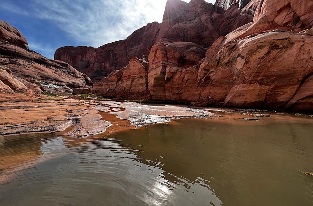
Rainbow Bridge access has been impacted by falling lake levels and recent storms/NPS
Continued declines in the level of Lake Powell have limited access to Rainbow Bridge National Monument in southern Utah.
The National Park Service has pulled the Lake Powell dock used to access the shoreline back into deeper water. While small vessels will still be able to access the shoreline, Glen Canyon National Recreation Area staff advise that access to the canyon and trail will likely require going through mud, debris, sand, and water before reaching the established trail.
Conditions could also change without notice due to weather, the agency added. Concessioner tours to other canyons on Lake Powell are not affected by this announcement.
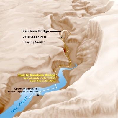
Map of trail leading to Rainbow Bridge from Lake Powell/NPS
While no longer connected to the shoreline, the Rainbow Bridge dock system will still be accessible with restroom facilities for visitors. The Park Service has plans to use seasonal trail crews this winter to re-establish a more accessible trail with the possibility of reconnecting the dock structure as conditions improve and resources allow. Further guidance will be provided at a later date.
Rainbow Bridge National Monument is only accessible via boat on Lake Powell or by obtaining a permit form the Navajo Nation Parks & Recreation Department to backpack on Navajo Tribal Lands from Navajo Mountain. Backpackers expecting to arrange drop-off and pick-up in advance at Rainbow Bridge will need to be aware of the current conditions impacting access.
Rainbow Bridge is one of the world's largest known natural bridges. Rainbow Bridge National Monument was established in 1910 before the National Park Service was established. In April 2017, NPS designated Rainbow Bridge a Traditional Cultural Property on the National Register of Historic Places, recognizing the site's historic and ongoing cultural significance to at least six American Indian tribes. In 2018, it was designated an International Dark-Sky Association Dark Sky Sanctuary, the first of its kind in the National Park Service.


Comments
Been there and took pictures when water at a high level. Bass Jumping in front of R.B. and birds singing. A magical place & Arch still in place.