You can never have enough guides to the national parks. Each author seems to catch different elements worth your attention.
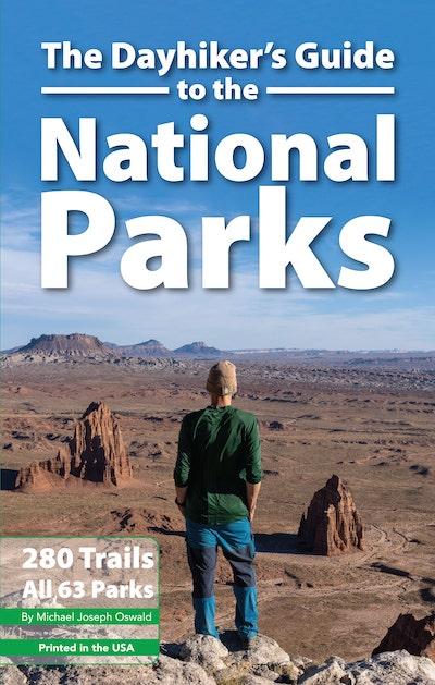
Michael Oswald, who previously wrote Your Guide to the National Parks (now in a third edition) and National Park Maps, An Atlas of the United States National Parks, returns to the parks with The Dayhiker's Guide To The National Parks, set to arrive in October (along with an eBook version).
Oswald's latest endeavor tackles 280 trails in the 63 "national parks" within the National Park System. As he points out on the back cover of the guide, "There are more than 10,000 miles of trails in the U.S. National Parks. Choosing the best ones can be a challenge."
How true. I know I often fail to properly research and plan my park adventures, and so often wake up in a park wondering which trail to head out on. Having a guide with suggestions is a good start.
Now, as the title denotes, this guide focuses on day hikes in the national parks. Longer distance overnight hikes might be contained in a forthcoming book from Oswald.
Naturally, Oswald has some suggestions to open this book with. His Top 25 day hikes include:
- Precipice Trail at Acadia
- Beehive Trail at Acadia
- Old Rag at Shenandoah
- Castle at Badlands
- Delta Lake at Grand Teton
- Grinnell Glacier at Glacier
- Hidden Lake at Glacier
- Highline at Glacier
- South Rim at Big Bend
- Chasm Lake at Rocky Mountain
- Sky Pond at Rocky Mountain
- Delicate Arch at Arches
- Chesler Park/Joint at Canyonlands
- Navajo Loop at Bryce Canyon
- Angels Landing at Zion
- Observation Point at Zion
- The Narrows at Zion
- Boy Scout/Willow Hole at Joshua Tree
- Bear Gulch/High Peaks at Pinnacles
- Golden Canyon at Death Valley
- Lakes at Sequoia
- Mist/JMT/Half Dome at Yosemite
- Skyline at Mount Rainier
- Maple Pass at North Cascades
- Sliding Sands at Haleakalā
Of course, those are just one hiker's opinion. But they're all good starting points as you work to tick off the national park trails you want to hike.
The guide, logically, is broken into geographic areas of the country: East, North, South, Southwest, West, Alaska, and Remote Islands. A map of the country sprawled across two pages gives you a rough idea of where the parks are located and how close they are to others in case you plan to knock off two or three parks in one trip.
Each park's chapter opens with a pretty picture from the park and a map of the park marked with various sites. For instance, the Cuyahoga Valley map calls out the Blossom Music Center, the Towpath Trail, Brandywine Falls, and the Hale Farm, along with other spots you might want to visit.
Individual hikes are detailed on a page that includes a map showing the trailhead location and the author's impression of whether the hike is easy, moderate, strenuous, or extreme. (Keep in mind, those values are a matter of personal perspective.) He also notes the length of the hike, whether it's an out-and-back hike, loop trail, or a lollipop hike (an out-and-back trek that features a loop at the far end). Elevation gain also is noted.
Each chapter also includes a page of additional information. For Acadia, for instance, there's a blurb about the Island Explorer shuttle buses, the busiest seasons at the park, the Carriage Roads, whether pets are welcome, and a definition of "Ladder" trails, those that feature steel rungs fixed on rock faces that you must climb up (and down). Yellowstone's chapter ends with cautions about grizzly bears and other wildlife, time management (spend at least three days in the park), and which waterfalls in Cascade Corner you can knock off in a day hike.
The soft-cover guide runs more than 350 pages and measures roughly 8.25 inches by 5.25 inches, making it small enough to carry in your daypack. There's also a QR code in the opening pages of the book that takes you to a Google Map with trailhead locations for all the trails in the book. "I'm planning on treating it as a living document, adding layers of information over the years," Oswald notes.
If there's a quibble to make about the book, it's one I've made with other hiking and park guides: There's no space, other than page margins, to make your own notations or record your visit with a National Park Passport stamp at the visitor center.
Traveler footnote: Though Oswald's Stone Road Press is not a Traveler advertiser, he is supporting our nonprofit news operation by offering our readers and listeners a 25 percent discount on purchases, from which he'll make a donation to the Traveler. The discount code is "NPT25" and can be used on all his books. Find his books at Stone Road Press.


Comments
Thanks for the good review! I'll put it on the list.