Few national park visits are complete without a hike of some distance and duration. We made the following hikes in the parks the past year, and think you'll find them interesting possibilities for 2013.
Shenandoah National Park: Dark Hollow Falls And Beyond
There are many nice hikes in Shenandoah National Park, some that ramble on for miles, some that run just a short way to a wonderful payoff. Dark Hollow Falls is one such payoff, but the hike is just a mile-and-a-half roundtrip, rather short if you were looking for a good leg stretcher. You can, however, easily extend that hike by more than a few miles by weaving in some other trails and fire roads.
Shenandoah National Park: Lewis Falls Trail
Fall might not be everyone's preferred season for hiking, but in Shenandoah National Park it can be one of the best seasons. Not only are crowds down to a small trickle, but the naked forests can make it easier to spot remnants of old homesteads.
Theodore Roosevelt National Park: Ridgeline Nature Trail
Badlands sprawl out in every direction I look. East, west, south, or north, from the Ridgeline Nature Trail in the South Unit of Theodore Roosevelt National Park it is easy to understand how the "badlands" term was coined. Located 10.8 miles from the park's Medora entrance, the trail makes a short dash uphill through Rocky Mountain junipers to lead you up onto a grassy ridge that bends and twists and rises and falls. Though little more than a half-mile in length, the trail is a great introduction to the park's landscape.

Imperial Geyser. Kurt Repanshek photo.
Yellowstone National Park: Imperial And Spray Geysers Via Fairy Falls Trail
A towering, wispy waterfall, one of Yellowstone National Park's tallest, and two backcountry geysers via the same trail? That's what you get when you leave the Fairy Falls Trailhead. And it's not a long hike, one that requires hours of trekking and a river ford or two. Rather, this hike can be done in as few as two hours and reward you not only with that nearly 200-foot-tall waterfall, Fairy Falls, but with relative solitude (relative when compared to the park's front-country geyser basins, that is) to enjoy Spray and Imperial geysers.
Yellowstone National Park: Monument Geyser Basin
Most visitors to Yellowstone National Park are familiar with the Upper, Lower, and Midway geyser basins, but how many these days have made the trek to a basin that once, thanks to its oddly shaped spires and acidic hot springs, was another must-see attraction for park visitors? These days the Monument Geyser Basin is largely overlooked, as the park's other geyser basins with their readily accessible boardwalks, deep and colorful hot springs, curious mudpots, and erupting geysers pull most visitors. But if you're looking for a short, but strenuous, hike to a basin of spindly spires in a most unlikely spot, the trail to the Monument Geyser Basin waits for you.
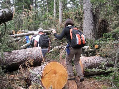
Blue Ridge Parkway: Walking to Rattlesnake Lodge on the Blue Ridge Parkway
This hike offers sweeping views of the Blue Ridge Mountains and artifacts that point to an old lodge. Today there's little left of Rattlesnake Lodge, but the trail (3 miles, 600 feet ascent, round-trip) switchbacks up, giving you winter views of the Blue Ridge Mountains. At one point, where the side of the trail seems most worn out, you'll enjoy unobstructed view of the mountain range.
Great Smoky Mountains National Park: Mountain Farm and Oconaluftee River Trails
The Great Smokies' stellar Mountain Farm Museum at the new Oconaluftee Visitor Center may just be a stroll, but combine it with one of the Smokies best-kept-secret easy walks, the Oconaluftee River Trail, and you have one of the park's best combinations of scenery and interpretation. It is a masterful meshing of insight into Native Americans and later settlers. In addition, this is one of the few trails in the park where bikes and dogs on leash are permitted.
Trail to Black Lake. Danny Bernstein photo.
Rocky Mountain National Park: Black Lake
Contrary to the impression you might have gotten from the popular press, the whole state of Colorado is not burning. In particular, the popular areas of Rocky Mountain National Park are open and ready for hiking. A visit to Black Lake is a great introductory hike to the park. It shows off several iconic lakes and waterfalls. It's a progressive hike and you can decide how far you want to go. This hike is a good place to get a feel for the three natural environment of the park.
Petrified Forest National Park: Long Logs And Agate House Trails
It's the heart of summer, the hottest time to visit Petrified Forest National Park in Arizona, but that doesn't mean you still can't enjoy the Long Logs and Agate House trails near the park's south entrance. You just have to be strategic in planning when to do these companion hikes. Together the two trails wind fewer than 4 miles through the petrified wood-littered landscape that's surrounded by gray-white badlands. There are reddish and cinnamon-hued long logs -- hence the name of the one trail -- and slabs that might have been sliced with a laser so clean are the cuts. And there's a pueblo recreated from petrified wood slabs similar to what ancestral puebloans might have used to build their homes seven-10 centuries ago.

Overlook above Upper Caprock Coulee Trail. Kurt Repanshek photo.
Theodore Roosevelt National Park: Upper Caprock Coulee Trail
The best vantage points to take in the grandeur of Theodore Roosevelt National Park are, quite understandably, up high. The Upper Caprock Coulee Trail takes you there, and along the way shows off some incredible badlands that so captivated Theodore Roosevelt. Its location in the park's northern unit also makes this hike relatively --and some times totally-- uncrowded. Of the park's annual visitation of about 600,000, only about 10 percent of those visitors take the time to explore the North Unit, Superintendent Valerie Naylor told me during a recent visit.
Buffalo National River: A Potpourri Of Trails
Though it's a "national river," the forests surrounding the Buffalo National River have quite a few options for getting out and stretching the legs. Indeed, hiking in the upper Buffalo National River can be your Arkansas 'Walk in the Woods." Whether it's spring, summer, fall or winter, the adventurous trails along the upper stretches of the national river are perfect for hiking. It is especially beautiful this time of year with spring foliage blossoming everywhere you turn.
Boardwalk along Hammock Hills Nature Trail. Randy Johnson photo.
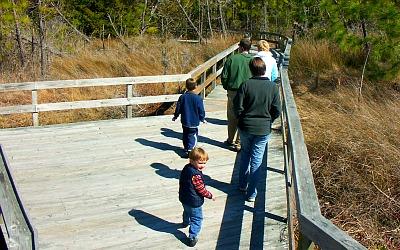
Cape Hatteras National Seashore: Hammock Hills Nature Trail
The farther away something is, the more people want to get there. That's the way it can seem with Ocracoke Island, one of the most inaccessible, but inviting, parts of North Carolina's Cape Hatteras National Seashore. To reach this idyllic little isle it takes a longish drive down the barrier islands of the northern Outer Banks to Hatteras Island, and then it's a short ferry hop south over to Ocracoke. Two other, more recommended, ferry routes link this wonderful island with the rest of the state. Each offers a 2-hour cruise across Pamlico Sound from 'mainland' North Carolina that perfectly set the stage for Ocracoke's appearance over the bow.
Petrified Forest National Park: The Crystal Forest
Though it's called the "Crystal Forest," it could just as easily have been dubbed "the wood lot" for all the slabs and trunks of petrified wood you'll find along this easy hike in Petrified Forest National Park. Located not quite 5 miles north of the Rainbow Forest Visitor Center at the park's south entrance, the Crystal Forest Trail meanders three-quarters of a mile past some of the most colorful stone logs you'll ever see.

Blue Mesa Trail. Kurt Repanshek photo.
Petrified Forest National Park: Blue Mesa Trail
There are, relative to other parks, only a handful of hikes for you to consider when you visit Petrified Forest National Park in Arizona, but you still should come up with a pecking order, if only to plan your day. And if you like to hike first thing in the morning, then the Blue Mesa Trail should rise to the very top of your list. When it comes to getting the most out of your hikes in Petrified Forest, so much comes down to the slant of the sun. Even small changes of angle from that fiery orb overhead can alter the color of the landscape, and that of the rock logs, on the ground at your feet. What looks spectacular in the morning very possibly could look drab in the afternoon, and vice versa.
Glacier National Park: A Day Hiker's Overview
Encompassing more than a million acres, Glacier National Park in northwestern Montana is home to some of the most beautiful alpine meadows, lakes, pristine forests, rugged peaks and glacially-carved valleys in the world. Its diverse habitats support nearly 70 species of mammals, including grizzly bears, black bears, mountain goats, bighorn sheep, moose, wolverines, gray wolves and mountain lions. With more than 740 miles of trails that lead to some of the most spectacular scenery on the planet, Glacier is also a hiker's paradise. Considering its massive size, most people divide the park into sections in order to focus on one or two areas at a time. The four most popular areas in the park are West Glacier / Lake McDonald, Two Medicine, Logan Pass, and Many Glacier. The following are some suggestions for day hikes in each of these areas.


Add comment