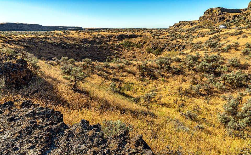
I spy with my little eye a tiny white SUV and one heck of a pothole, Drumheller Channels National Natural Landmark, Ice Age Floods National Geologic Trail / Rebecca Latson
It’s time to test those national park mental muscles of yours with another quiz and trivia piece. See how much you already know before looking at the answers at the bottom.
1. If you’ve ever visited Drumheller Channels National Natural Landmark you may have seen giant potholes (yes, giant potholes) created from spinning water vortices beneath the colossal Ice Age floodwaters surging through a portion of eastern Washington to create the Channeled Scablands. These vortices, known as ____, drilled down into the ground to pluck out boulders and erode away soils, leaving behind huge, round, exposed holes.
a) Eddies
b) Whirlpools
c) Kolks
d) Undercurrents

Keep wildlife wild and stay away from scorpions, Capitol Reef National Park / NPS
2. The largest scorpion found at Capitol Reef National Park is known as the ___.
a) Black hairy scorpion
b) Arizona bark scorpion
c) Giant desert hairy scorpion
d) Northern scorpion
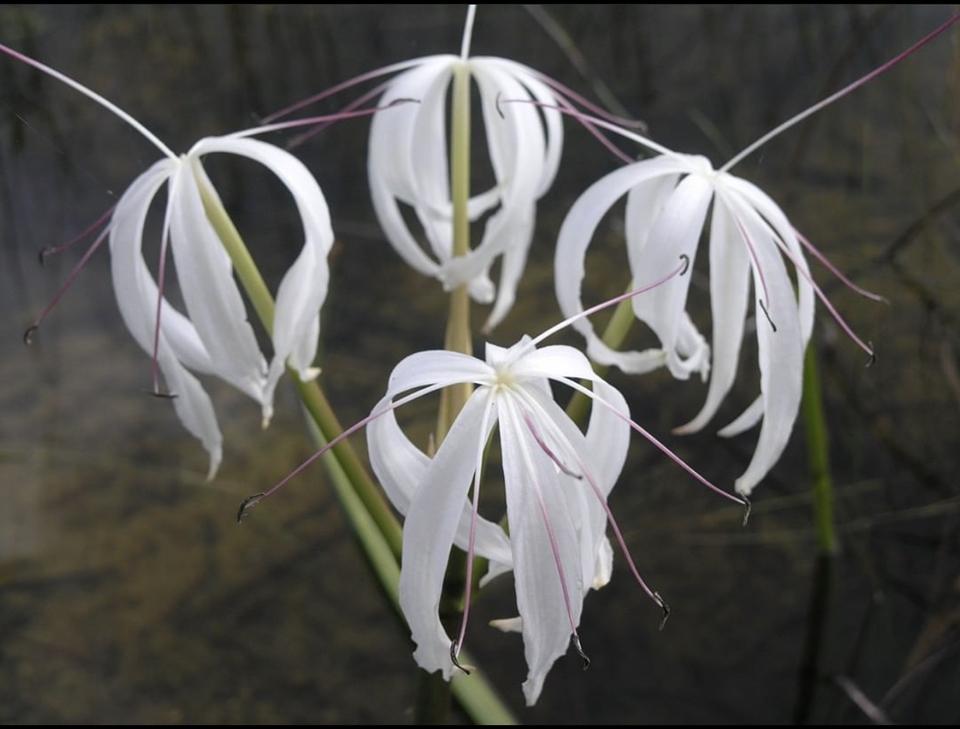
Swamp lily blooms, Everglades National Park / NPS
3. According to Everglades National Park, the swamp lily, pictured here, “is also referred to as a “string lily” and is a white, fragrant plant with six separate petals that grows in wetlands, moist hammocks, and along streams throughout the U.S. “ This flower also goes by another name:
a) Seven sisters
b) Slender fingers
c) White ribbons
d) Fragrant fancy

A prairie panorama, Tallgrass Prairie National Preserve /NPS
4. “Established on November 12, 1996, Tallgrass Prairie National Preserve protects a nationally significant remnant of the once vast tallgrass prairie ecosystem. Tallgrass prairie once covered 170 million acres of North America, but within a generation most of it had been transformed into farmland. Today less than ____ remains intact.”
a) Three percent
b) Four percent
c) Five percent
d) Six percent
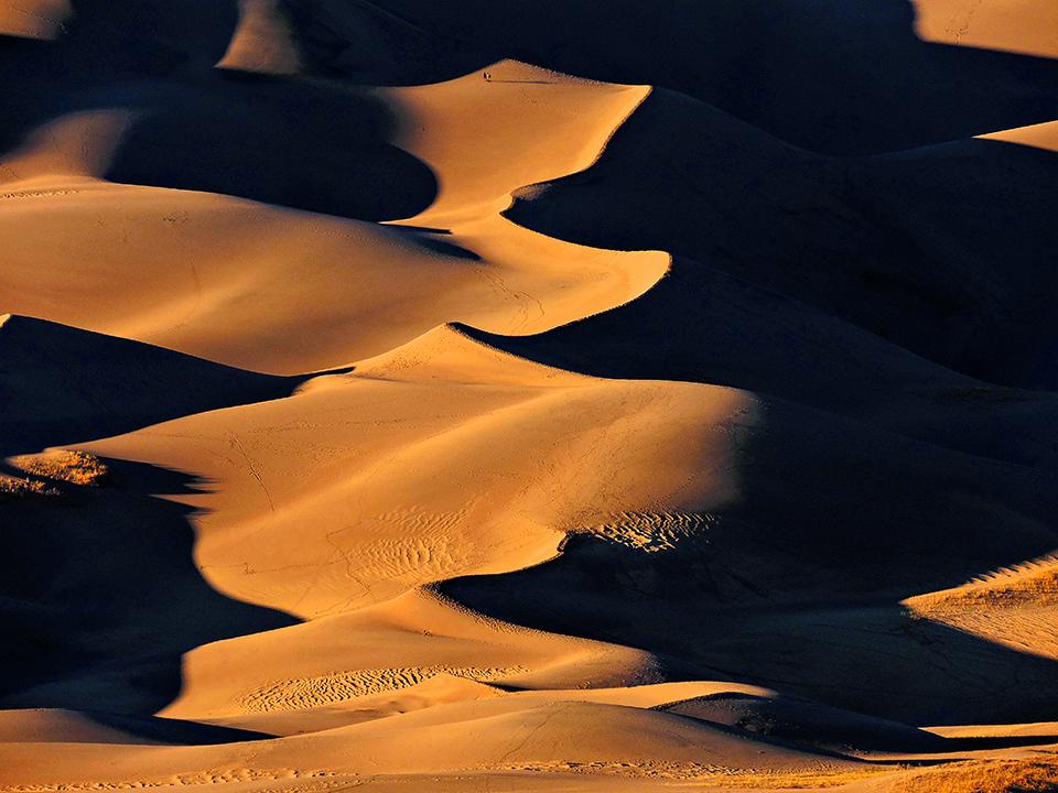
I spy with my little eye, two tiny hikers on some very large sand dunes, Great Sand Dunes National Park and Preserve / NPS - Patrick Myers
5. True or False: NASA uses the terrain of Great Sand Dunes National Park and Preserve to test their space suits.
a) True
b) False
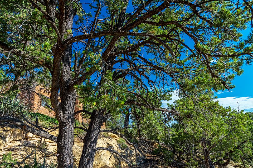
If a tree falls and nobody is around, does it still make a sound? Mesa Verde National Park / Rebecca Latson
6. “The vast majority of trees throughout Mesa Verde National Park are junipers or ___.”
a) Ponderosa pines
b) Pinyon pines
c) Jack pines
d) Bristlecone pines
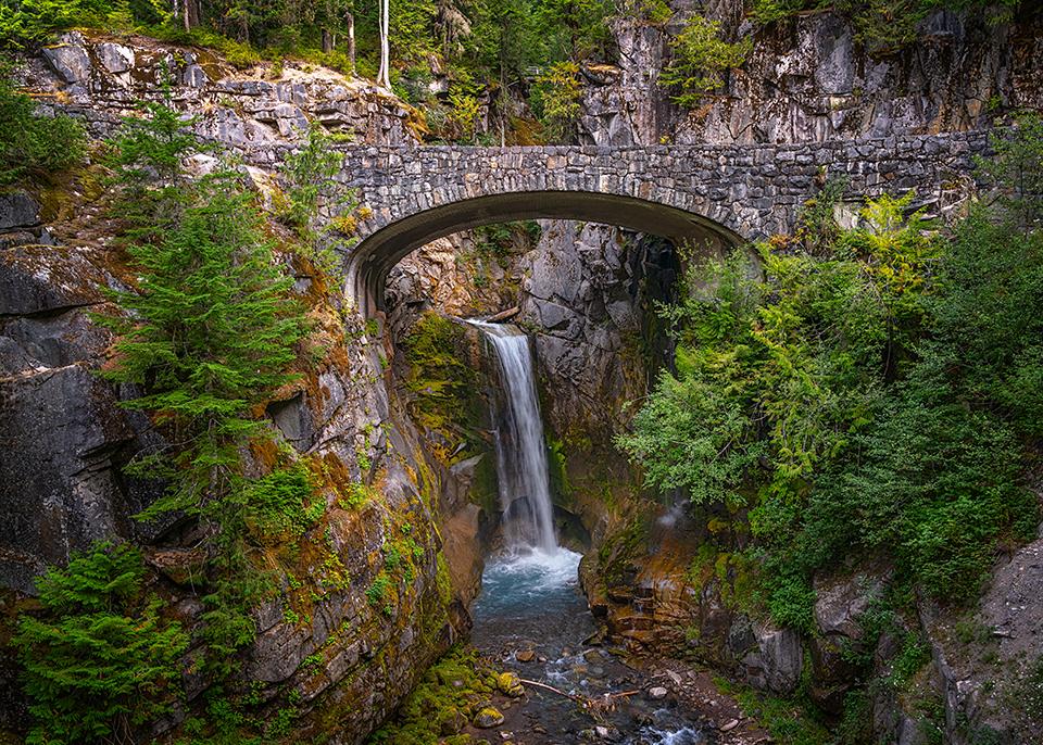
Christine Falls, Mount Rainier National Park / Rebecca Latson
7. True or False: Christine Falls, in Mount Rainier National Park, is named for P.B. Van Trump’s daughter.
a) True
b) False
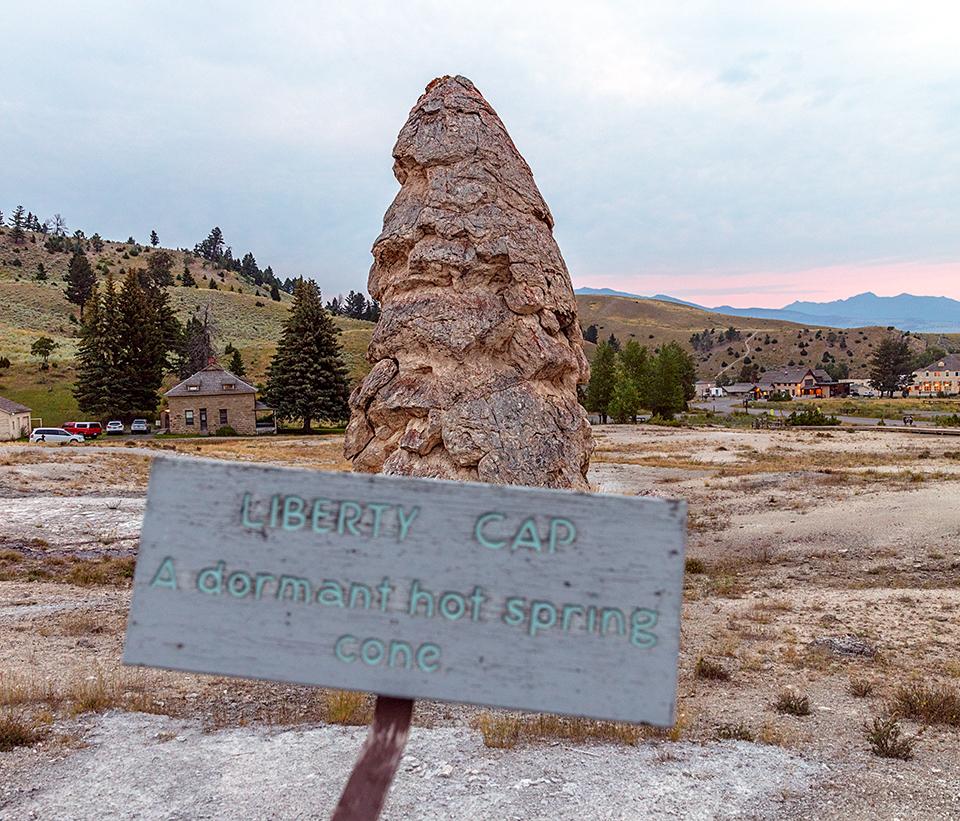
Liberty Cap travertine formation, Yellowstone National Park / Rebecca Latson
8. Liberty Cap at Mammoth Hot Springs in Yellowstone National Park, was named so in 1871 by the Hayden Survey because it resembled:
a) The top part of the Liberty Bell
b) A hat worn by freed slaves in Rome
c) A mushroom named “Liberty Cap”
d) French Revolution peaked caps
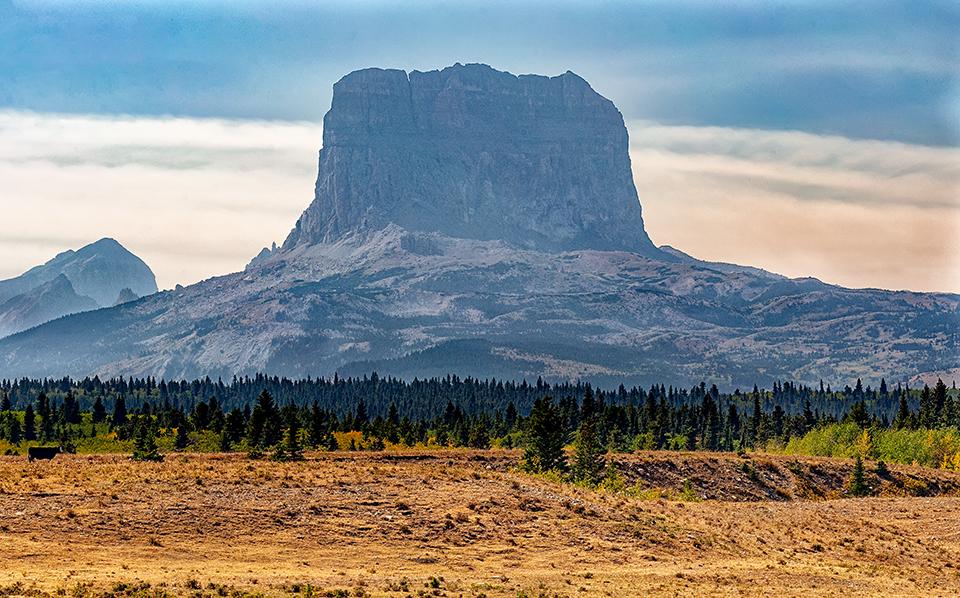
Sacred Chief Mountain, Glacier National Park / Rebecca Latson
9. Physical evidence of human use in the Glacier National Park area dates back more than __ years.
a) 9,000
b) 10,000
c) 11,000
d) 12,000
10. Woof woof! During the journey out to the Pacific Ocean along what is now the Lewis and Clark National Historic Trail, Captain Meriwether Lewis brought along his four-footed pal: a Newfoundland waterdog named ___.
a) Seaman
b) Scout
c) Bridger
d) Spot
Trivia
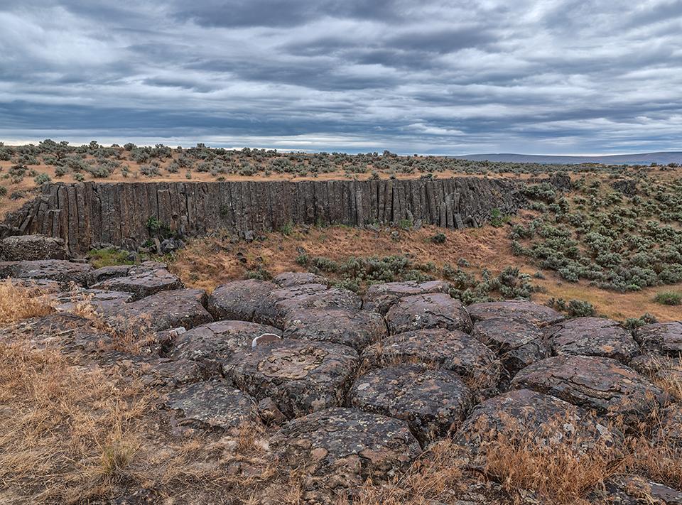
Columnar basalts, Drumheller Channels National Natural Landmark, Ice Age Floods National Geologic Trail / Rebecca Latson
In addition to giant potholes created by Ice Ace floodwaters, Drumheller Channels National Natural Landmark is home to some pretty awesome columnar basalts rimming the sides of buttes like Lady Finger cookies around a cake. How did these interesting hexagonal strips of basalt form in the first place? It’s all about cooling lava. “The hexagons form as lava cools and contracts. When lava cools slowly and evenly at the base of a flow, cracks spread upward and outward through the solidifying rock, forming columns. You might wonder why these shapes are hexagons and not triangles or squares. It turns out that the hexagon is the most efficient way for heat to be released when something cools.”
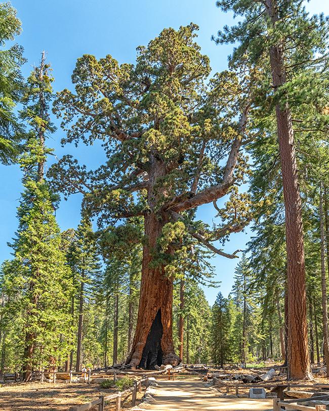
The majesty of Grizzly Giant at Mariposa Grove, Yosemite National Park / Rebecca Latson
Estimated to be almost 3,000 years old, the Grizzly Giant sequoia tree in Mariposa Grove of Yosemite National Park stands 209 feet (63.7 m) tall. As you walk around the tree, you’ll notice it has a bit of a lean, and that’s not just due to the wide-angle-lens perspective in this photo. Back in the early 1900s there were fears the tree might fall over, so stabilizing cables were proposed. The cables were never installed and the tree remains in place. The lean could be due to the giant sequoia’s root system. Sequoia trees have a shallow root system but the roots themselves extend quite a distance from the parent tree. These roots intertwine with other tree roots, and those other roots may be helping Grizzly Giant to stay upright. It’s sort of like grasping arms or clasping hands with someone else to keep from falling while looking over a steep precipice. To read more about this giant among giants in Mariposa Grove, click here.
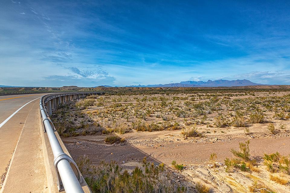
The bridge over a dry Tornillo Creek, Big Bend National Park / Rebecca Latson
As you drive the main road through Big Bend National Park from Panther Junction toward Rio Grande Village, “just beyond the River Road turnoff, you will cross a concrete bridge over Tornillo Creek. Tornillo means “screw” in Spanish, and here refers to the screwbean mesquite, which has spiral-shaped pods and grows along the creek banks. Most of the year, the creek is dry and you may wonder about the logic of constructing a large modern bridge at such a place. However, during the summer rainy season, flash floods occasionally roar down Tornillo Creek, filling this dry wash from bank to bank in minutes. In fact, after a particularly heavy rainfall in August of 1966, water actually splashed onto the bridge roadway.”
Quiz Answers
1c
“Vortices, known as kolks, form in high-energy flow environments. These kolks literally pluck pieces of rock from the streambed and grind out deep rounded holes that are now exposed in the dry canyons (coulees) of the Channeled Scablands.” To read more about Drumheller Channels, click here.
2a
“The black hairy scorpion (Hadrurus spadix) is the largest scorpion in Capitol Reef, with a length of about 5 inches (13 cm). It is easily distinguished from other scorpions in the area by its black body (cephalothorax). Its many hairs help it sense vibrations that may indicate the presence of prey and predators. They typically dwell underground in burrows that may contain intricate tunnels up to a few meters in length. This species is aggressive, attacking large insects, other scorpions, and even snakes and lizards.”
3a
“Another common name is ‘seven sisters’ because some say the shape of the flowers resemble the shape of the Pleiades, a star cluster found in the constellation Orion’s belt.”
4b
Today less than 4 percent of tallgrass prairie remains intact, mostly in the Kansas Flint Hills. You can read about Tallgrass Prairie National Preserve in this Traveler article, and listen to podcast episode 178 about Traveler Editor Kurt Repanshek’s visit to this national preserve.
5b False
NASA uses the terrain and geological conditions of Great Sand Dunes National Park to test their rovers.
6b
“The vast majority of trees throughout Mesa Verde National Park are junipers or pinyon pines … Indians throughout the Southwest make important uses of the pinyon pine. The nuts, which grow several to the cone, are usually toasted before being stored for winter. They are also ground with corn, used as a flour, and eaten fresh or parched. Pinyon gum is used to mend cracks in pottery and to waterproof baskets. Navajos use the gum in making black dye.”
7a True
Christine Falls is a 60-foot plunging waterfall “named for Christine Van Trump, daughter of P.B. Van Trump, one of the first climbers of Mount Rainier. “
8d
“Liberty Cap was named in 1871 by the Hayden Survey because it resembled the peaked knit caps symbolizing freedom and liberty during the French Revolution.”
9b
“Physical evidence of human use dates back more than 10,000 years within the boundaries of Glacier National Park. Numerous Native American tribes utilized the area around and within what is now the park for hunting, fishing, ceremonies, and gathering plants.”
10a
Lewis’ Newfoundland waterdog Seaman accompanied the Corps of Discovery and even helped with the hunting. To read more about Seaman, click here.
References
In addition to the information found on the National Park Service’s park-specific websites, the following was used for reference.


Add comment